
Advanced Search for Maps
Showing 31-40 of 509
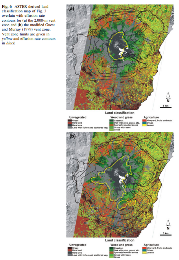
Figure in a journal article
ASTER-derived land classification map of Fig. 3 overlain with effusion rate contours for the 2,000-m vent zone and the modified Guest and Murray (1979) vent zone
Figure 6 in: Harris, A. J., Favalli, M., Wright, R., & Garbeil, H. (2011). Hazard assessment at Mount Etna using a hybrid lava flow inundation model and satellite-based land classification. Natural Hazards, 58(3), 1001-1027. https://doi.org/10.1007/s11069-010-9709-0
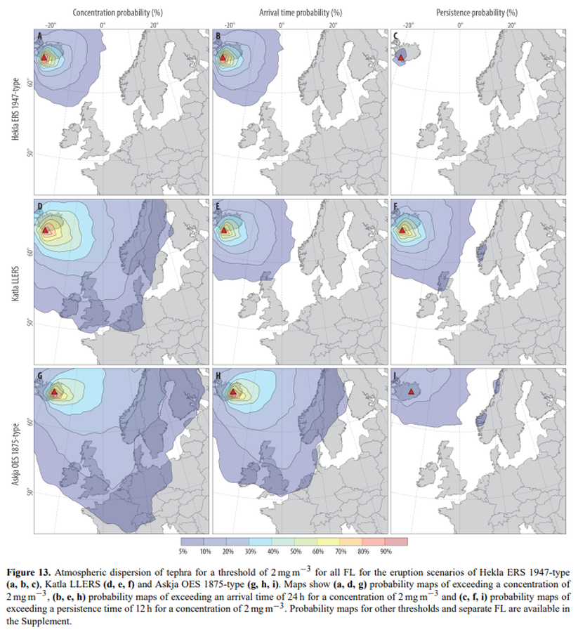
Figure in a journal article
Atmospheric dispersion of tephra for a threshold of 2 mg m−3 for all FL for the eruption scenarios of Hekla ERS 1947-type (a, b, c), Katla LLERS (d, e, f) and Askja OES 1875-type (g, h, i)
Figure 13 in: Biass, S., Scaini, C., Bonadonna, C., Folch, A., Smith, K., & Höskuldsson, A. (2014). A multi-scale risk assessment for tephra fallout and airborne concentration from multiple Icelandic volcanoes–Part 1: Hazard assessment. Natural hazards and earth system sciences, 14(8), 2265-2287. https://doi.org/10.5194/nhess-14-2265-2014
Official, Figure in hazard assessment
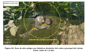
Balística volcán Irazú
(Irazú volcano ballistics)
Figure 65 in: Soto, G.J. & Sjöbohm, L. (2015). Escenarios de amenaza del volcán Irazú (Costa Rica): Una aproximación preliminar. FUNDEVI, Universidad de Costa Rica, Escuela Centroamericana de Geología. 188 p. https://doi.org/10.13140/RG.2.2.22061.54240
Official, Flyer, brochure, short fact-sheet, or handout
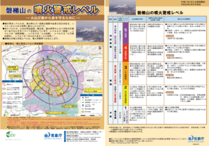
Bandaisan Volcanic Alert Levels
Japan Meteorological Agency. (2019). Bandaisan Volcanic Alert Levels. Volcano Monitoring and Warning Center, Volcano Division, Earthquake and Volcano Department.

Figure in a thesis or dissertation
Batur Community Hazard Map
Figure 5.5 in: Donovan, K.H.M. (2010). Cultural responses to volcanic hazards on Mt Merapi, Indonesia. University of Plymouth, PhD Dissertation.
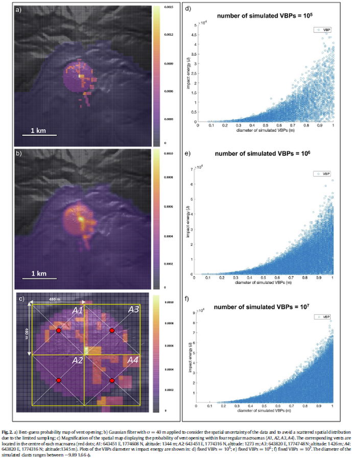
Figure in a journal article
Best-guess probability map of vent opening
Figure 2 in: Massaro, S., Rossi, E., Sandri, L., Bonadonna, C., Selva, J., Moretti, R., & Komorowski, J. C. (2022). Assessing hazard and potential impact associated with volcanic ballistic projectiles: The example of La Soufrière de Guadeloupe volcano (Lesser Antilles). Journal of volcanology and geothermal research, 423, 107453. https://doi.org/10.1016/j.jvolgeores.2021.107453
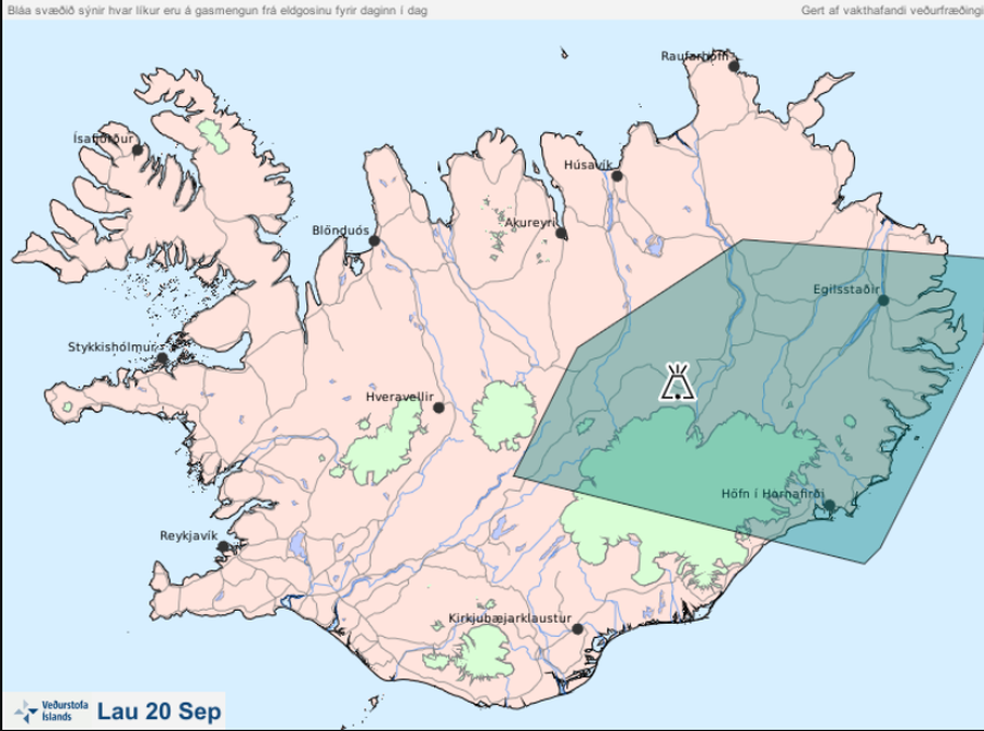
Official, Map in an information statement
Bláa svæðið sýnir hvar líkur eru á gasmengun frá eldgosinu fyrir daginn í dag lau 20 Sep
(The blue area shows the probability of gas pollution from the eruption before today Sat Sep 20)
Iceland Meteorological Office (IMO). (2014). Bláa svæðið sýnir hvar líkur eru á gasmengun frá eldgosinu fyrir daginn í dag lau 20 Sep
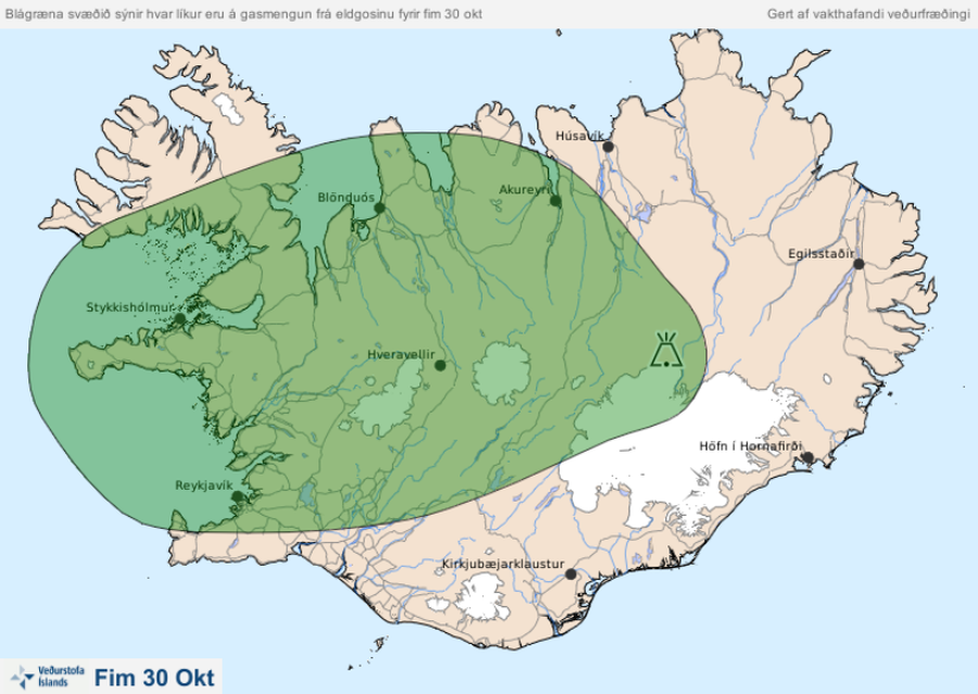
Official, Map in an information statement
Blágræna svæðið sýnir hvar líkur eru á gasmengun frá eldgosinu fyrir fim 30 okt
(The blue-green area shows the probability of gas pollution from the volcanic eruption before Oct. 30)
Iceland Meteorological Office (IMO). (2014). Blágræna svæðið sýnir hvar líkur eru á gasmengun frá eldgosinu fyrir fim 30 okt
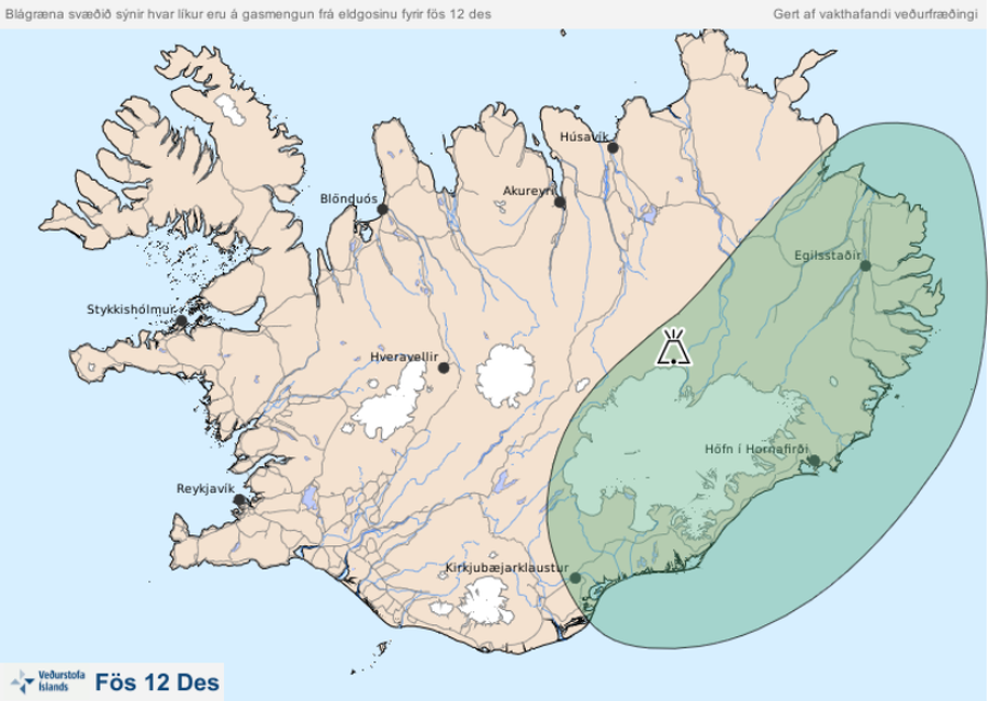
Official, Map in an information statement
Blágræna svæðið sýnir hvar líkur eru á gasmengun frá eldgosinu fyrir fös 12 des
(The blue-green area shows the probability of gas pollution from the eruption before Fri Dec 12)
Iceland Meteorological Office (IMO). (2014). Blágræna svæðið sýnir hvar líkur eru á gasmengun frá eldgosinu fyrir fös 12 des
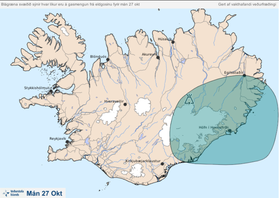
Official, Map in an information statement
Blágræna svæðið sýnir hvar líkur eru á gasmengun frá eldgosinu fyrir mán 27 okt
(The blue-green area shows the likelihood of gas pollution from the eruption before Mon Oct 27)
Iceland Meteorological Office (IMO). (2014). Blágræna svæðið sýnir hvar líkur eru á gasmengun frá eldgosinu fyrir mán 27 okt