
A variety of hazardous phenomena or processes (e.g., lahars, lava flows) are depicted on volcanic hazard maps. Which hazard processes are considered depends on the particular volcano, but also on the temporal and spatial scale of the map and on the map purpose and audience. Maps may focus on a single hazard process type, strive to depict all possible hazard processes, or only show access or danger zones without specifying particular hazard process types.
The most commonly considered hazard processes (Figure 1) in the Volcanic Hazard Maps Database include tephra (52% of maps); pyroclastic density currents, base surges, and/or ash-cloud surges (48%); lahars (46%); ballistics (37%); and lava flows (37%).
Other less commonly considered hazard processes include low-probability, high-impact events, such as debris avalanches and lateral blasts; and secondary hazard processes, such as flooding, tsunamis, fire, and littoral blasts.
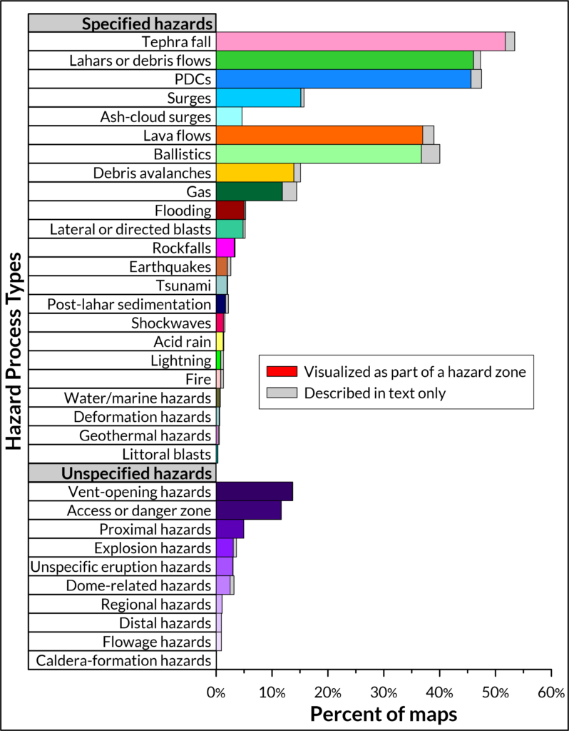
Some hazard processes are more commonly described in text (grey bars in Figure 1) than displayed on the map as part of hazard zones (colored bars in Figure 1), e.g. fire, lightning, and geothermal hazards.
Some hazard zones depict unspecified hazard processes, as is the case with access or danger zones. Other unspecified hazard processes include vent-opening hazards, unspecified eruption or explosion hazards, dome-related hazards, flowage hazards, and hazards related to caldera formation.
Maps can be searched by hazard process type using the advanced search tool.