
Advanced Search for Maps
Showing 1-1 of 1
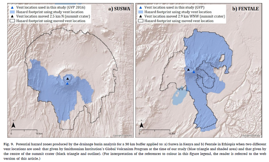
Figure in a journal article
Potential hazard zones produced by the drainage basin analysis for a 30 km buffer applied to: a) Suswa in Kenya and b) Fentale in Ethiopia when two different vent locations are used: that given by Smithsonian Institution’s Global Volcanism Program at the time of our study (blue triangle and shaded area) and that given by the centre of the summit crater (black triangle and outline)
Figure 9 in: Jenkins, S. F., Mee, K., Engwell, S. L., Loughlin, S. C., Faria, B. V. E., Yirgu, G., ... & Crummy, J. (2024). Assessing volcanic hazard and exposure in a data poor context: Case study for Ethiopia, Kenya, and Cabo Verde. Progress in Disaster Science, 23, 100350.