
Advanced Search for Maps
Showing 1-3 of 3
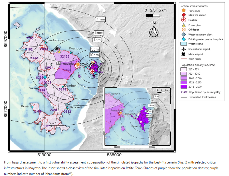
Figure in a journal article
From hazard assessment to a first vulnerability assessment
Figure 6 in: Michaud-Dubuy, A., Komorowski, J. C., Lacombe, T., & Gurioli, L. (2024). Tephra fallout hazard assessment for a hydrovolcanic eruptive scenario in Mayotte. Scientific Reports, 14(1), 31880.
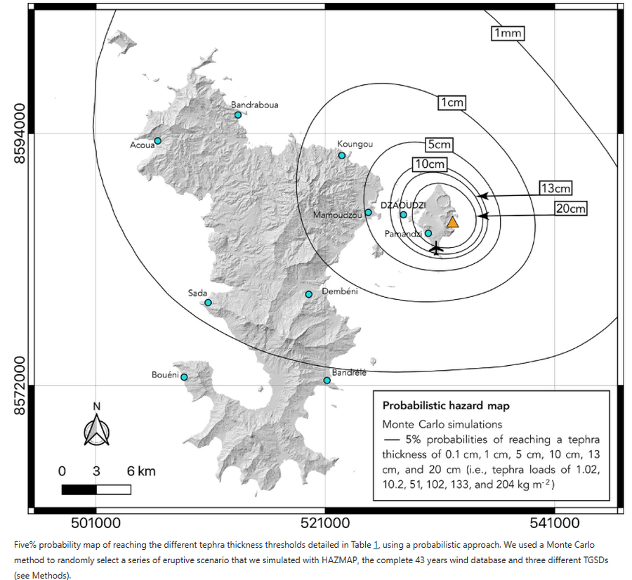
Figure in a journal article
Probabilistic hazard map
Figure 4 in: Michaud-Dubuy, A., Komorowski, J. C., Lacombe, T., & Gurioli, L. (2024). Tephra fallout hazard assessment for a hydrovolcanic eruptive scenario in Mayotte. Scientific Reports, 14(1), 31880.
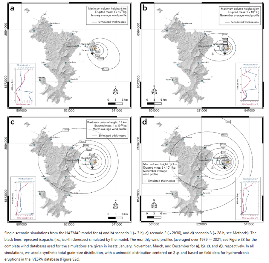
Figure in a journal article
Single scenario simulations from the HAZMAP model
Figure 3 in: Michaud-Dubuy, A., Komorowski, J. C., Lacombe, T., & Gurioli, L. (2024). Tephra fallout hazard assessment for a hydrovolcanic eruptive scenario in Mayotte. Scientific Reports, 14(1), 31880.