Advanced Search for Maps
Showing 1-2 of 2
Karkar, Papua New Guinea
Official, Figure in hazard assessment
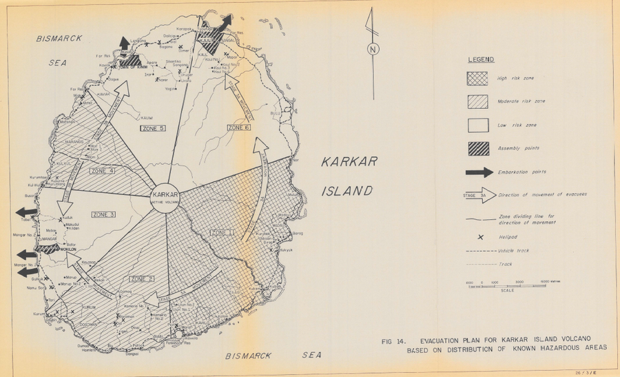
Evacuation Plan for Karkar Island Volcano Based on Distribution of Known Hazardous Areas
Figure 14 in: Lowenstein, P.L. (1982). Problems of volcanic hazards in Papua New Guinea. Geological Survey of Papua New Guinea, Report 82/7, 62 p.
Official, Figure in hazard assessment
Evacuation Plan for Karkar Island Volcano Based on Distribution of Known Hazardous Areas
Figure 14 in: Lowenstein, P.L. (1982). Problems of volcanic hazards in Papua New Guinea. Geological Survey of Papua New Guinea, Report 82/7, 62 p.
Karkar, Papua New Guinea
Official, Figure in hazard assessment
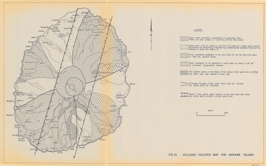
Volcanic Hazards Map for Karkar Island
Figure 13 in: Lowenstein, P.L. (1982). Problems of volcanic hazards in Papua New Guinea. Geological Survey of Papua New Guinea, Report 82/7, 62 p.
Official, Figure in hazard assessment
Volcanic Hazards Map for Karkar Island
Figure 13 in: Lowenstein, P.L. (1982). Problems of volcanic hazards in Papua New Guinea. Geological Survey of Papua New Guinea, Report 82/7, 62 p.