
Advanced Search for Maps
Showing 1-3 of 3

Figure in a journal article
Overzichtskaart van den Tjerimai
(Overview map of the Tjerimai)
Neumann van Padang, M. (1937). De uitbarsting van den Tjerimai in 1937 (verschijnselen van Juni t/m September). De Ingenieur in Nederlandsch-Indië. Mijnbouw en Geologie. De Mijningenieur. 4 (12), p. 212-228

Figure in a journal article
The outline of the threatened region of Mt. Tjerimai
Figure 4 in: Neumann Van Padang, M. (1960). Measures taken by the authorities of the Vulcanological Survey to safeguard the population from the consequences of volcanic outbursts. Bulletin Volcanologique, 23(1), 181-192.
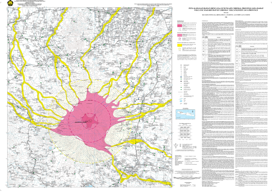
Official, Map sheet or poster
Volcanic Hazard Map of Ciremai Volcano, West Java Province
Hadisantono, R.D., Abdurachman, E.K., Martono, A., Sumpena, A.D., & Fathoni M. (2006). Volcanic Hazard Map of Ciremai Volcano, West Java Province. Center for Volcanology and Geological Hazard Mitigation (CVGHM).