
Advanced Search for Maps
Showing 1-3 of 3
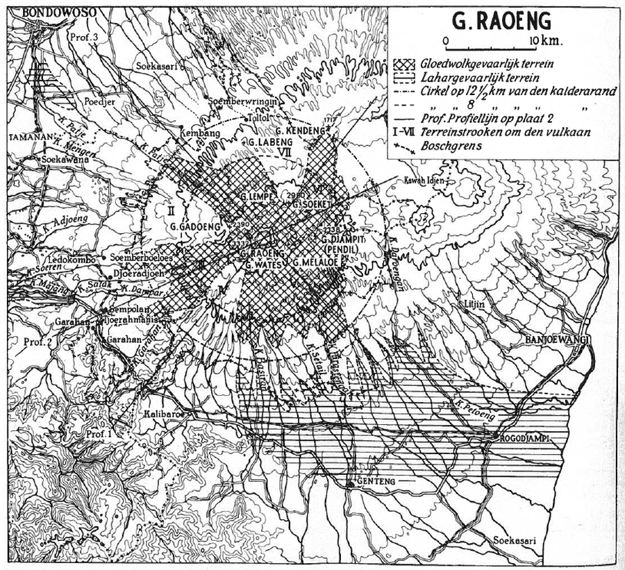
Figure in a journal article
G. Raoeng
Neumann van Padang, M. (1937). De gevaarlijke stroken om den Raoeng. De bergcultures : officieel orgaan van het Algemeen Landbouw Syndicaat, 11 (8), p. 229-237.

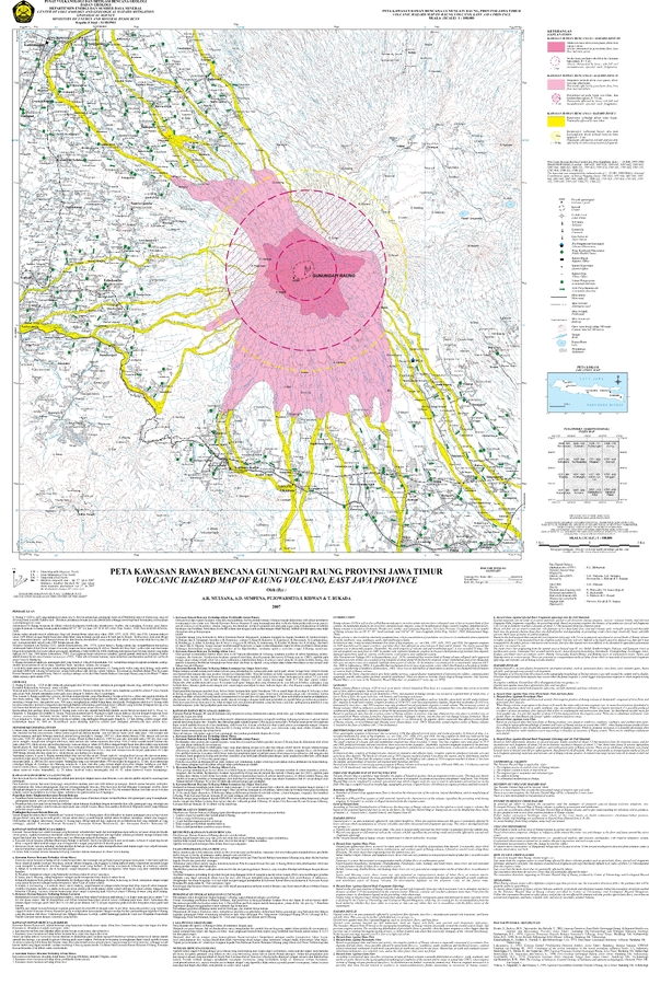
Figure in a journal article
Mt. Raung and the dangerously situated regions
Figure 5 in: Neumann Van Padang, M. (1960). Measures taken by the authorities of the Vulcanological Survey to safeguard the population from the consequences of volcanic outbursts. Bulletin Volcanologique, 23(1), 181-192.
Official, Map sheet or poster
Volcanic Hazard Map of Raung Volcano, East Java Province
Mulyana, A.R., Sumpena, A.D., Pujowarsito, Ridwan, I., & Rukada, T. (2007). Volcanic Hazard Map of Raung Volcano, East Java Province. Center for Volcanology and Geological Hazard Mitigation (CVGHM).