
Advanced Search for Maps
Showing 1-3 of 3
Official, Map sheet or poster
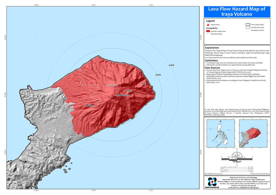
Lava Flow Hazard Map of Iraya Volcano
Department of Science and Technology-Philippine Institute of Volcanology and Seismology (DOST-PHIVOLCS). (2023). Lava Flow Hazard Map of Iraya Volcano. Version 1. 1:15,000. Quezon City, Philippines.
Official, Figure in hazard assessment
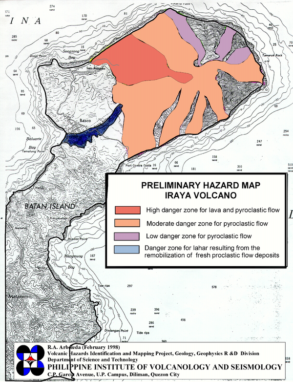
Preliminary Hazard Map Iraya Volcano
Arboleda, R.A. (1998). Preliminary Hazard Map Iraya Volcano. Volcanic Hazards Identification and Mapping Project, Geology, Geophysics R&D Division. Philippine Institute of Volcanology and Seismology (PHIVOLCS). Quezon City.
Official, Map sheet or poster
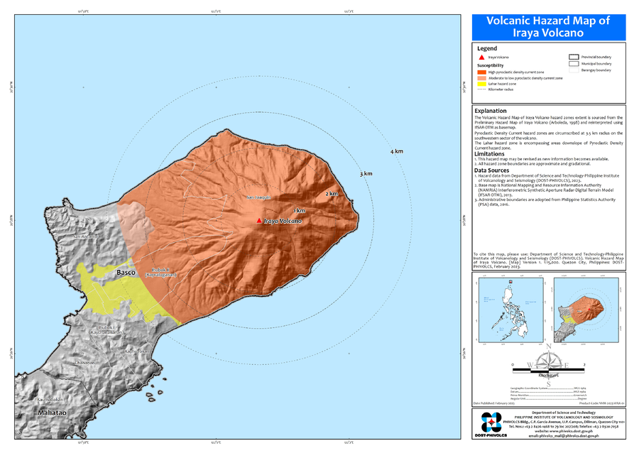
Volcanic Hazard Map of Iraya Volcano
Department of Science and Technology-Philippine Institute of Volcanology and Seismology (DOST-PHIVOLCS). (2023). Volcanic Hazard Map of Iraya Volcano. Version 1. 1:15,000. Quezon City, Philippines.