
Advanced Search for Maps
Showing 1-3 of 3

Figure in a journal article
Delineation of impact areas for three VBP diameters ejected during the scenario of a hydrothermal eruption at the Hsiaoyiokeng fumarole
Figure 6 in: Nurmawati, A., & Konstantinou, K. I. (2018). Hazard assessment of volcanic ballistic impacts at Mt Chihshin, Tatun Volcano Group, northern Taiwan. Natural hazards, 92(1), p. 77-92. https://doi.org/10.1007/s11069-018-3192-4
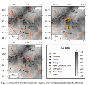
Figure in a journal article
Delineation of impact areas for three VBP diameters ejected during the scenario of a vulcanian eruption originating at the peak of Mt Chihshin
Figure 7 in: Nurmawati, A., & Konstantinou, K. I. (2018). Hazard assessment of volcanic ballistic impacts at Mt Chihshin, Tatun Volcano Group, northern Taiwan. Natural hazards, 92(1), p. 77-92. https://doi.org/10.1007/s11069-018-3192-4
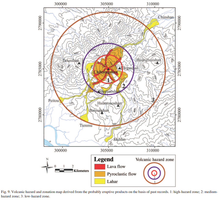
Figure in a journal article
Volcanic hazard and zonation map derived from the probably eruptive products on the basis of past records
Figure 9 in: Tsai, Y.W., Song, S.R., Chen, H.F., Li, S.F., Lo, C.H., Lo, W., & Tsao, S. (2010). Volcanic stratigraphy and potential hazards of the Chihsingshan volcano subgroup in the Tatun Volcano Group, northern Taiwan. TAO: Terrestrial, Atmospheric and Oceanic Sciences, 21(3), 5. https://doi.org/10.3319/TAO.2010.02.22.03(TH)