
Advanced Search for Maps
Showing 1-6 of 6
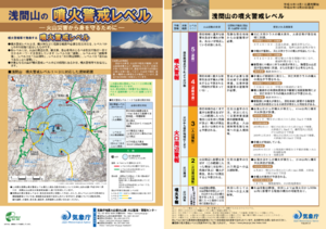
Official, Flyer, brochure, short fact-sheet, or handout
Asamayama Volcanic Alert Levels
Japan Meteorological Agency. (2016). Asamayama Volcanic Alert Levels. Volcano Monitoring and Warning Center, Volcano Division, Earthquake and Volcano Department.
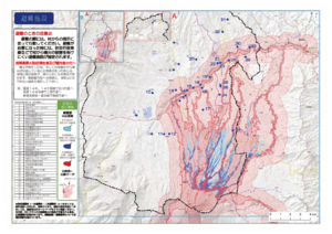
Official, Map in a booklet, long fact-sheet, or handbook
Evacuation facilities
Asamayama Volcanic Disaster Prevention Committee. (2019). Asamayama Volcanic Disaster Prevention Map. Tsumagoi Village.
Map sheet or poster
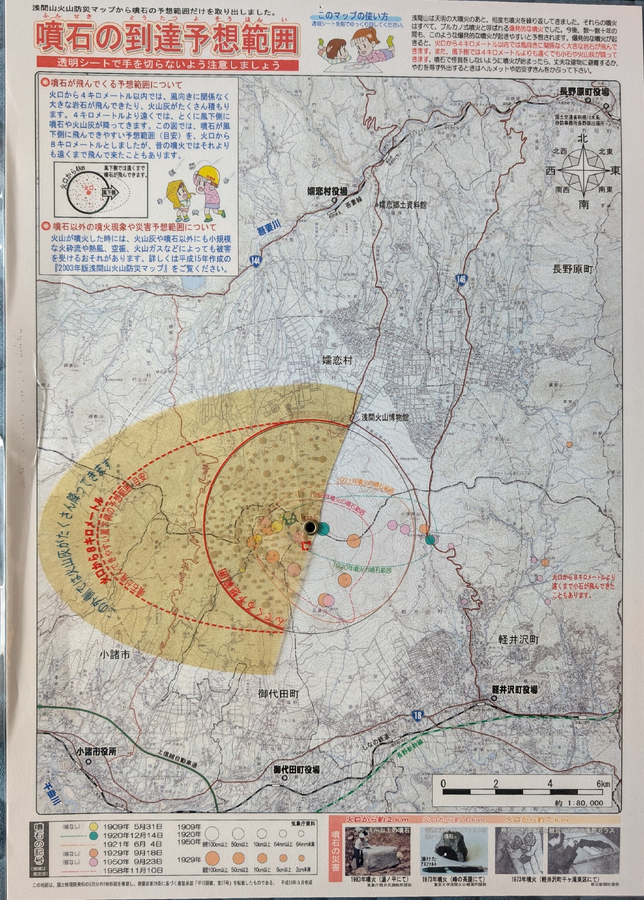
Expected Range of Volcanic Rocks
Japan Meteorological Agency. (2004). Expected Range of Volcanic Rocks.
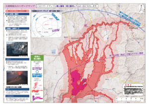
Official, Map in a booklet, long fact-sheet, or handbook
Hazard map of large-scale eruption
Asamayama Volcanic Disaster Prevention Committee. (2019). Asamayama Volcanic Disaster Prevention Map. Tsumagoi Village.
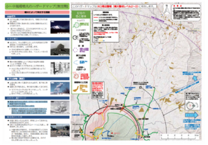
Official, Map in a booklet, long fact-sheet, or handbook
Hazard map of small to medium-scale eruptions (snow season)
Asamayama Volcanic Disaster Prevention Committee. (2019). Asamayama Volcanic Disaster Prevention Map. Tsumagoi Village.
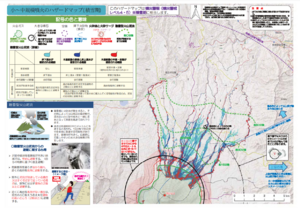
Official, Map in a booklet, long fact-sheet, or handbook
Hazard map of small to medium-scale eruptions (snowless period)
Asamayama Volcanic Disaster Prevention Committee. (2019). Asamayama Volcanic Disaster Prevention Map. Tsumagoi Village.