
Advanced Search for Maps
Showing 1-2 of 2
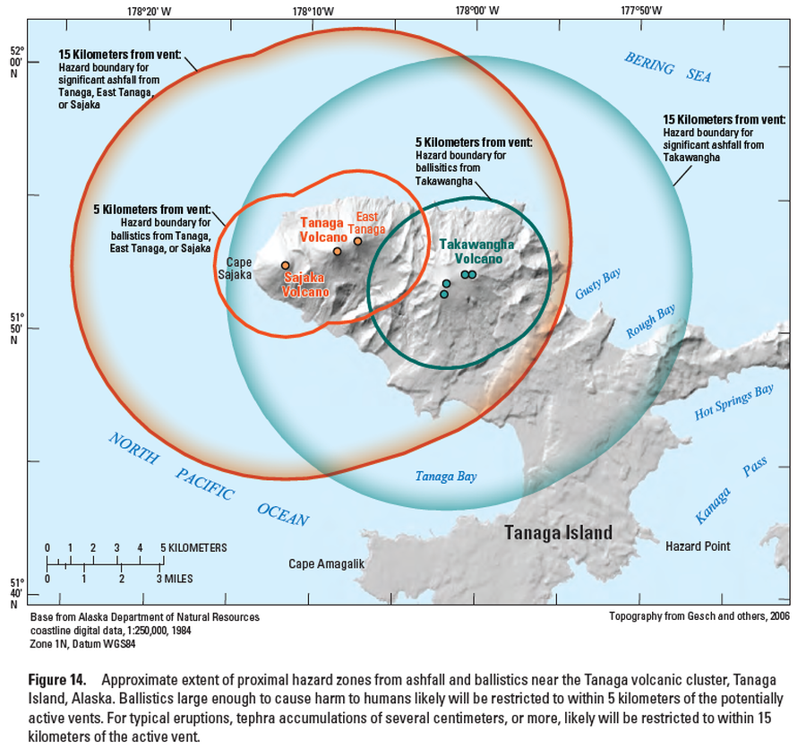
Official, Figure in hazard assessment
Approximate extent of proximal hazard zones from ashfall and ballistics near the Tanaga volcanic cluster, Tanaga Island, Alaska
Figure 14 in: Coombs, M.L., McGimsey, R.G. & Browne, B.L. (2007). Preliminary volcano-hazard assessment for the Tanaga volcanic cluster, Tanaga Island, Alaska. U.S. Geological Survey, Scientific Investigations Report 2007-5094, 41 p., 1 plate. https://doi.org/10.3133/sir20075094
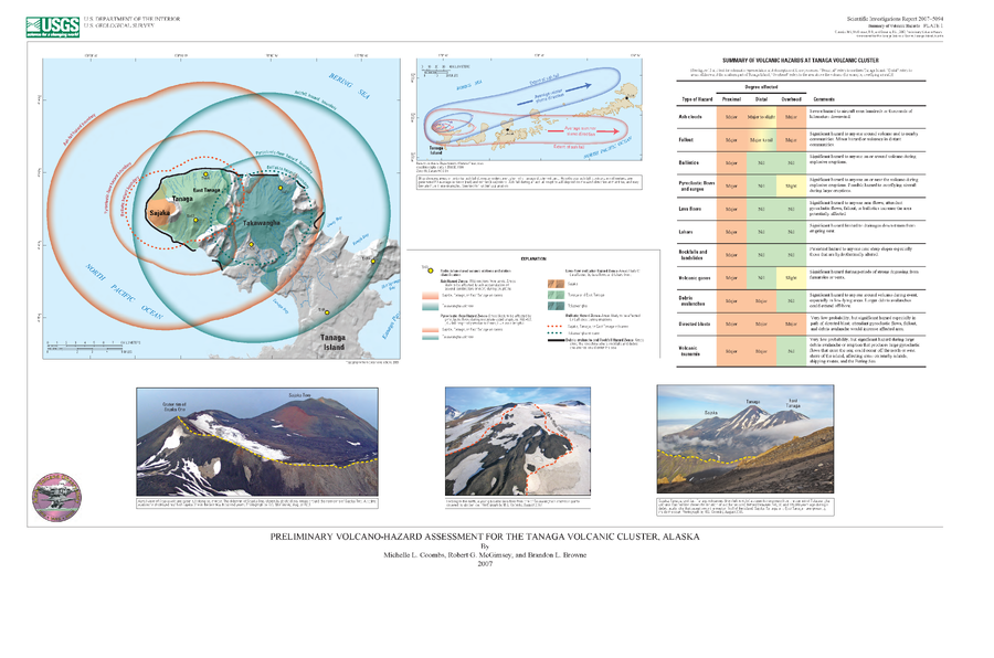
Official, Insert/poster-size map with accompanying report
Preliminary Volcano-Hazard Assessment for the Tanaga Volcanic Cluster, Alaska
Plate 1 in: Coombs, M.L., McGimsey, R.G. & Browne, B.L. (2007). Preliminary volcano-hazard assessment for the Tanaga volcanic cluster, Tanaga Island, Alaska. U.S. Geological Survey, Scientific Investigations Report 2007-5094, 41 p., 1 plate. https://doi.org/10.3133/sir20075094