
Advanced Search for Maps
Showing 1-4 of 4
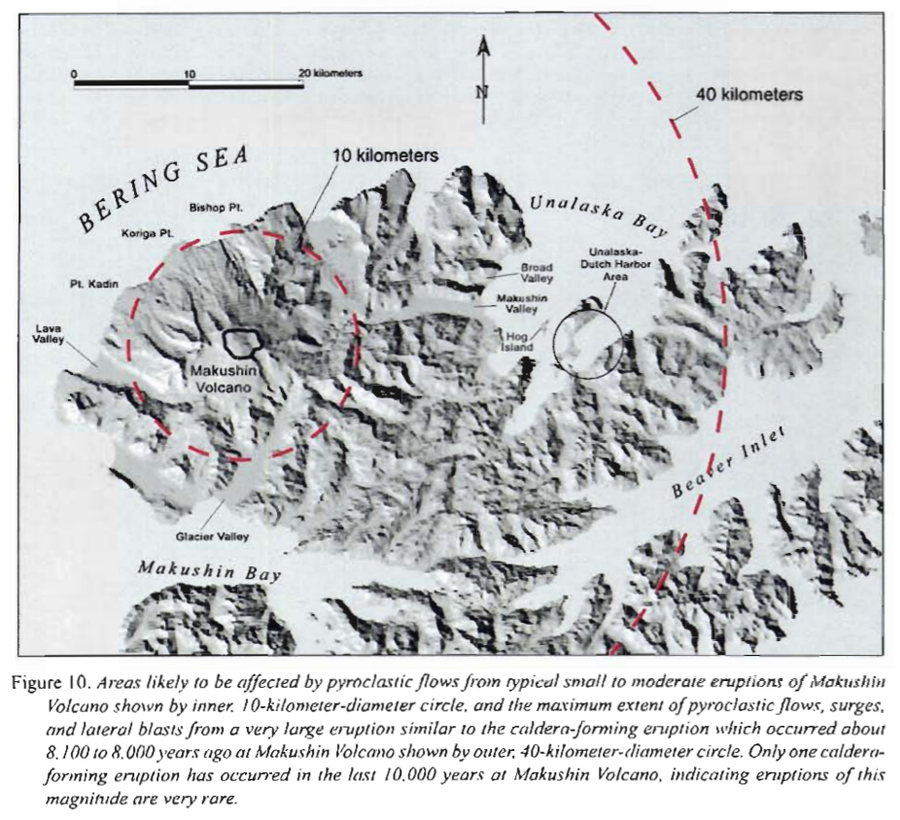
Official, Figure in hazard assessment
Areas likely to be affected by pyroclastic flows from typical small to moderate eruptions of Makushin
Figure 10 in: Beget, J.E., Nye, C.J. & Bean, K.W. (2000). Preliminary volcano-hazard assessment for Makushin Volcano, Alaska. Alaska Division of Geological & Geophysical Surveys, Report of Investigation 2000-4, 22 p., 1 sheet, scale 1:100,000.
Makushin, United States
Official, Figure in hazard assessment
Lateral blast hazard zone at Makushin Volcano, assuming the extent of a future blast is comparable to that at Mount St. Helens in 1980
Figure 13 in: Beget, J.E., Nye, C.J. & Bean, K.W. (2000). Preliminary volcano-hazard assessment for Makushin Volcano, Alaska. Alaska Division of Geological & Geophysical Surveys, Report of Investigation 2000-4, 22 p., 1 sheet, scale 1:100,000.
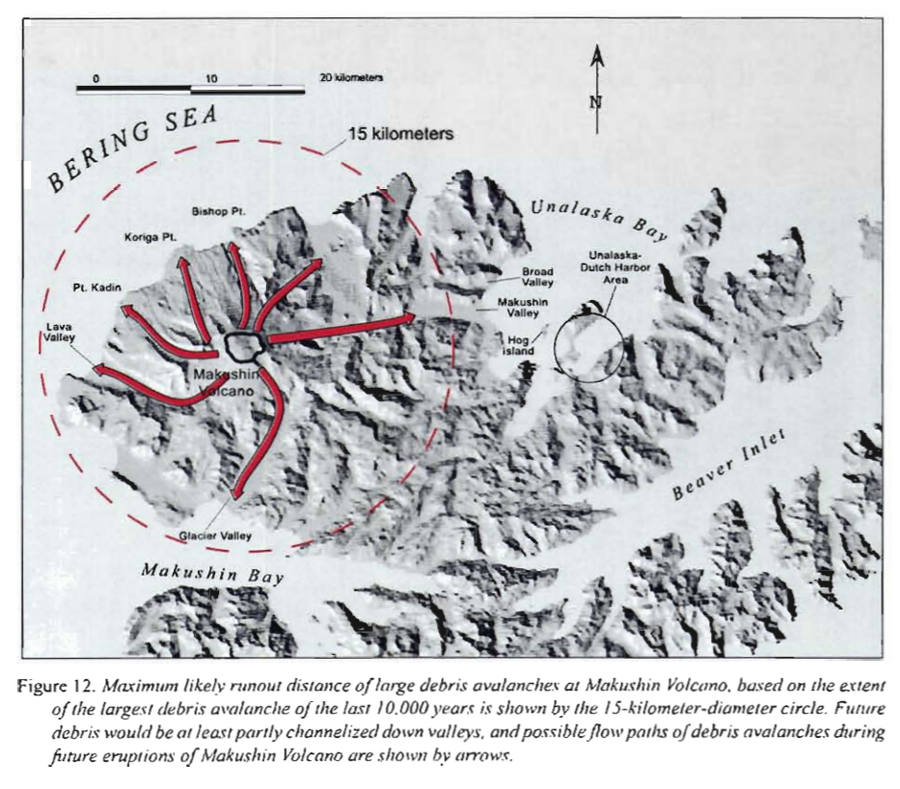
Official, Figure in hazard assessment
Maximum likely runout distance of large debris avalanches at Makushin Volcano
Figure 12 in: Beget, J.E., Nye, C.J. & Bean, K.W. (2000). Preliminary volcano-hazard assessment for Makushin Volcano, Alaska. Alaska Division of Geological & Geophysical Surveys, Report of Investigation 2000-4, 22 p., 1 sheet, scale 1:100,000.
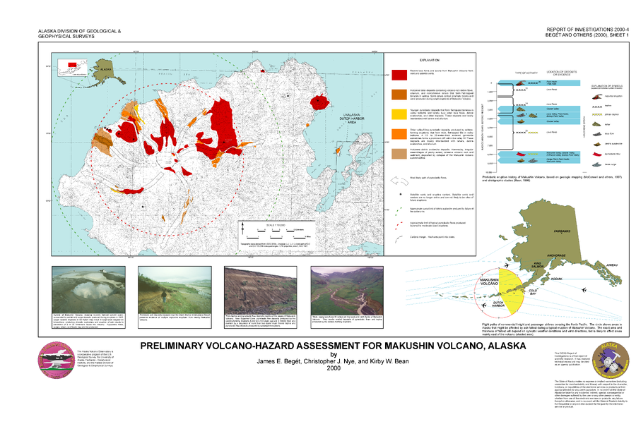
Official, Insert/poster-size map with accompanying report
Preliminary Volcano-Hazard Assessment for Makushin Volcano, Alaska
Sheet 1 in: Beget, J.E., Nye, C.J. & Bean, K.W. (2000). Preliminary volcano-hazard assessment for Makushin Volcano, Alaska. Alaska Division of Geological & Geophysical Surveys, Report of Investigation 2000-4, 22 p., 1 sheet, scale 1:100,000.