
Advanced Search for Maps
Showing 1-4 of 4
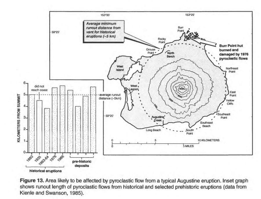
Official, Figure in hazard assessment
Area likely to be affected by pyroclastic flow from a typical Augustine eruption
Figure 13 in: Waythomas, C.F. & Waitt, R. (1998). Preliminary volcano-hazard assessment for Augustine Volcano, Alaska. U.S. Geological Survey, Open-File Report 98-106. https://doi.org/10.3133/ofr98106
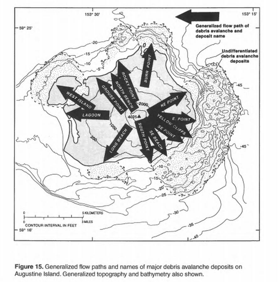
Official, Figure in hazard assessment
Generalized flow paths and names of major debris avalanche deposits on Augustine Island
Figure 15 in: Waythomas, C.F. & Waitt, R. (1998). Preliminary volcano-hazard assessment for Augustine Volcano, Alaska. U.S. Geological Survey, Open-File Report 98-106. https://doi.org/10.3133/ofr98106
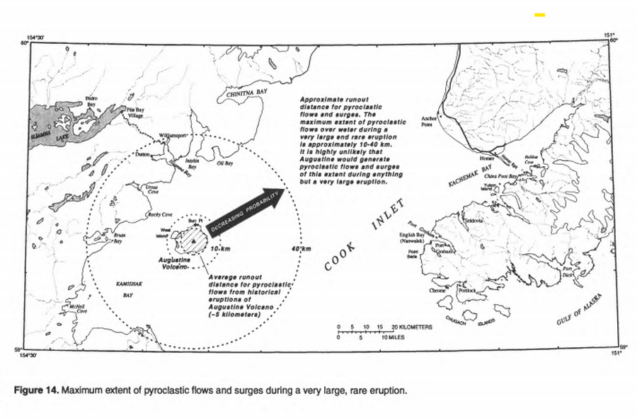
Official, Figure in hazard assessment
Maximum extent of pyroclastic flows and surges during a very large, rare eruption
Figure 14 in: Waythomas, C.F. & Waitt, R. (1998). Preliminary volcano-hazard assessment for Augustine Volcano, Alaska. U.S. Geological Survey, Open-File Report 98-106. https://doi.org/10.3133/ofr98106
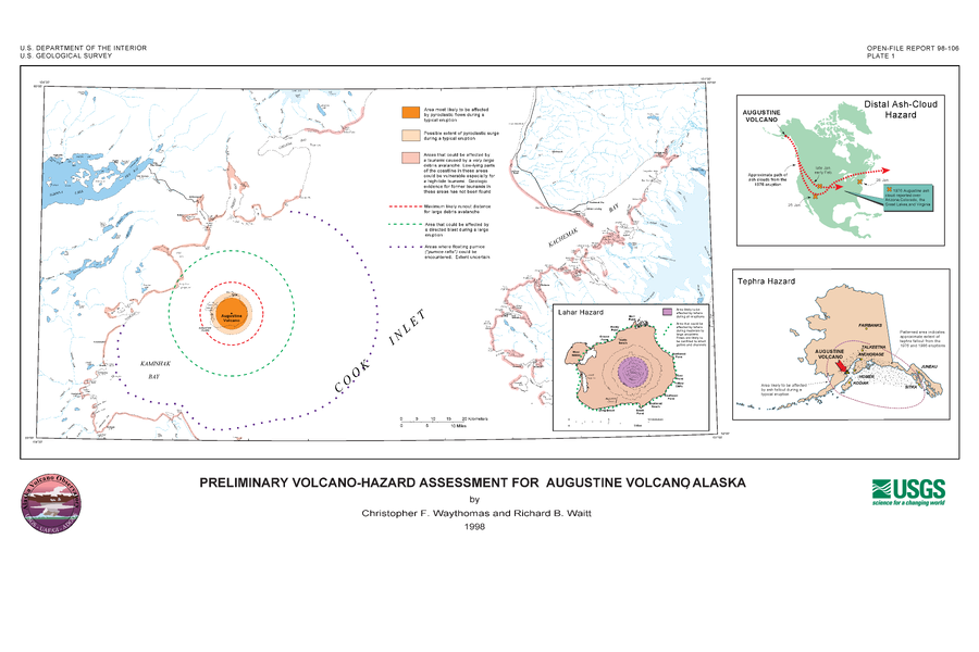
Official, Insert/poster-size map with accompanying report
Preliminary Volcano-Hazard Assessment for Augustine Volcano, Alaska
Plate 1 in: Waythomas, C.F. & Waitt, R. (1998). Preliminary volcano-hazard assessment for Augustine Volcano, Alaska. U.S. Geological Survey, Open-File Report 98-106. https://doi.org/10.3133/ofr98106