
Advanced Search for Maps
Showing 1-7 of 7
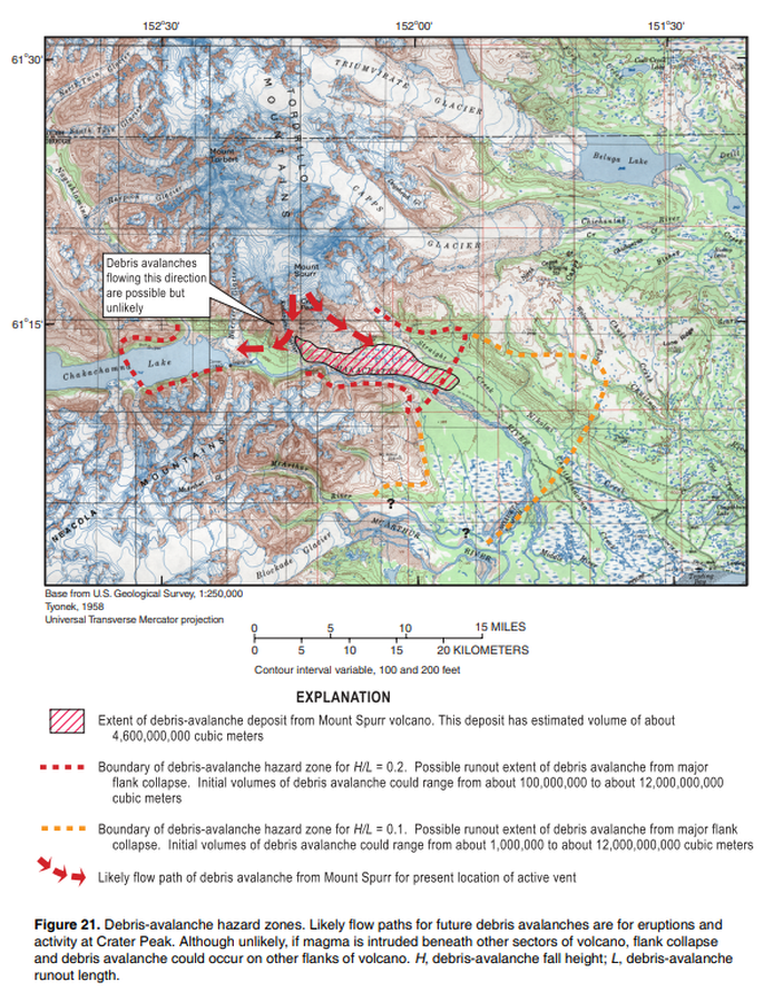
Official, Figure in hazard assessment
Debris-avalanche hazard zone
Figure 21 in: Waythomas, C.F. & Nye, C.J. (2002). Preliminary volcano-hazard assessment for Mount Spurr Volcano, Alaska. U.S. Geological Survey, Open-File Report 2001-482, 40 p., 1 plate. https://doi.org/10.3133/ofr01482
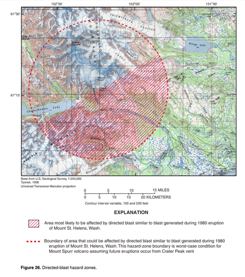
Official, Figure in hazard assessment
Directed-blast hazard zones
Figure 26 in: Waythomas, C.F. & Nye, C.J. (2002). Preliminary volcano-hazard assessment for Mount Spurr Volcano, Alaska. U.S. Geological Survey, Open-File Report 2001-482, 40 p., 1 plate. https://doi.org/10.3133/ofr01482
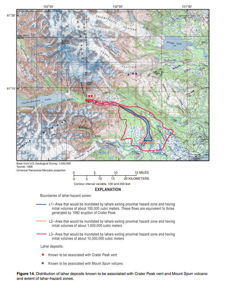
Official, Figure in hazard assessment
Distribution of lahar deposits known to be associated with Crater Peak vent and Mount Spurr volcano and extent of hazard zones
Figure 14 in: Waythomas, C.F. & Nye, C.J. (2002). Preliminary volcano-hazard assessment for Mount Spurr Volcano, Alaska. U.S. Geological Survey, Open-File Report 2001-482, 40 p., 1 plate. https://doi.org/10.3133/ofr01482
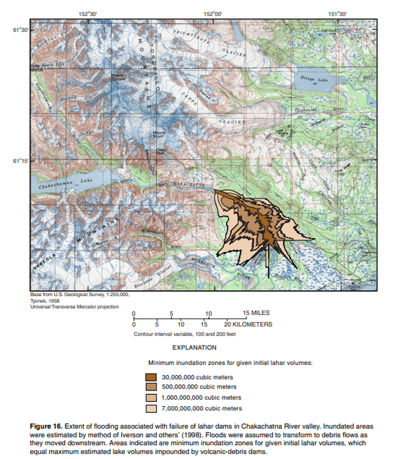
Official, Figure in hazard assessment
Extent of flooding associated with failure of lahar dams in Chakachatna River
Figure 16 in: Waythomas, C.F. & Nye, C.J. (2002). Preliminary volcano-hazard assessment for Mount Spurr Volcano, Alaska. U.S. Geological Survey, Open-File Report 2001-482, 40 p., 1 plate. https://doi.org/10.3133/ofr01482
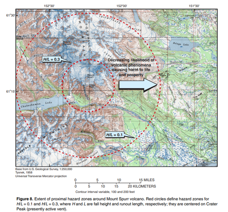
Official, Figure in hazard assessment
Extent of proximal hazard zones around Mount Spurr volcano
Figure 8 in: Waythomas, C.F. & Nye, C.J. (2002). Preliminary volcano-hazard assessment for Mount Spurr Volcano, Alaska. U.S. Geological Survey, Open-File Report 2001-482, 40 p., 1 plate. https://doi.org/10.3133/ofr01482
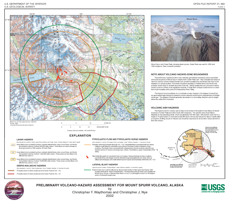
Official, Insert/poster-size map with accompanying report
Preliminary Volcano-Hazard Assessment for Mount Spurr Volcano, Alaska
Plate1 in: Waythomas, C.F. & Nye, C.J. (2002). Preliminary volcano-hazard assessment for Mount Spurr Volcano, Alaska. U.S. Geological Survey, Open-File Report 2001-482, 40 p., 1 plate. https://doi.org/10.3133/ofr01482
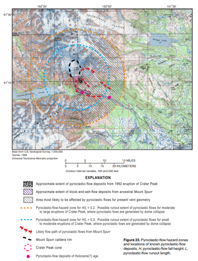
Official, Figure in hazard assessment
Pyroclastic-flow hazard zones and locations of known pyroclastic-flow deposits
Figure 23 in: Waythomas, C.F. & Nye, C.J. (2002). Preliminary volcano-hazard assessment for Mount Spurr Volcano, Alaska. U.S. Geological Survey, Open-File Report 2001-482, 40 p., 1 plate. https://doi.org/10.3133/ofr01482