
Advanced Search for Maps
Showing 1-3 of 3
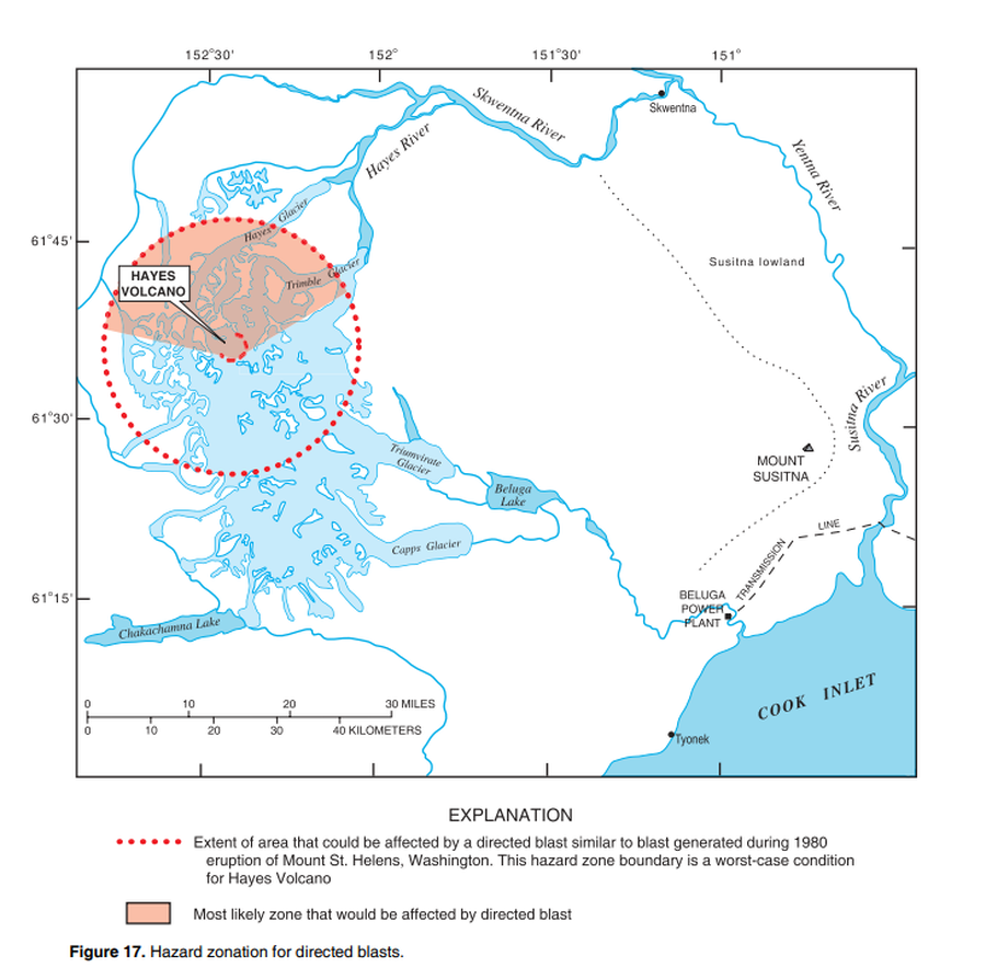
Official, Figure in hazard assessment
Hazard zonation for directed blasts
Figure 17 in: Waythomas, C.F. & Miller, T.P. (2002). Preliminary volcano-hazard assessment for Hayes Volcano, Alaska. U.S. Geological Survey, Open-File Report 02-072, 33 p., 1 plate. https://doi.org/10.3133/ofr0272
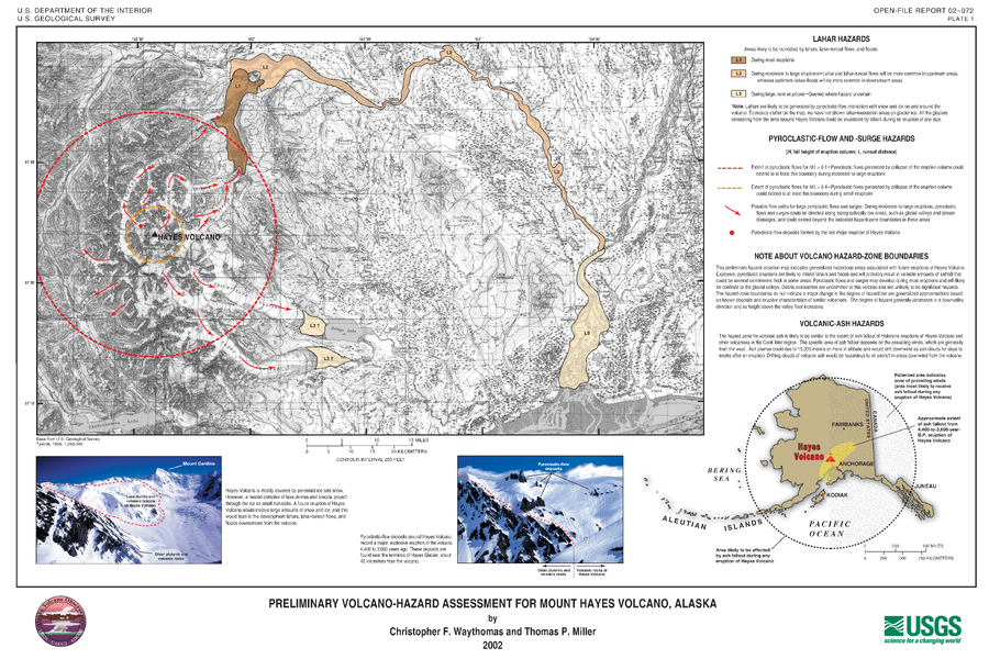
Official, Insert/poster-size map with accompanying report
Preliminary Volcano-Hazard Assessment for Mount Hayes Volcano, Alaska
Plate 1 in: Waythomas, C.F. & Miller, T.P. (2002). Preliminary volcano-hazard assessment for Hayes Volcano, Alaska. U.S. Geological Survey, Open-File Report 02-072, 33 p., 1 plate. https://doi.org/10.3133/ofr0272
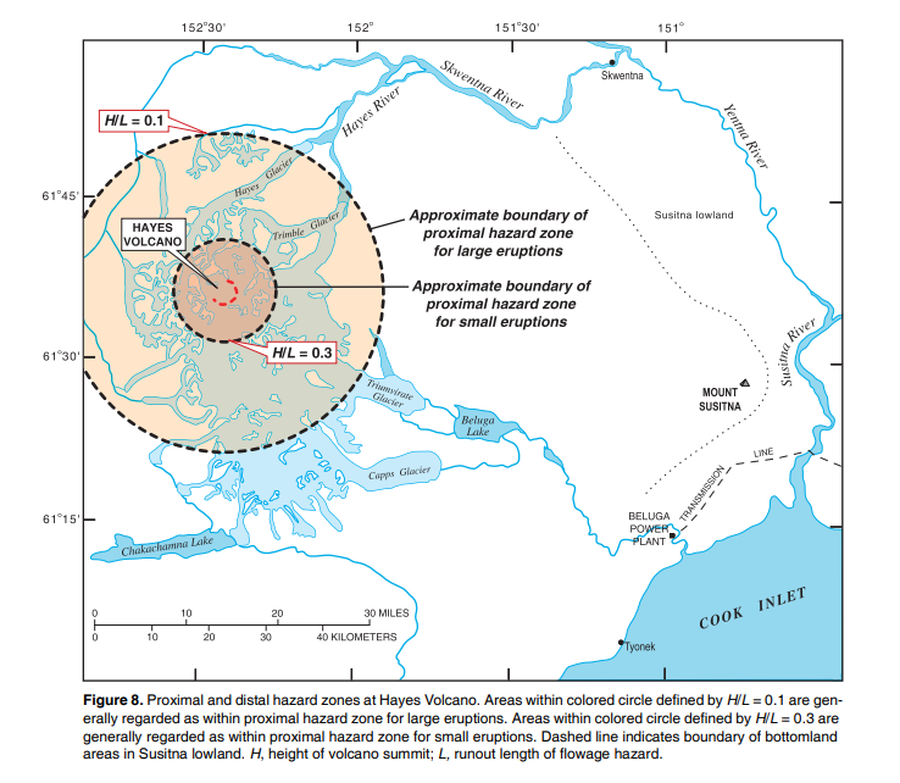
Official, Figure in hazard assessment
Proximal and distal hazard zones at Hayes Volcano
Figure 8 in: Waythomas, C.F. & Miller, T.P. (2002). Preliminary volcano-hazard assessment for Hayes Volcano, Alaska. U.S. Geological Survey, Open-File Report 02-072, 33 p., 1 plate. https://doi.org/10.3133/ofr0272