
Advanced Search for Maps
Showing 1-2 of 2
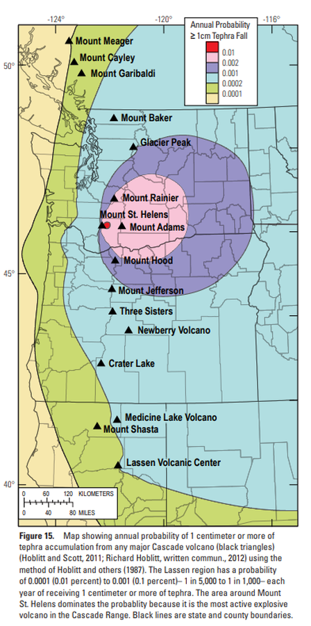
Official, Figure in hazard assessment
Map showing annual probability of 1 centimeter or more of tephra accumulation from any major Cascade volcano
Figure 15 in: Clynne, M. A., Robinson, J. E., Nathenson, M. & Muffler, L. P. (2012). Volcano hazards assessment for the Lassen region, northern California. U.S. Geological Survey, Scientific Investigations Report 2012-5176-A, 47 p., 1 plate. https://doi.org/10.3133/sir20125176A
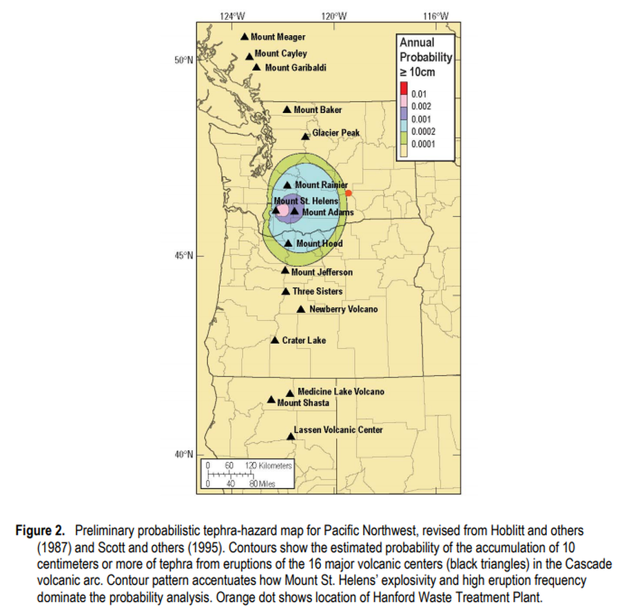
Official, Figure in hazard assessment
Preliminary probabilistic tephra-hazard map for Pacific Northwest
Figure 2 in: Hoblitt, R.P., & Scott, W.E. (2011). Estimate of tephra accumulation probabilities for the U.S. Department of Energy's Hanford Site, Washington. U.S. Geological Survey, Open-File Report 2011-1064, 15 p. https://doi.org/10.3133/ofr20111064