
Advanced Search for Maps
Showing 1-4 of 4

Official, Figure in hazard assessment
Diagrammatic representation (best guess) of relative risk on Oahu from fallout of tephra originating in the zone of most recent volcanism.
Figure 2 in: Crandell, D. R. (1975). Assessment of volcanic risk on the island of Oahu, Hawaii. U.S. Geological Survey, Open-File Report 75-287. https://doi.org/10.3133/ofr75287

Official, Figure in hazard assessment
Zones of relative risk from lateral blasts
Figure 3 in: Crandell, D. R. (1975). Assessment of volcanic risk on the island of Oahu, Hawaii. U.S. Geological Survey, Open-File Report 75-287. https://doi.org/10.3133/ofr75287

Official, Figure in hazard assessment
Zones of relative risk from lava flows
Figure 4 in: Crandell, D. R. (1975). Assessment of volcanic risk on the island of Oahu, Hawaii. U.S. Geological Survey, Open-File Report 75-287. https://doi.org/10.3133/ofr75287
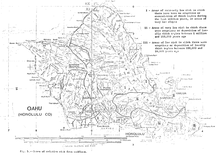
Official, Figure in hazard assessment
Zones of relative risk from mudflows
Figure 5 in: Crandell, D. R. (1975). Assessment of volcanic risk on the island of Oahu, Hawaii. U.S. Geological Survey, Open-File Report 75-287. https://doi.org/10.3133/ofr75287