
Advanced Search for Maps
Showing 1-2 of 2
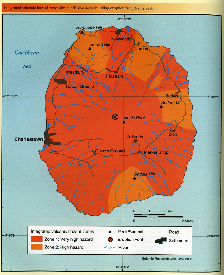
Official, Figure in hazard assessment
Integrated volcanic hazard zones for an effusive dome building eruption from Nevis Peak
Page 176 in: Simpson, K. (2005). Nevis. In: Lindsay, J.M., Shepherd, J.B., Robertson, R.E.A., & Ali, S. (Eds) Volcanic hazard atlas of the Lesser Antilles. Seismic Research Unit, The University of the West Indies, Trinidad and Tobago, W.I., p. 170-178.
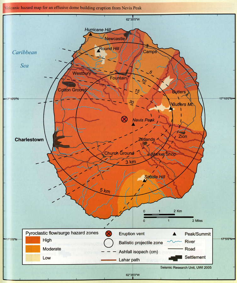
Official, Figure in hazard assessment
Volcanic hazard map for an effusive dome building eruption from Nevis Peak
Page 175 in: Simpson, K. (2005). Nevis. In: Lindsay, J.M., Shepherd, J.B., Robertson, R.E.A., & Ali, S. (Eds) Volcanic hazard atlas of the Lesser Antilles. Seismic Research Unit, The University of the West Indies, Trinidad and Tobago, W.I., p. 170-178.