
Advanced Search for Maps
Showing 1-2 of 2
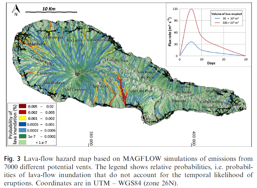
Figure in a journal article
Lava-flow hazard map based on MAGFLOW simulations of emissions from 7000 different potential vents
Figure 3 in: Cappello, A., Zanon, V., Del Negro, C., Ferreira, T. J., & Queiroz, M. G. (2015). Exploring lava‐flow hazards at Pico Island, Azores Archipelago (Portugal). Terra Nova, 27(2), 156-161.
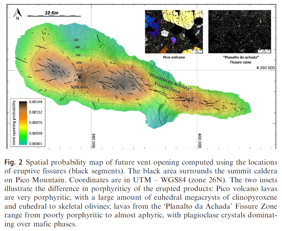
Figure in a journal article
Spatial probability map of future vent opening computed using the locations of eruptive fissures (black segments)
Figure 2 in: Cappello, A., Zanon, V., Del Negro, C., Ferreira, T. J., & Queiroz, M. G. (2015). Exploring lava‐flow hazards at Pico Island, Azores Archipelago (Portugal). Terra Nova, 27(2), 156-161.