
Advanced Search for Maps
Showing 1-4 of 4
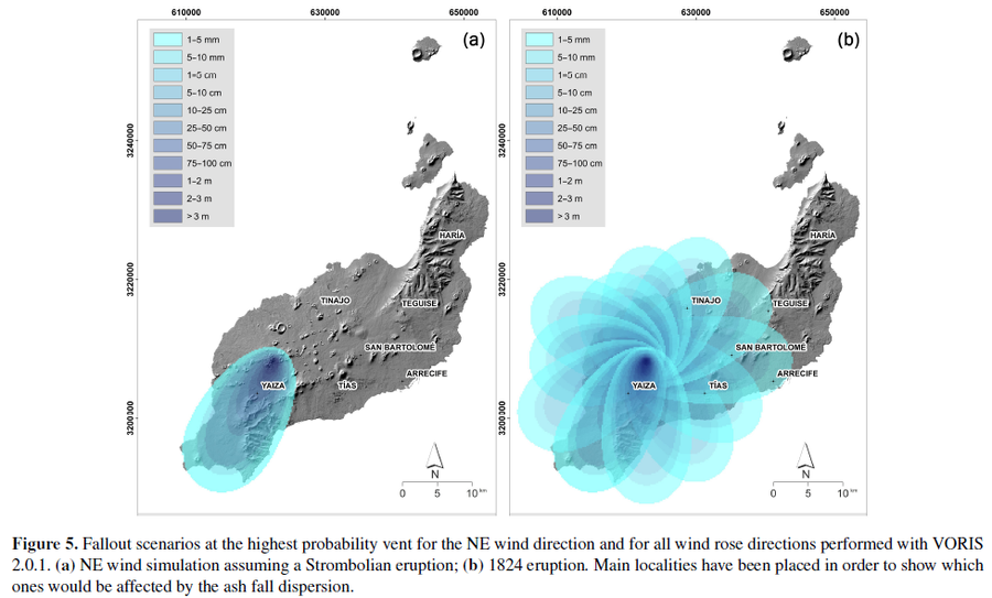
Figure in a journal article
Fallout scenarios at the highest probability vent for the NE wind direction and for all wind rose directions performed with VORIS 2.0.1
Figure 5 in: Becerril, L., Martí, J., Bartolini, S., & Geyer, A. (2017). Assessing qualitative long-term volcanic hazards at Lanzarote Island (Canary Islands). Natural Hazards and Earth System Sciences, 17(7), 1145-1157. https://doi.org/10.5194/nhess-17-1145-2017
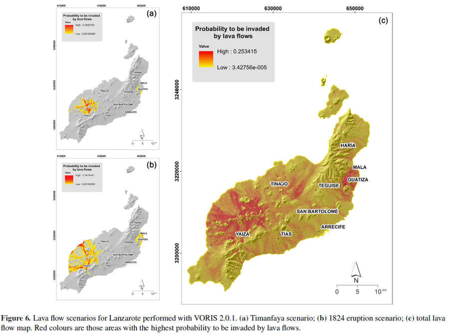
Figure in a journal article
Lava flow scenarios for Lanzarote performed with VORIS 2.0.1
Figure 6 in: Becerril, L., Martí, J., Bartolini, S., & Geyer, A. (2017). Assessing qualitative long-term volcanic hazards at Lanzarote Island (Canary Islands). Natural Hazards and Earth System Sciences, 17(7), 1145-1157. https://doi.org/10.5194/nhess-17-1145-2017
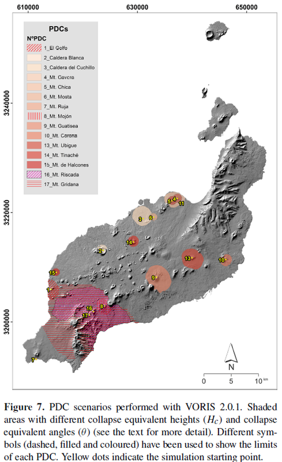
Figure in a journal article
PDC scenarios performed with VORIS 2.0.1
Figure 7 in: Becerril, L., Martí, J., Bartolini, S., & Geyer, A. (2017). Assessing qualitative long-term volcanic hazards at Lanzarote Island (Canary Islands). Natural Hazards and Earth System Sciences, 17(7), 1145-1157. https://doi.org/10.5194/nhess-17-1145-2017
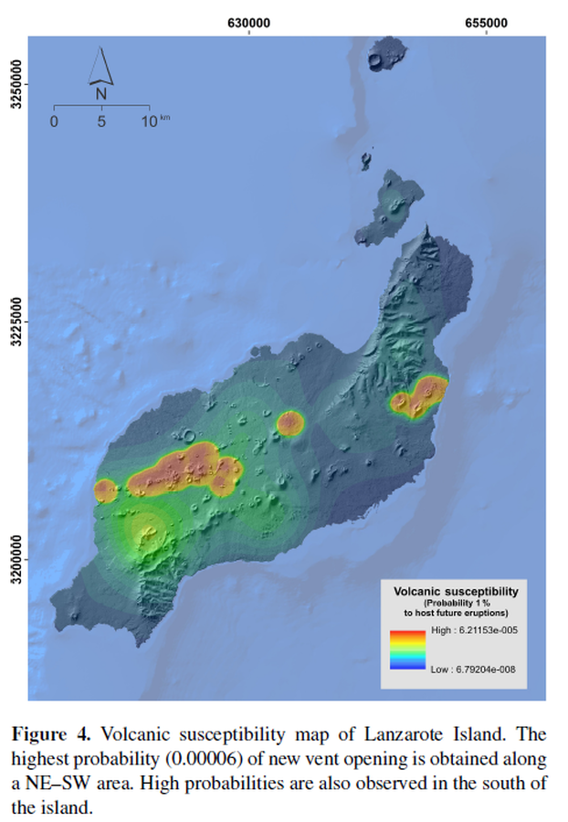
Figure in a journal article
Susceptibility map of Lanzarote Island
Figure 4 in: Becerril, L., Martí, J., Bartolini, S., & Geyer, A. (2017). Assessing qualitative long-term volcanic hazards at Lanzarote Island (Canary Islands). Natural Hazards and Earth System Sciences, 17(7), 1145-1157. https://doi.org/10.5194/nhess-17-1145-2017