
Advanced Search for Maps
Showing 1-4 of 4
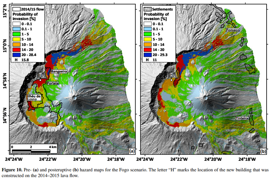
Figure in a journal article
Pre- and posteruptive hazard maps for the Fogo scenario
Figure 10 in: Richter, N., Favalli, M., de Zeeuw-van Dalfsen, E., Fornaciai, A., da Silva Fernandes, R. M., Pérez, N. M., Levy, J., Victoria, S.S., & Walter, T. R. (2016). Lava flow hazard at Fogo Volcano, Cabo Verde, before and after the 2014–2015 eruption. Natural Hazards and Earth System Sciences, 16(8), 1925-1951. https://doi.org/10.5194/nhess-16-1925-2016
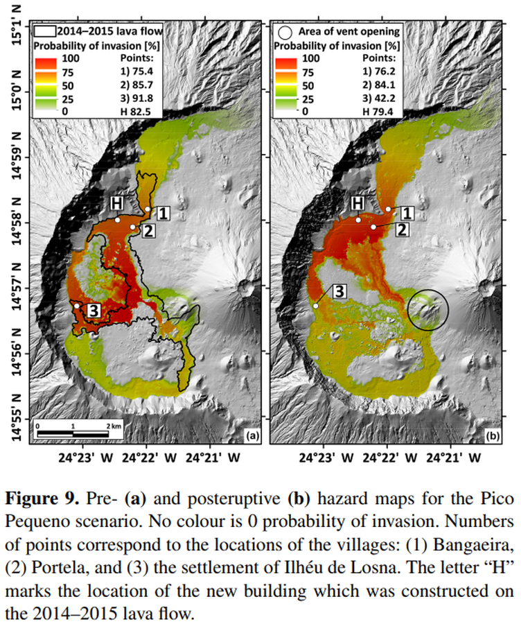
Figure in a journal article
Pre- and posteruptive hazard maps for the Pico Pequeno scenario
Figure 9 in: Richter, N., Favalli, M., de Zeeuw-van Dalfsen, E., Fornaciai, A., da Silva Fernandes, R. M., Pérez, N. M., Levy, J., Victoria, S.S., & Walter, T. R. (2016). Lava flow hazard at Fogo Volcano, Cabo Verde, before and after the 2014–2015 eruption. Natural Hazards and Earth System Sciences, 16(8), 1925-1951. https://doi.org/10.5194/nhess-16-1925-2016
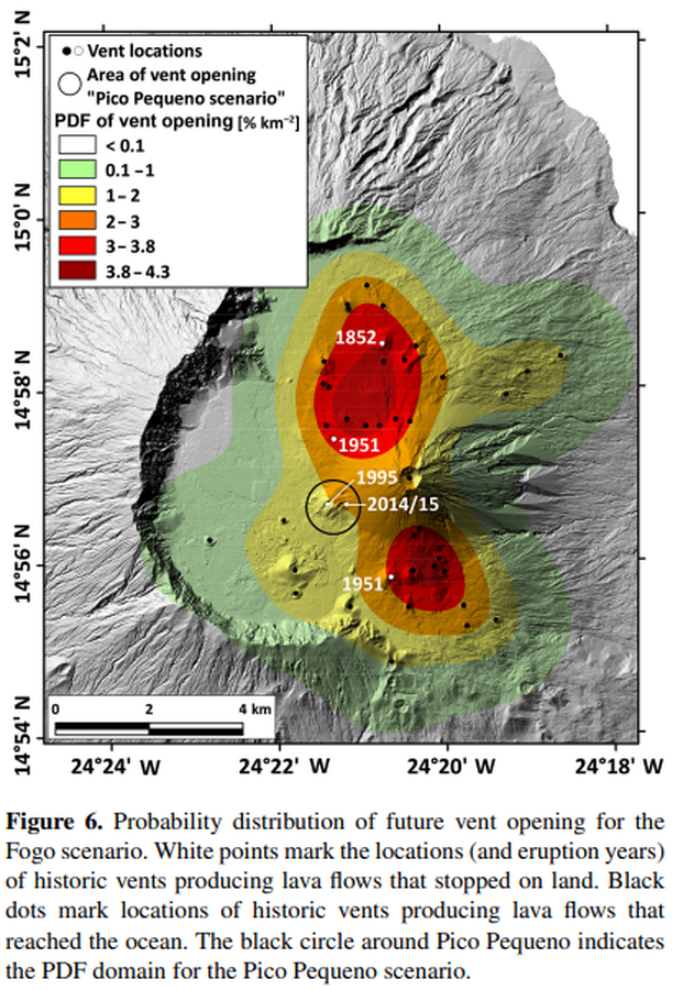
Figure in a journal article
Probability distribution of future vent opening for the Fogo scenario
Figure 6 in: Richter, N., Favalli, M., de Zeeuw-van Dalfsen, E., Fornaciai, A., da Silva Fernandes, R. M., Pérez, N. M., Levy, J., Victoria, S.S., & Walter, T. R. (2016). Lava flow hazard at Fogo Volcano, Cabo Verde, before and after the 2014–2015 eruption. Natural Hazards and Earth System Sciences, 16(8), 1925-1951. https://doi.org/10.5194/nhess-16-1925-2016

Figure in a journal article
Provisional volcanic hazard map for a large explosive eruption similar to the 1680 event
Figure 5 in: Komorowski JC., Morin J., Jenkins S., & Kelman I. (2016) Challenges of Volcanic Crises on Small Islands States. In: Fearnley C.J., Bird D.K., Haynes K., McGuire W.J., Jolly G. (eds) Observing the Volcano World. Advances in Volcanology. International Association of Volcanology and Chemistry of the Earth’s Interior – IAVCEI. Springer. https://doi.org/10.1007/11157_2015_15. Adapted from: Day, S.F., Faria, B.V.E. (2009). A geological hazard map of the Island of Fogo showing broad distribution of volcanic and other hazards. MIA-VITA Workshop, São Filipe, Fogo.