
Advanced Search for Maps
Showing 11-16 of 16
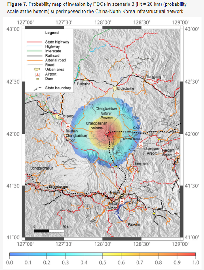
Figure in a journal article
Probability map of invasion by PDCs in scenario 3
Figure 7 in: Lombardi AM, Del Gaudio P, Guo Z, Zhang M, Liu G, Sepe V, Liu J, Ventura G. (2020). Scenario-Based Pyroclastic Density Current Invasion Maps at Poorly Known Volcanoes: A Case Study from Changbaishan (China/North Korea). Applied Sciences, 10(7), 2622. https://doi.org/10.3390/app10072622
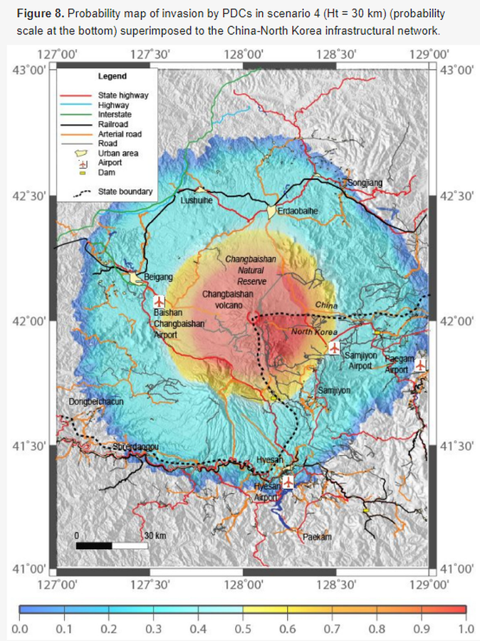
Figure in a journal article
Probability map of invasion by PDCs in scenario 4
Figure 8 in: Lombardi AM, Del Gaudio P, Guo Z, Zhang M, Liu G, Sepe V, Liu J, Ventura G. (2020). Scenario-Based Pyroclastic Density Current Invasion Maps at Poorly Known Volcanoes: A Case Study from Changbaishan (China/North Korea). Applied Sciences, 10(7), 2622. https://doi.org/10.3390/app10072622
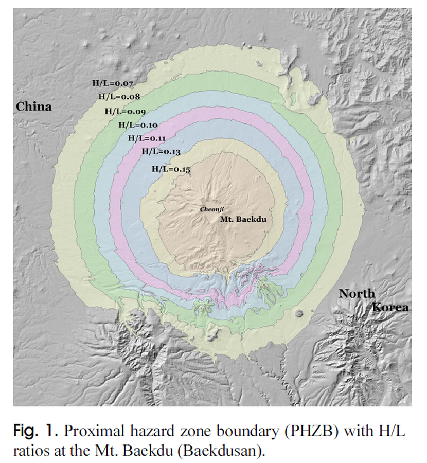
Figure in a journal article
Proximal hazard zone boundary (PHZB) with H/L ratios at the Mt. Baekdu (Baekdusan)
Figure 1 in: Yun, S. H. & Chang, C. (2017). Prediction of Lahar Flow Inundation Areas Using LAHARZ_py Program: Application for the Mt. Baekdu Volcano. Economic and Environmental Geology, 50(4), 277-286. https://doi.org/10.9719/EEG.2017.50.4.277
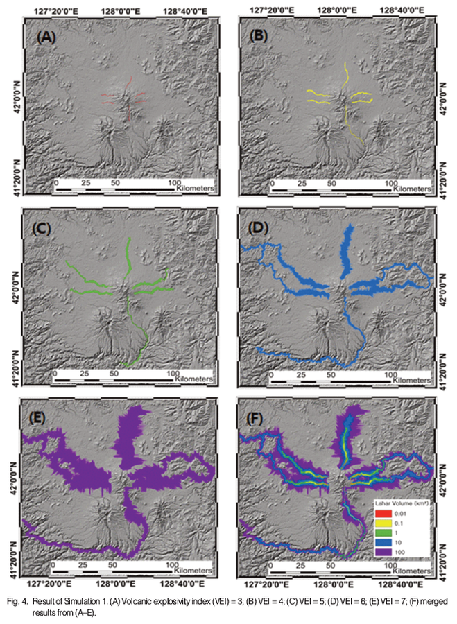
Figure in a journal article
Result of Simulation 1
Figure 4 in: Park, S.-J., & Lee, C.-W. (2018). Inundation Hazard Zone Created by Large Lahar Flow at the Baekdu Volcano Simulated using LAHARZ. Korean Journal of Remote Sensing, 34(1), 75–87. https://doi.org/10.7780/KJRS.2018.34.1.5
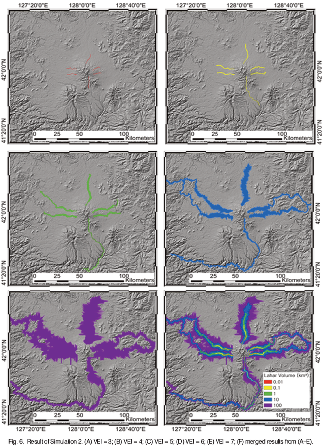
Figure in a journal article
Result of Simulation 2
Figure 6 in: Park, S.-J., & Lee, C.-W. (2018). Inundation Hazard Zone Created by Large Lahar Flow at the Baekdu Volcano Simulated using LAHARZ. Korean Journal of Remote Sensing, 34(1), 75–87. https://doi.org/10.7780/KJRS.2018.34.1.5
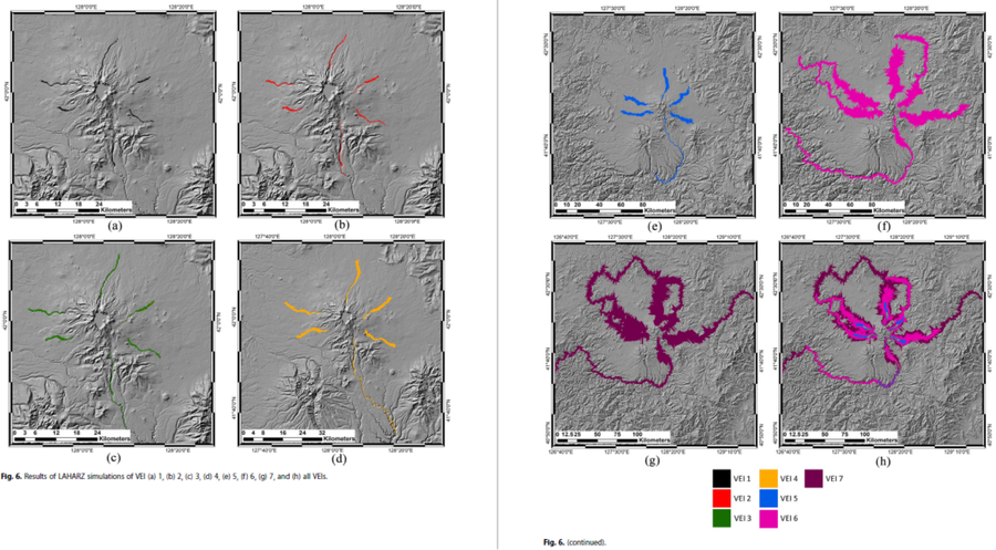
Figure in a journal article
Results of LAHARZ simulations of VEI (a) 1, (b) 2, (c) 3, (d) 4, (e) 5, (f) 6, (g) 7, and (h) all VEIs
Figure 6 in: Achmad, A.R., Lee, S., Park, S. Eom, J., & Lee, C.-W. (2020). Estimating the potential risk of the Mt. Baekdu Volcano using a synthetic interferogram and the LAHARZ inundation zone. Geosciences Journal. 24, 755–768. https://doi.org/10.1007/s12303-020-0032-9
Page: 1 2