Advanced Search for Maps
Showing 11-19 of 19
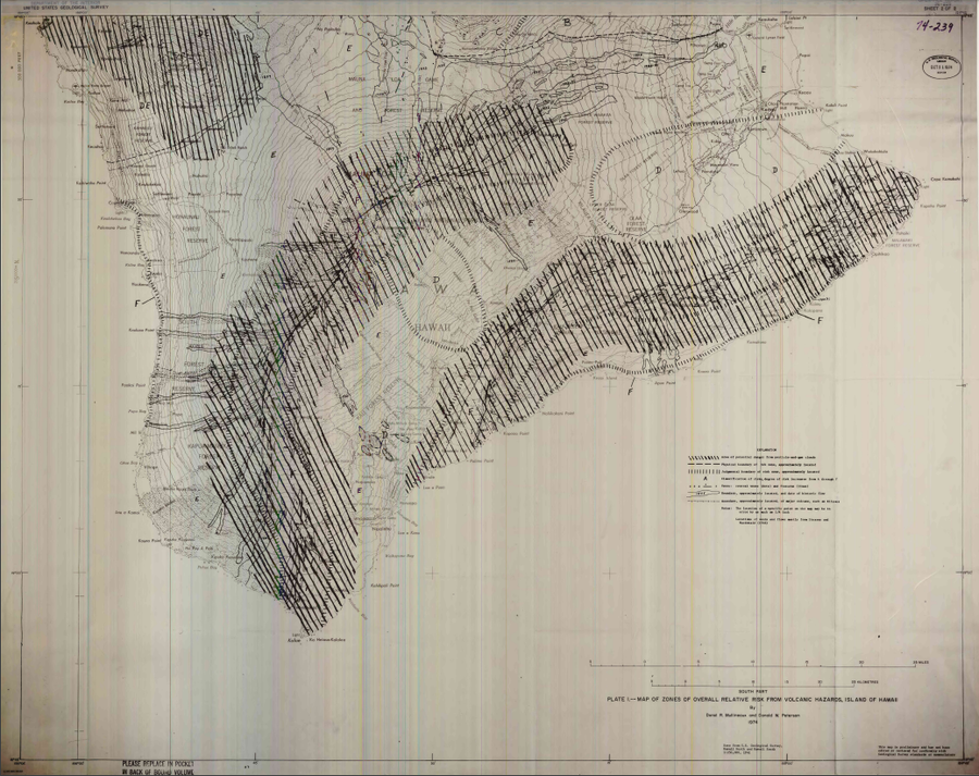
Official, Insert/poster-size map with accompanying report
Map of Zones of Overall Relative Risk From Volcanic Hazards, Island of Hawaii
Plate 1 in: Mullineaux, D.R. & Peterson, D.W. (1974). Volcanic hazards on the Island of Hawaii. U.S. Geological Survey, Open-File Report 74-239. https://doi.org/10.3133/ofr74239
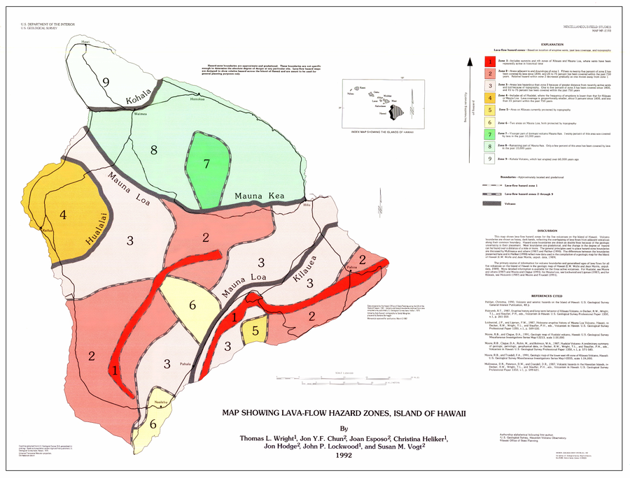
Official, Map sheet or poster
Map Showing Lava-Flow Hazard Zones, Island of Hawaii
Wright, T.L., Chun, J.Y.F., Exposo, J., Heliker, C., Hodge, J., Lockwood, J.P., & Vogt, S.M. (1992). Map showing lava-flow hazard zones, Island of Hawaii. U.S. Geological Survey, Miscellaneous Field Studies Map 2193, scale 1:250,000. https://doi.org/10.3133/mf2193
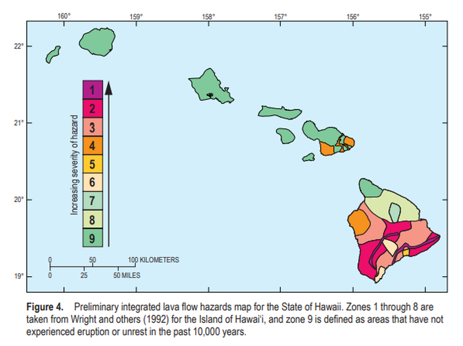
Official, Figure in a journal article
Preliminary integrated lava flow hazards map for the State of Hawaii
Figure 4 in: Kauahikaua, J.P. & Tilling, R.I. (2014). Natural hazards and risk reduction in Hawai‘i. In: Poland, M.P., Takahashi, T.J., & Landowski, C.M. (eds.) Characteristics of Hawaiian Volcanoes. US Geological Survey Professional Paper 1801, p. 397-427. https://doi.org/10.3133/pp180110
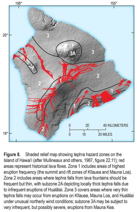
Official, Figure in a journal article
Shaded relief map showing tephra hazard zones on the Island of Hawai‘i
Figure 8 in: Kauahikaua, J.P. & Tilling, R.I. (2014). Natural hazards and risk reduction in Hawai‘i. In: Poland, M.P., Takahashi, T.J., & Landowski, C.M. (eds.) Characteristics of Hawaiian Volcanoes. US Geological Survey Professional Paper 1801, p. 397-427. https://doi.org/10.3133/pp180110
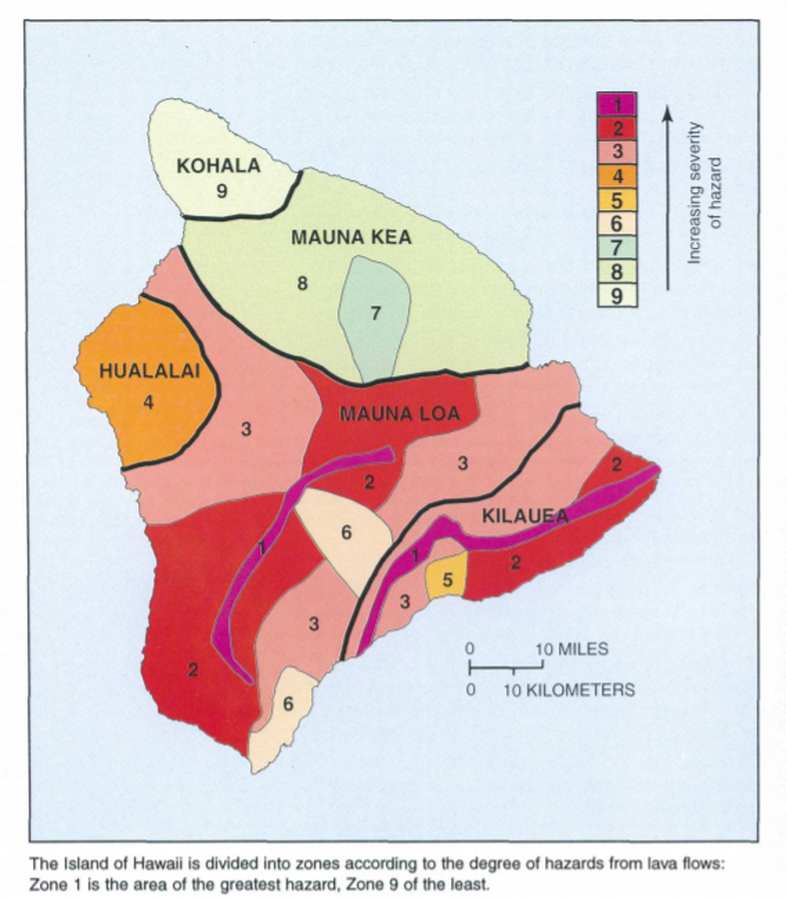
Official, Map in a booklet, long fact-sheet, or handbook
The Island of Hawaii is divided into zones according to the degree of hazards from lava flows
Page 22 in: U.S. Geological Survey (USGS). (1997). Volcanic and Seismic Hazards on the Island of Hawaii. U.S. Geological Survey, Unumbered Series, 48 p. https://doi.org/10.3133/7000036 (Simplified from: Wright 1992)
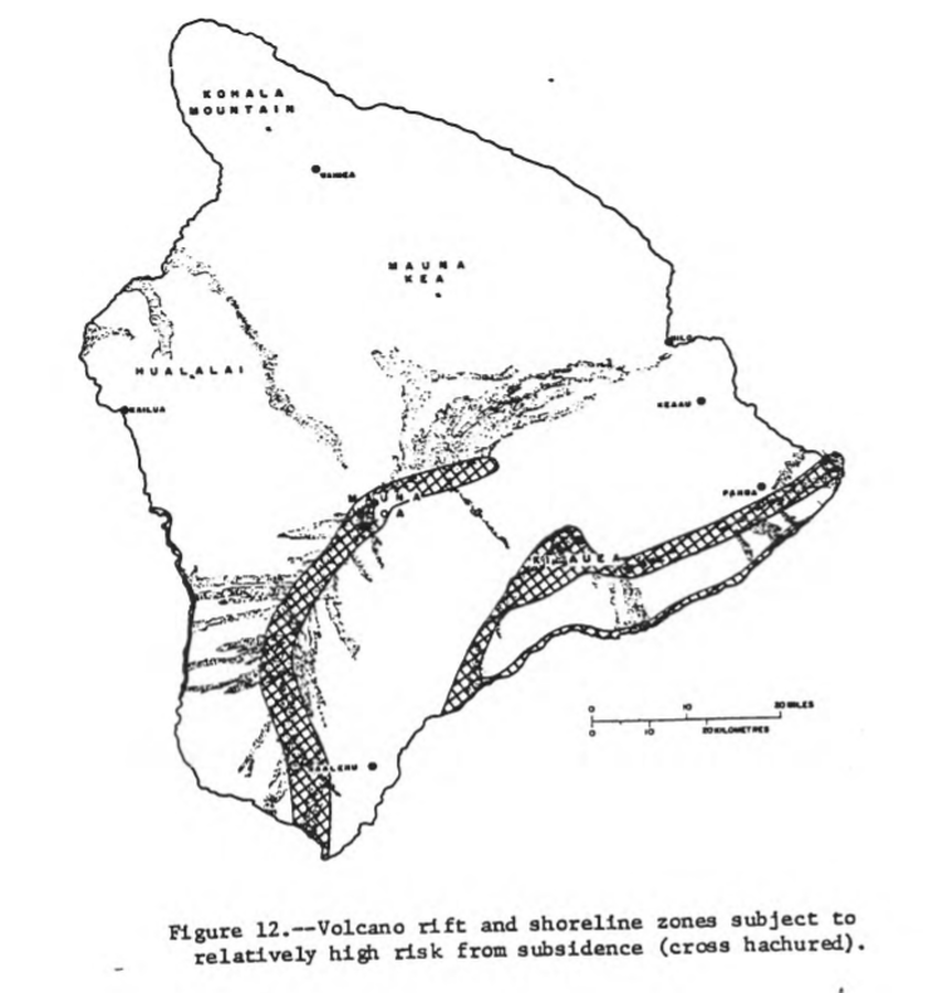
Official, Figure in hazard assessment
Volcano rift and shoreline zones subject to relatively high risk from subsidence (cross hachured)
Figure 12 in: Mullineaux, D.R. & Peterson, D.W. (1974). Volcanic hazards on the Island of Hawaii. U.S. Geological Survey, Open-File Report 74-239. https://doi.org/10.3133/ofr74239
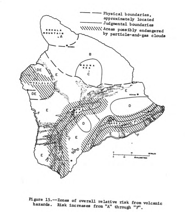
Official, Figure in hazard assessment
Zones of overall relative risk from volcanic hazards. Risk increases from "A" through "F"
Figure 15 in: Mullineaux, D.R. & Peterson, D.W. (1974). Volcanic hazards on the Island of Hawaii. U.S. Geological Survey, Open-File Report 74-239. https://doi.org/10.3133/ofr74239
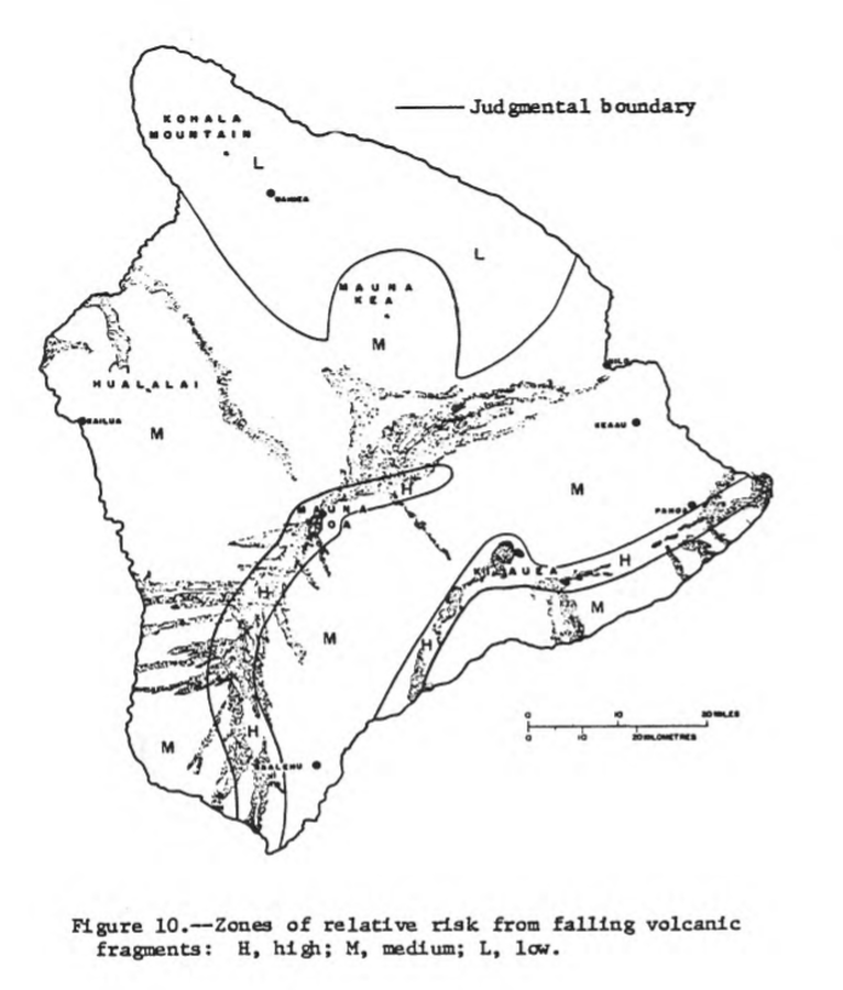
Official, Figure in hazard assessment
Zones of relative risk from falling volcanic fragments
Figure 10 in: Mullineaux, D.R. & Peterson, D.W. (1974). Volcanic hazards on the Island of Hawaii. U.S. Geological Survey, Open-File Report 74-239. https://doi.org/10.3133/ofr74239

Official, Figure in hazard assessment
Zones of relative risk from lava-flow burial
Figure 9 in: Mullineaux, D.R. & Peterson, D.W. (1974). Volcanic hazards on the Island of Hawaii. U.S. Geological Survey, Open-File Report 74-239. https://doi.org/10.3133/ofr74239
Page: 1 2
