Advanced Search for Maps
Showing 21-21 of 21

Official, Figure in a journal article
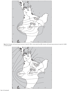
Volcanic ash hazard map (contours in mm) for 500 yr return period and volcanic ash hazard map (contours in mm) for 10,000 yr return period
Figure 8 in: Hurst, T. & Smith, W. (2010). Volcanic ashfall in New Zealand–probabilistic hazard modelling for multiple sources. New Zealand Journal of Geology and Geophysics, 53(1), 1-14. https://doi.org/10.1080/00288301003631129
