Advanced Search for Maps
Showing 31-40 of 46
Mauna Loa, United States
Official, Insert/poster-size map with accompanying report
Maps Showing Lava Inundation Zones for Mauna Loa, Hawai'i - Map 8. Ho'okena, Ka'ohe, and Ka'apuna inundation zones
Sheet 8 in: Trusdell, F.A., Graves, P., & Tincher, C.R. (2002). Map Showing Lava Inundation Zones for Mauna Loa, Hawai‘i. U.S. Geological Survey, Miscellaneous Field Studies Map MF-2401. 10 Map Sheets (each 22 x 34 inches); Pamphlet (14 p.) scale 1:70000. https://doi.org/10.3133/mf2401
Mauna Loa, United States
Official, Insert/poster-size map with accompanying report
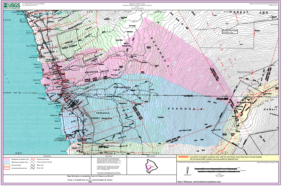
Maps Showing Lava Inundation Zones for Mauna Loa, Hawai'i - Map 9. Honaunau and Kealakekua inundation zones
Sheet 9 in: Trusdell, F.A., Graves, P., & Tincher, C.R. (2002). Map Showing Lava Inundation Zones for Mauna Loa, Hawai‘i. U.S. Geological Survey, Miscellaneous Field Studies Map MF-2401. 10 Map Sheets (each 22 x 34 inches); Pamphlet (14 p.) scale 1:70000. https://doi.org/10.3133/mf2401
Mauna Loa, United States
Official, Insert/poster-size map with accompanying report
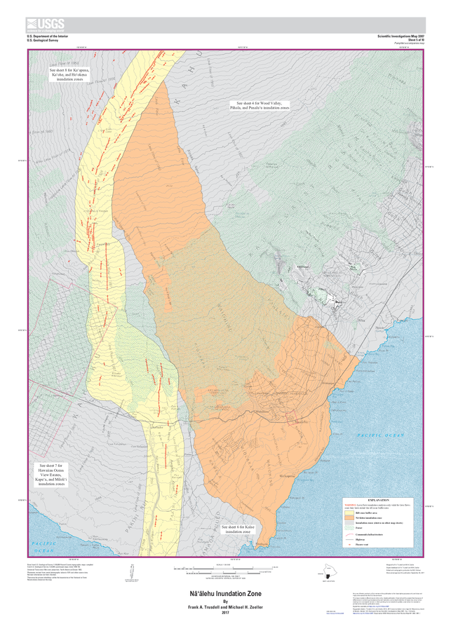
Nāʻālehu Inundation Zone
Sheet 5 in: Trusdell, F.A. & Zoeller, M.H. (2017). Lava inundation zone maps for Mauna Loa, Island of Hawaiʻi, Hawaii. U.S. Geological Survey, Scientific Investigations Map 3387, 12 p., 10 sheets. https://doi.org/10.3133/sim3387
Hawai‘i (regional), United States
Official, Figure in a journal article
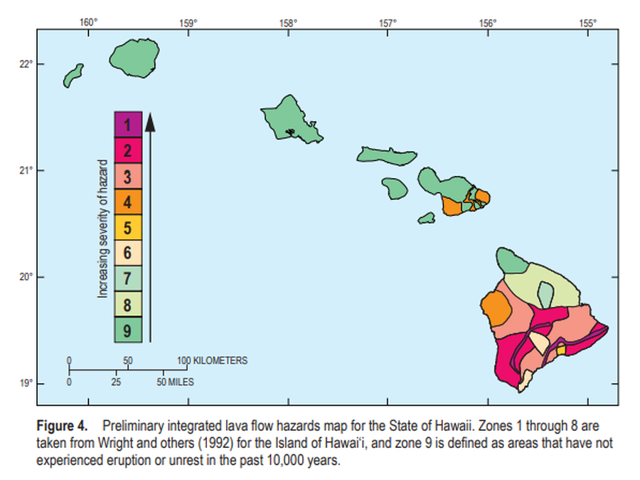
Preliminary integrated lava flow hazards map for the State of Hawaii
Figure 4 in: Kauahikaua, J.P. & Tilling, R.I. (2014). Natural hazards and risk reduction in Hawai‘i. In: Poland, M.P., Takahashi, T.J., & Landowski, C.M. (eds.) Characteristics of Hawaiian Volcanoes. US Geological Survey Professional Paper 1801, p. 397-427. https://doi.org/10.3133/pp180110
Mauna Loa, United States
Official, Insert/poster-size map with accompanying report
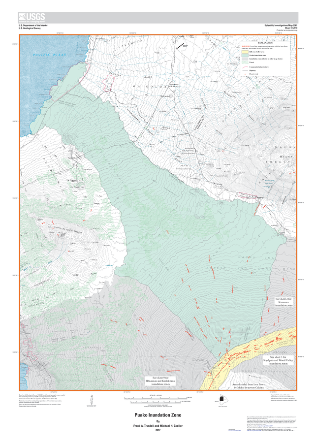
Puako Inundation Zone
Sheet 10 in: Trusdell, F.A. & Zoeller, M.H. (2017). Lava inundation zone maps for Mauna Loa, Island of Hawaiʻi, Hawaii. U.S. Geological Survey, Scientific Investigations Map 3387, 12 p., 10 sheets. https://doi.org/10.3133/sim3387
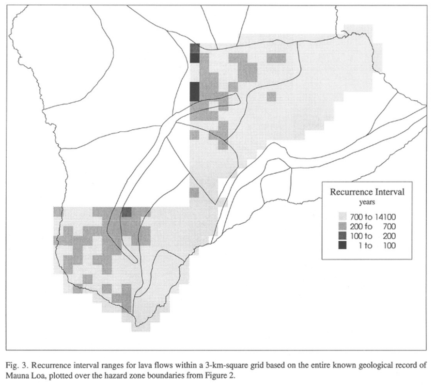
Mauna Loa, United States
Official, Figure in a journal article
Recurrence interval ranges for lava flows within a 3-km-square grid based on the entire known geological record of Mauna Loa
Figure 3 in: Kauahikaua, J., Margriter, S., Lockwood, J., & Trusdell, F. (1995). Applications of GIS to the estimation of lava flow hazards on Mauna Loa Volcano, Hawai'i. Washington DC American Geophysical Union Geophysical Monograph Series, 92, 315-325. https://doi.org/10.1029/GM092p0315
Mauna Loa, United States
Official, Figure in a journal article
Recurrence interval ranges for lava flows within a 3-km-square grid based on the geologic record of Mauna Loa from the last 150 years
Figure 4 in: Kauahikaua, J., Margriter, S., Lockwood, J., & Trusdell, F. (1995). Applications of GIS to the estimation of lava flow hazards on Mauna Loa Volcano, Hawai'i. Washington DC American Geophysical Union Geophysical Monograph Series, 92, 315-325. https://doi.org/10.1029/GM092p0315
Mauna Loa, United States
Official, Figure in a journal article
Recurrence intervals for lava flows erupted between 1843 and the present within topographically-defined catchments
Figure 5 in: Kauahikaua, J., Margriter, S., Lockwood, J., & Trusdell, F. (1995). Applications of GIS to the estimation of lava flow hazards on Mauna Loa Volcano, Hawai'i. Washington DC American Geophysical Union Geophysical Monograph Series, 92, 315-325. https://doi.org/10.1029/GM092p0315
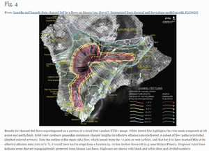
Mauna Loa, United States
Figure in a journal article
Results for channel-fed flows superimposed on a portion of a cloud-free Landsat ETM+ image
Figure 4 in: Rowland, S. K., Garbeil, H., & Harris, A. J. (2005). Lengths and hazards from channel-fed lava flows on Mauna Loa, Hawai ‘i, determined from thermal and downslope modeling with FLOWGO. Bulletin of Volcanology, 67(7), 634-647. https://doi.org/10.1007/s00445-004-0399-x
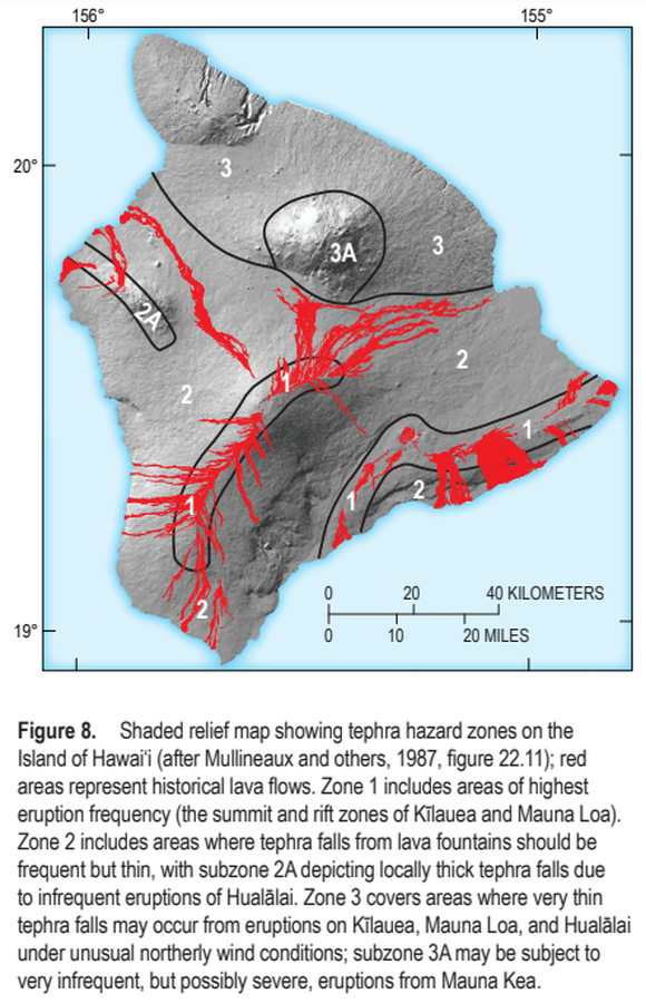
Hawai‘i (regional), United States
Official, Figure in a journal article
Shaded relief map showing tephra hazard zones on the Island of Hawai‘i
Figure 8 in: Kauahikaua, J.P. & Tilling, R.I. (2014). Natural hazards and risk reduction in Hawai‘i. In: Poland, M.P., Takahashi, T.J., & Landowski, C.M. (eds.) Characteristics of Hawaiian Volcanoes. US Geological Survey Professional Paper 1801, p. 397-427. https://doi.org/10.3133/pp180110