
Advanced Search for Maps
Showing 61-70 of 1482
Official, Map sheet or poster
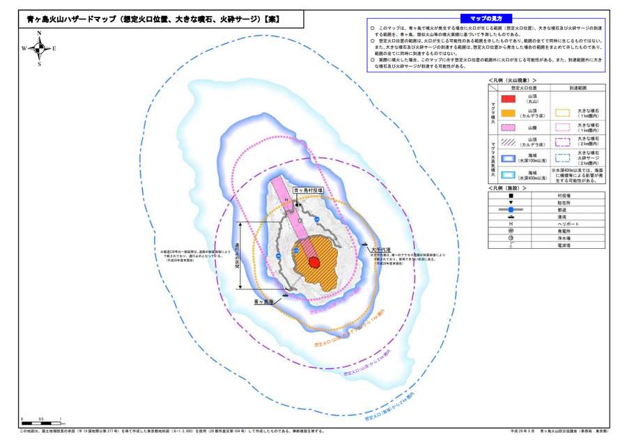
Aogashima volcanic hazard map (assumed crater position, volcanic blocks, pyroclastic surge)
Aogashima Volcano Disaster Prevention Council. (2017). Aogashima volcanic hazard map. Disaster Prevention Division, Bureau of General Affairs, Tokyo Metropolitan Government.
Official, Map sheet or poster
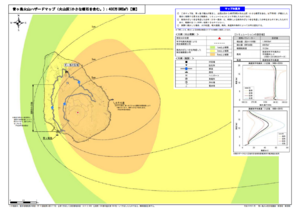
Aogashima volcano hazard map (volcanic ash (including volcanic lapilli): 4 million m³ DRE)
Aogashima Volcano Disaster Prevention Council. (2017). Aogashima volcanic hazard map. Disaster Prevention Division, Bureau of General Affairs, Tokyo Metropolitan Government.
Official, Map sheet or poster
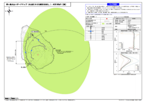
Aogashima volcano hazard map (volcanic ash (including volcanic lapilli): 400,000 m³ DRE)
Aogashima Volcano Disaster Prevention Council. (2017). Aogashima volcanic hazard map. Disaster Prevention Division, Bureau of General Affairs, Tokyo Metropolitan Government.
Official, Figure in hazard assessment
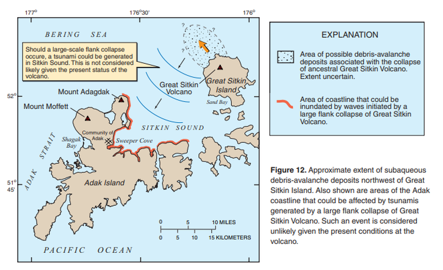
Approximate extent of subaqueous debris-avalanche deposits northwest of Great Sitkin Island. Also shown are areas of Adak coastline that could be affected by tsunamis generated by a large flank collapse of Great Sitkin Volcano.
Figure 12 in: Waythomas, C.F., Miller, T.P. & Nye, C.J. (2003). Preliminary volcano-hazard assessment for Great Sitkin Volcano, Alaska. U.S. Geological Survey, Open-File Report 03-112, 25 p., 1 plate. https://doi.org/10.3133/ofr03112

Official, Flyer, brochure, short fact-sheet, or handout
Are You at Risk from the Next Eruption of Mount Hood? Hazards Zonation Map
Gardner, C. A., Scott, W. E., Major, J. J., & Pierson, T. C. (2000). Mount Hood-history and hazards of Oregon's most recently active volcano. US Geological Survey, Fact Sheet 060-00 (PDF Version). https://doi.org/10.3133/fs06000

Official, Sign or billboard
Area closed. Do not enter. Increased risk of eruption.
Department of Conservation. (2020). Area closed. Do not enter. Increased risk of eruption. December 2020 R183230.
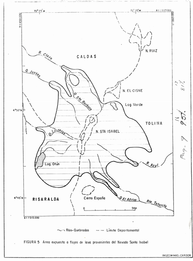
Official, Figure in hazard assessment
Area expuesta a flujos de lava provenientes del Nevado Santa Isabel
(Area exposed to lava flows from Nevado de Santa Isabel)
Figure 5 in: Instituto de Investigaciones en Geociencias, Mineria y Quimica (INGEOMINAS). (1993). Mapa Preliminar de Amenaza Volcanica Potencial Complejo de Domos Santa Isabel, Cordillera Central de Colombia. Ibague.
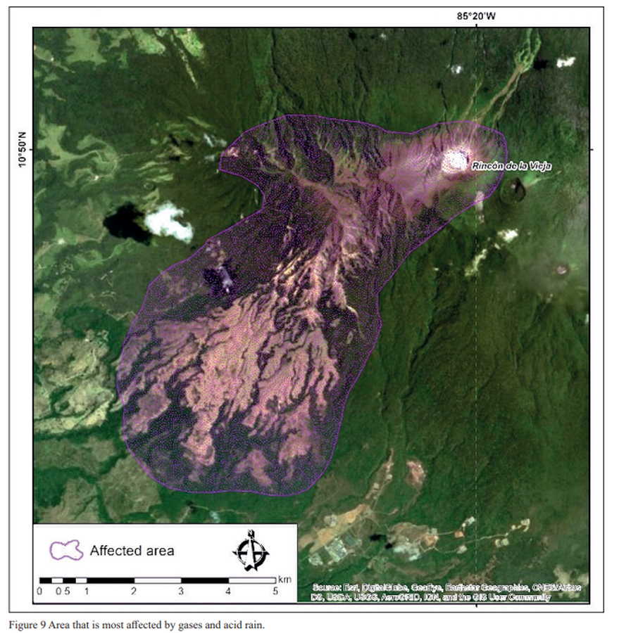
Figure in a journal article
Area that is most affected by gases and acid rain
Figure 9 in: Alpízar, Y., Fernández, M., Ramírez, C., & Arroyo, D. (2019). Hazard Map of Rincón de la Vieja Volcano, Costa Rica: Qualitative Integration of Computer Simulations and Geological Data. Anuario do Instituto de Geociencias, 42(3). http://dx.doi.org/10.11137/2019_3_474_488
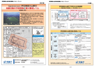
Official, Figure in hazard assessment
Area where the crater may appear and area where eruptions may affect
Page 18 in: Shizuoka Prefecture and Volcano Disaster Prevention Measure Deliberation Committee at Izu-Tobu Volcanoes. (2011). Volcano disaster prevention measure deliberation committee report at Izu-Tobu Volcanoes. Emergency Management Information Division, Shizuoka Prefecture.
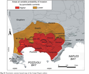
Figure in a journal article
Areas at variable probability of invasion by pyroclastic currents
Figure 15 in: Orsi, G., Di Vito, M. A., & Isaia, R. (2004). Volcanic hazard assessment at the restless Campi Flegrei caldera. Bulletin of Volcanology, 66(6), p. 514-530. https://doi.org/10.1007/s00445-003-0336-4