
Advanced Search for Maps
Showing 11-20 of 54
Official, Sign or billboard
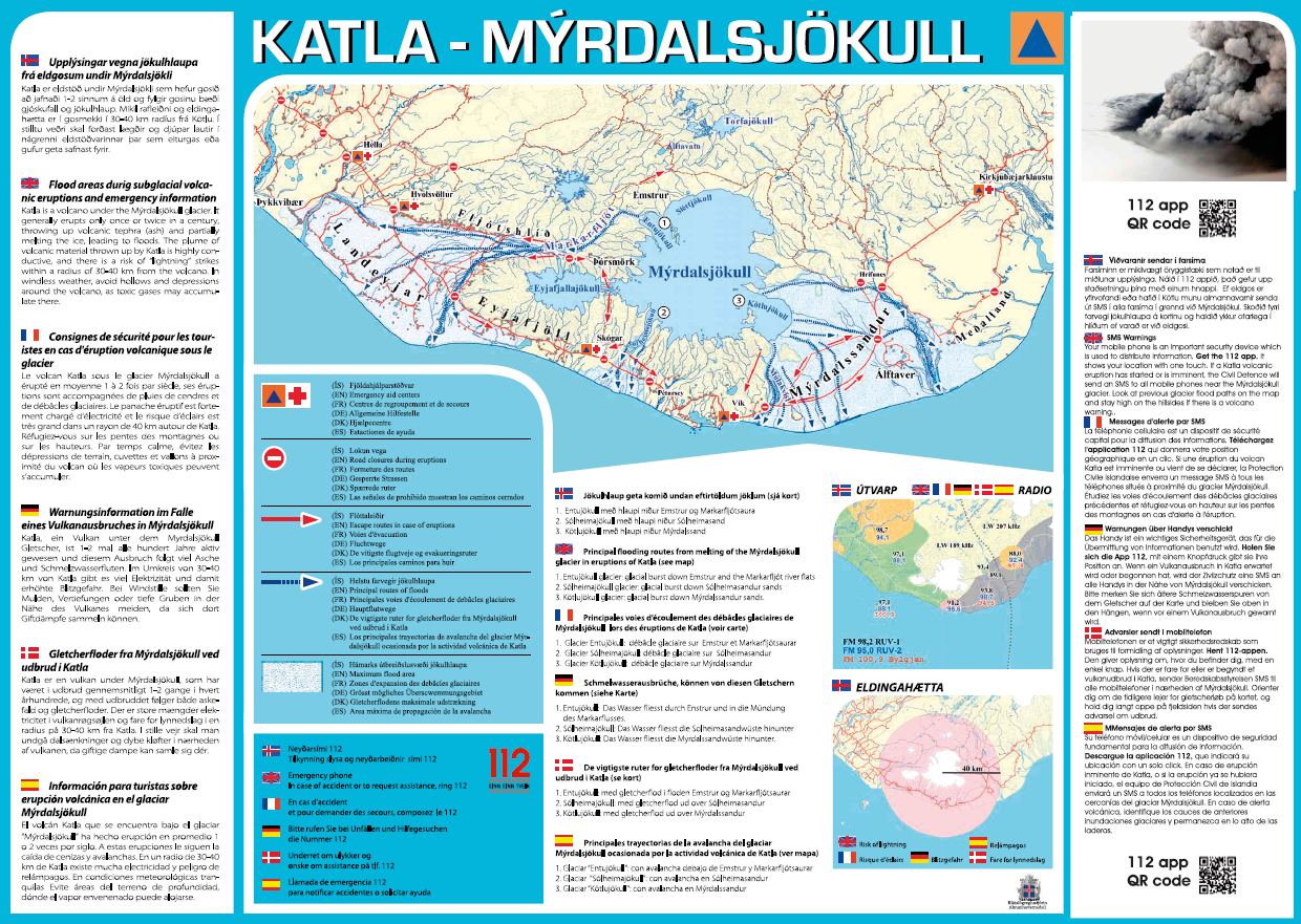
Katla – Mýrdalsjökull
Almannavarnir. (2017). Katla – Mýrdalsjökull.
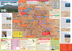
Official, Hiking or trail map
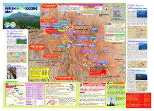
Kirishima Trekking Map
Kirishimashi. (2020). Kirishima Trekking Map. 2020.03
Official, Hiking or trail map
Kirishima Trekking Map
Kirishimashi. (2014). Kirishima Trekking Map. 2014.11
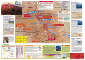
Official, Hiking or trail map
Kirishima Trekking Map
Kirishimashi. (2015). Kirishima Trekking Map.
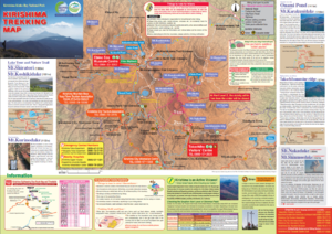
Official, Hiking or trail map
Kirishima Trekking Map
Kirishimashi. (2019). Kirishima Trekking Map. 2019.03

Official, Sign or billboard
Lahar Warning Whakapapa Village
Department of Conservation. Lahar Warning Whakapapa Village.

Official, Sign or billboard
Map of areas not recommended not to enter or camp - Ruapehu Volcanic Risk
Department of Conservation. (2020). Map of areas not recommended not to enter or camp - Ruapehu Volcanic Risk. September 2020 R183230.
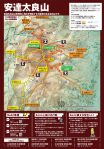
Official, Hiking or trail map
Mt. Adatara Evacuation Routes Around the Crater Area
Adatarayama Volcanic Disaster Management Council. (2019). Mt. Adatara Evacuation Routes Around the Crater Area.
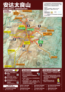
Official, Hiking or trail map
Mt. Adatara Evacuation Routes Around the Crater Area [Chinese version]
Adatarayama Volcanic Disaster Management Council. (2019). Mt. Adatara Evacuation Routes Around the Crater Area.
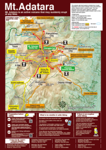
Official, Hiking or trail map
Mt. Adatara Evacuation Routes Around the Crater Area [English version]
Adatarayama Volcanic Disaster Management Council. (2019). Mt. Adatara Evacuation Routes Around the Crater Area.