
Advanced Search for Maps
Showing 371-372 of 372

Figure in a journal article
Zones of volcanic risk associated with phreatomagmatic eruptions of return period 1-3 years interpolated from the historical record.
Figure 9 in: Houghton, B. F., Latter, J. H., & Hackett, W. R. (1987). Volcanic hazard assessment for Ruapehu composite volcano, Taupo volcanic zone, New Zealand. Bulletin of volcanology, 49(6), p. 737-751. https://doi.org/10.1007/BF01079825
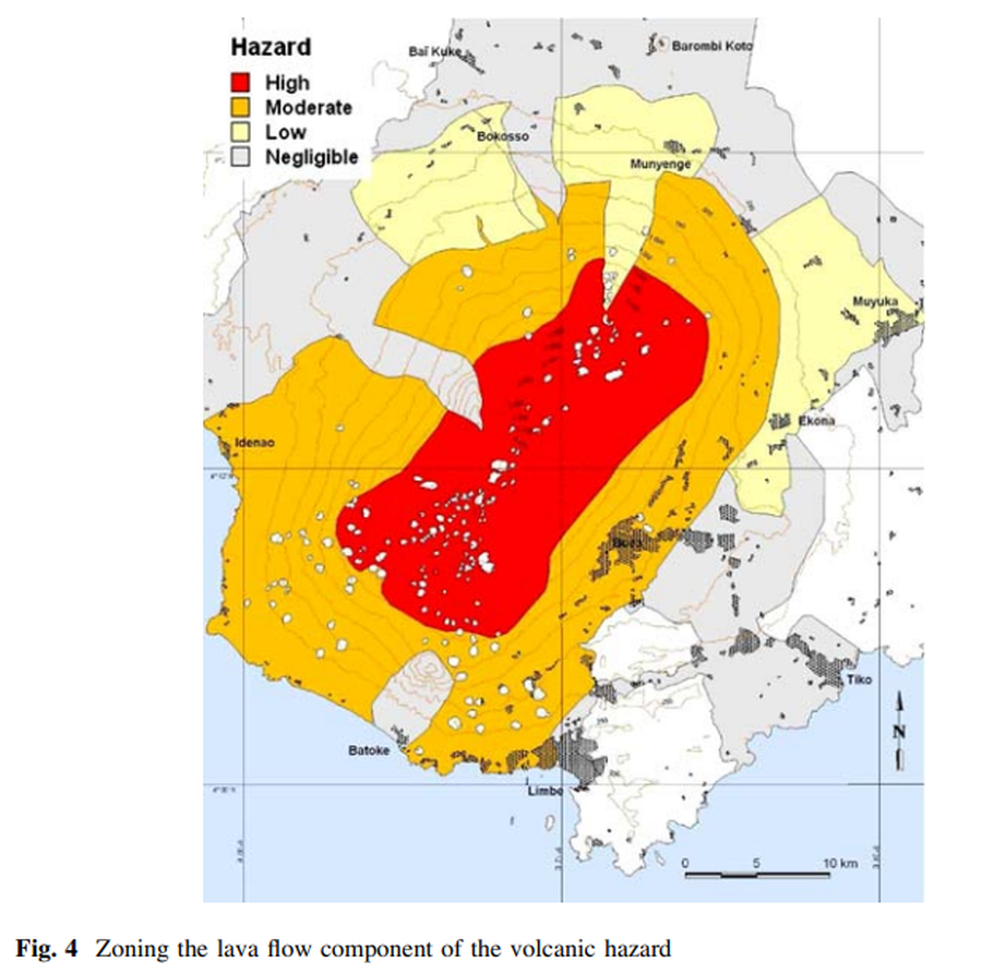
Figure in a journal article
Zoning the lava flow component of the volcanic hazard
Figure 4 in: Thierry, P., Stieltjes, L., Kouokam, E., Nguéya, P., & Salley, P. M. (2008). Multi-hazard risk mapping and assessment on an active volcano: the GRINP project at Mount Cameroon. Natural Hazards, 45(3), 429-456. https://doi.org/10.1007/s11069-007-9177-3