
Advanced Search for Maps
Showing 351-354 of 354
Official, Map sheet or poster
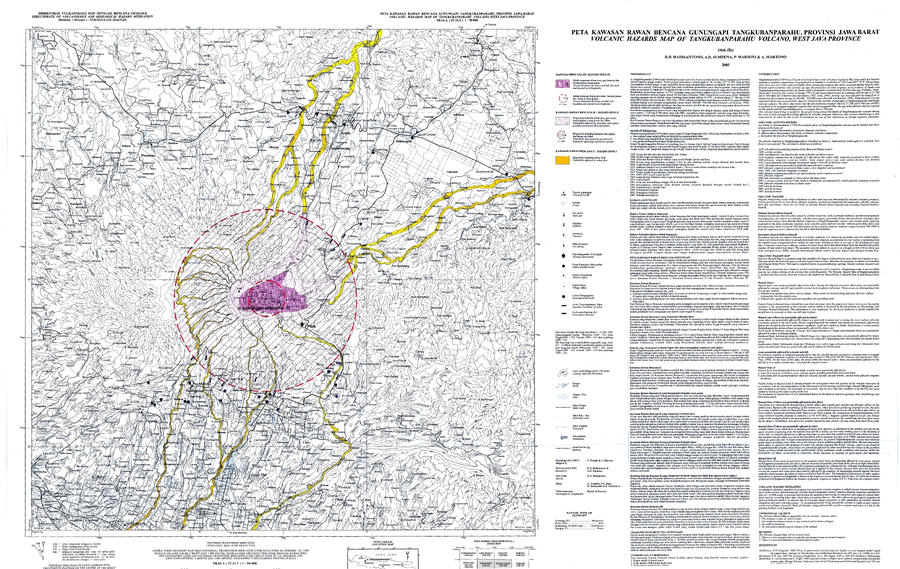
Volcanic Hazards Map of Tangkubanparahu Volcano, West Java Province
Hadisantono, R.D., Sumpena, A.D., Warsito, P., & Martono, A. (2005). Volcanic Hazards Map of Tangkubanparahu Volcano, West Java Province. Directorate of Volcanology and Geological Hazard Mitigation (DVGHM).
Official, Map sheet or poster
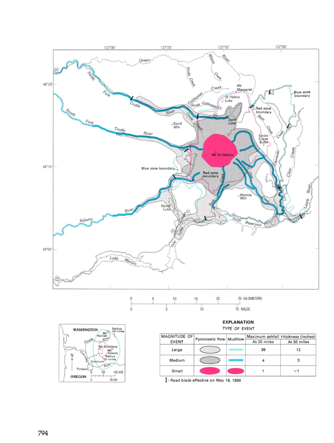
Volcanic-hazards zones, originally drawn on USFS map (approximately 1/2 in. = 1 mi), April 1, 1980.
Figure 454 in: Miller, C.D., Mullineaux, D.R. & Crandell, D.R. (1981). Hazards assessments at Mount St. Helens. In: Lipman, P. W. & Mullineaux, D. R. (Eds.) The 1980 eruptions of Mount St. Helens, Washington. U.S. Geological Survey, Professional Paper 1250, p. 789-802. https://doi.org/10.3133/pp1250
Official, Map sheet or poster
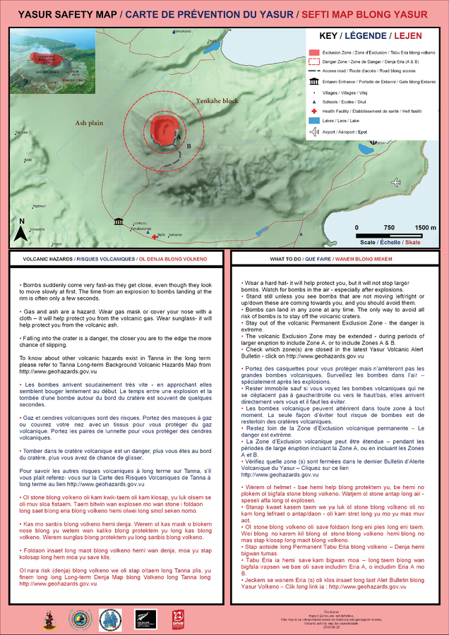
Yasur Safety Map
Vanuatu Meteorology & Geo-Hazards Department. (2016). Yasur Safety Map. Government of Vanuatu, Vanuatu Meteorology & Geo-Hazards Department, Vanuatu National Disaster Risk Management Office, New Zealand Foreign Affairs & Trade Aid Programme, GNS Science.
Official, Map sheet or poster
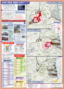
Yufudake/Tsurumidake/Garandake Volcano Disaster Prevention Map
Beppu City, Yufu City, Oita Prefecture, Usa City, & Hiji Town Survey. (2006). Yufudake/Tsurumidake/Garandake Volcano Disaster Prevention Map.