
Advanced Search for Maps
Showing 131-132 of 132
Official, Insert/poster-size map with accompanying report
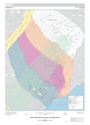
Wood Valley, Pāhala, and Punaluʻu Inundation Zones
Sheet 4 in: Trusdell, F.A. & Zoeller, M.H. (2017). Lava inundation zone maps for Mauna Loa, Island of Hawaiʻi, Hawaii. U.S. Geological Survey, Scientific Investigations Map 3387, 12 p., 10 sheets. https://doi.org/10.3133/sim3387
Official (foreign agency), Insert/poster-size map with accompanying report
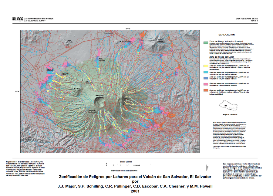
Zonificación de Peligros por Lahares para el Volcán de San Salvador, El Salvador
(Lahar Hazard Zoning for the San Salvador Volcano, El Salvador)
Plate 1 (Color) in: Major, J.J., Schilling, S.P., Sofield, D.J., Escobar, C.D., & Pullinger, C.R. (2001). Volcano Hazards in the San Salvador Region, El Salvador. U.S. Geological Survey, Open-File Report 2001-366, 24 p., 2 plates. https://doi.org/10.3133/ofr01366