
Advanced Search for Maps
Showing 11-20 of 20
Official, Map in an information statement
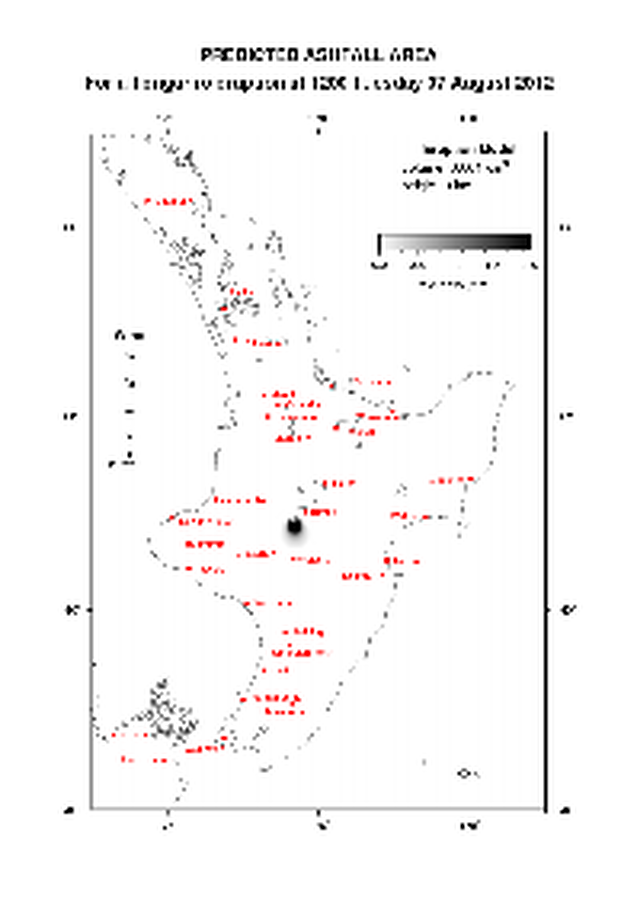
Predicted Ashfall Area for a Tongariro eruption at 0600 Thursday 16 August 2012
GNS Science. (2012). Volcanic Alert Bulletin TON2012-21.

Official, Map in an information statement
Predicted Ashfall Area for a Tongariro eruption at 0600 Tuesday 14 August 2012
GNS Science. (2012). Volcanic Alert Bulletin TON2012-19.

Official, Map in an information statement
Predicted Ashfall Area for a Tongariro eruption at 0600 Wednesday 15 August 2012
GNS Science. (2012). Volcanic Alert Bulletin TON2012-20.
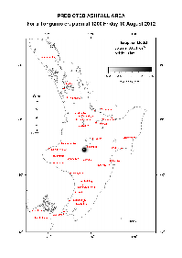
Official, Map in an information statement
Predicted Ashfall Area for a Tongariro eruption at 1200 Friday 10 August 2012
GNS Science. (2012). Volcanic Alert Bulletin TON2012-13.

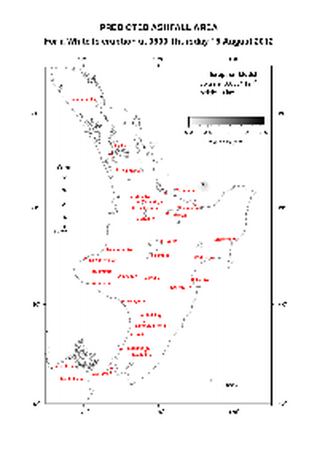
Official, Map in an information statement
Predicted Ashfall Area for a Tongariro eruption at 1200 Thursday 09 August 2012
GNS Science. (2012). Volcanic Alert Bulletin TON2012-12.
Official, Map in an information statement
Predicted Ashfall Area for a Tongariro eruption at 1200 Tuesday 07 August 2012
GNS Science. (2012). Volcanic Alert Bulletin TON2012-08.

Official, Map in an information statement
Predicted Ashfall Area for a Tongariro eruption at 1200 Wednesday 08 August 2012
GNS Science. (2012). Volcanic Alert Bulletin TON2012-09.

Official, Map in an information statement
Predicted Ashfall Area for a Tongariro eruption at 1500 Monday 13 August 2012
GNS Science. (2012). Volcanic Alert Bulletin TON2012-18.
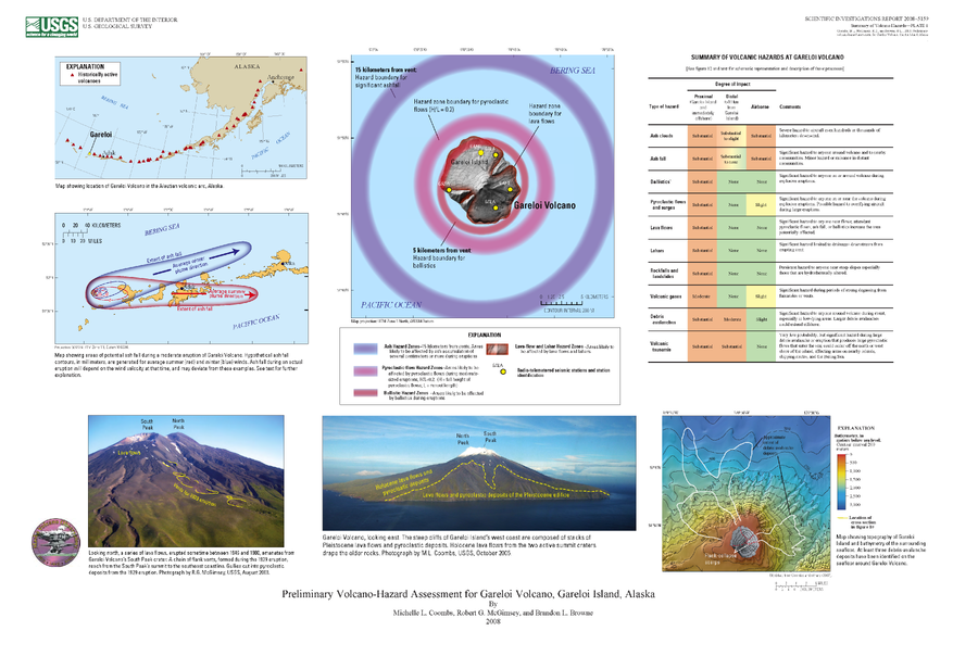
Official, Insert/poster-size map with accompanying report
Preliminary Volcano-Hazard Assessment for Gareloi Volcano, Gareloi Island, Alaska
Plate 1 in: Coombs, M.L., McGimsey, R.G. & Browne, B.L. (2008). Preliminary volcano-hazard assessment for Gareloi Volcano, Gareloi Island, Alaska. U.S. Geological Survey, Scientific Investigations Report 2008–5159, 27 p., 1 plate.
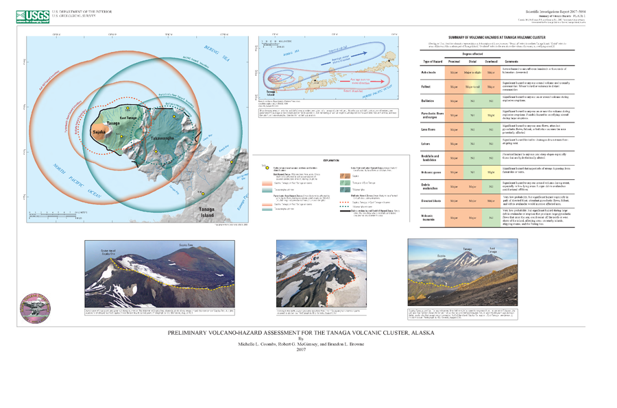
Official, Insert/poster-size map with accompanying report
Preliminary Volcano-Hazard Assessment for the Tanaga Volcanic Cluster, Alaska
Plate 1 in: Coombs, M.L., McGimsey, R.G. & Browne, B.L. (2007). Preliminary volcano-hazard assessment for the Tanaga volcanic cluster, Tanaga Island, Alaska. U.S. Geological Survey, Scientific Investigations Report 2007-5094, 41 p., 1 plate. https://doi.org/10.3133/sir20075094
Page: 1 2