
Advanced Search for Maps
Showing 11-15 of 15

Figure in a journal article
Probabilistic hazard map for volcanic ballistics at Lascar volcano at 1:75,000 scale.
Figure 7 in: Bertin, D. (2017). 3‐D ballistic transport of ellipsoidal volcanic projectiles considering horizontal wind field and variable shape‐dependent drag coefficients. Journal of Geophysical Research: Solid Earth, 122(2), p. 1126-1151. https://doi.org/10.1002/2016JB013320
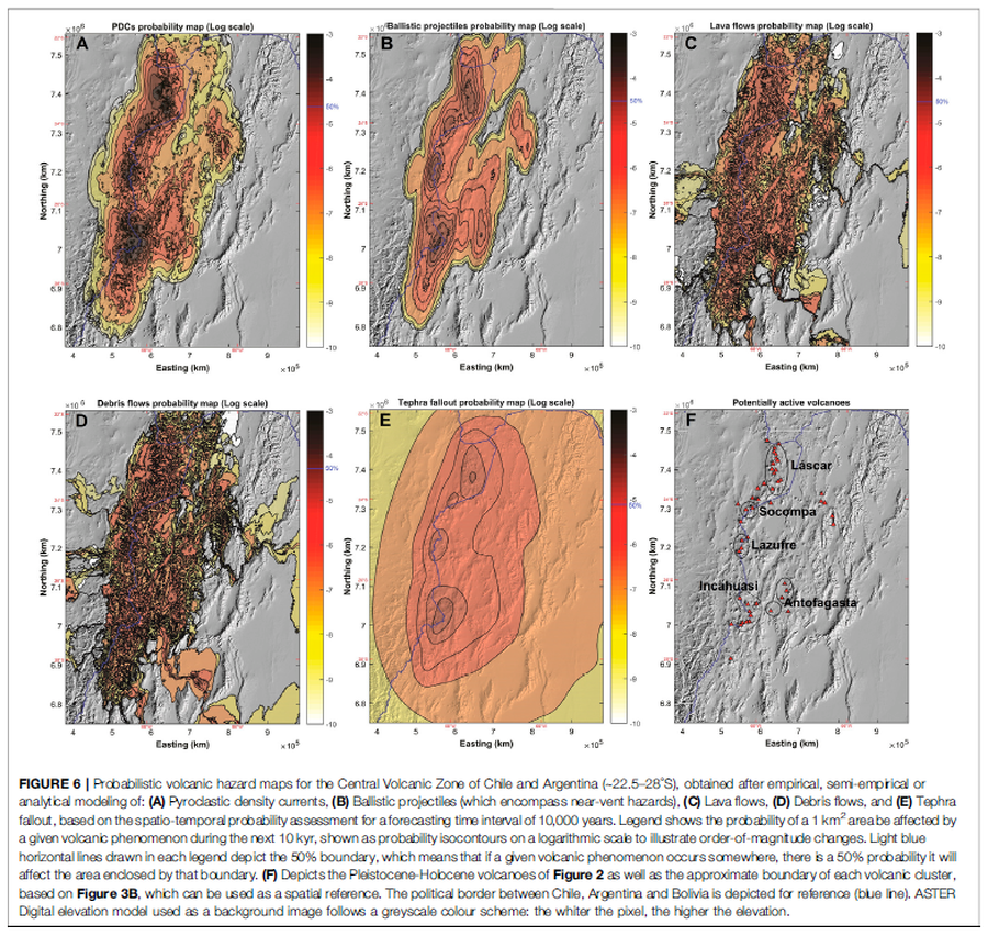
Figure in a journal article
Probabilistic volcanic hazard maps for the Central Volcanic Zone of Chile and Argentina (∼22.5–28°S), obtained after empirical, semi-empirical or analytical modeling
Figure 6 in: Bertin, D., Lindsay, J.M., Cronin, S.J., de Silva, S.L., Connor, C.B., Caffe, P.J., Grosse, P., Báez, W., Bustos, E., & Constantinescu, R. (2022). Probabilistic Volcanic Hazard Assessment of the 22.5–28° S Segment of the Central Volcanic Zone of the Andes. Frontiers in Earth Science, 10. https://doi.org/10.3389/feart.2022.875439
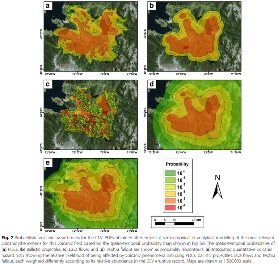
Figure in a journal article
Probabilistic volcanic hazard maps for the CLV
Figure 7 in: Bertin, D., Lindsay, J. M., Becerril, L., Cronin, S. J., & Bertin, L. J. (2019). MatHaz: a Matlab code to assist with probabilistic spatio-temporal volcanic hazard assessment in distributed volcanic fields. Journal of Applied Volcanology, 8(1), 1-25. https://doi.org/10.1186/s13617-019-0084-6
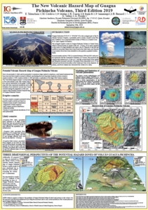
Official, Figure in a conference presentation
The New Volcanic Hazard Map of Guagua Pichincha Volcano, Third Edition 2019
Telenchana, E., Córdova, M., Mothes, P., Espín, P., Samaniego, P., Bernard, B., Vallejo, S., & Proaño A. (2019). The new potential volcanic hazard map of Guagua Pichincha Volcano, Third Edition 2019. 8th International Symposium on Andean Geodynamics (ISAG).
Puyehue-Cordon Caulle, Chile
Official, Figure in hazard assessment
Zonificación de peligro por piroclastos balísticos en el Complejo Volcánico Puyehue-Cordón Caulle
(Hazard zoning for ballistic pyroclastic from the Puyehue-Cordón Caulle Volcanic Complex)
Figure 15 in: Toloza, V., Jorquera, C., Mella, M., Gho, R. (2020). Peligros del Complejo Volcánico Puyehue-Cordón Caulle, regiones de Los Ríos y Los Lagos. Servicio Nacional de Geología y Minería, Carta Geológica de Chile, Serie Geología Ambiental 36, 63 p., 1 mapa escala 1:75.000. Santiago.
Page: 1 2