
Advanced Search for Maps
Showing 11-12 of 12
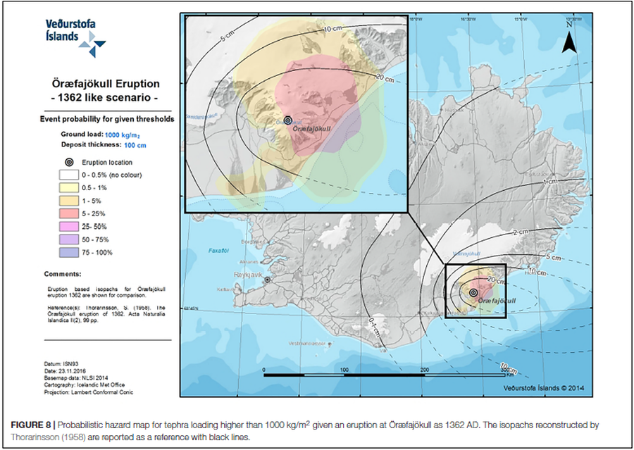
Figure in a journal article
Probabilistic hazard map for tephra loading higher than 1000 kg/m² given an eruption at Öræfajökull as 1362 AD
Figure 8 in: Barsotti, S., Di Rienzo, D. I., Thordarson, T., Björnsson, B. B., & Karlsdóttir, S. (2018). Assessing impact to infrastructures due to tephra fallout from Öræfajökull volcano (Iceland) by using a scenario-based approach and a numerical model. Frontiers in Earth Science, 6, 196. https://doi.org/10.3389/feart.2018.00196
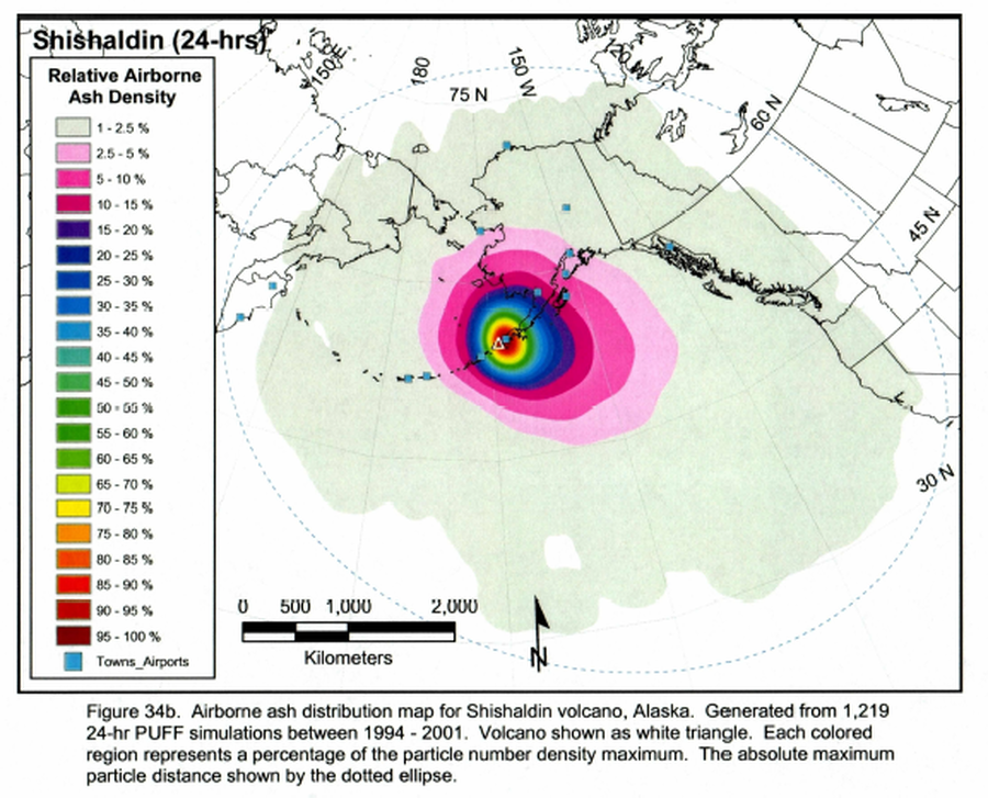
Figure in a thesis or dissertation
Shishaldin 24-hrs. Airborne ash distribution map for Shishaldin volcano, Alaska
Figure 34b in: Papp, K. (2002). An analysis of volcanic ash plume movement and dispersion within the North Pacific. University of Alaska Fairbanks, M.S. Thesis. https://scholarworks.alaska.edu/handle/11122/6307
Page: 1 2