
Advanced Search for Maps
Showing 61-63 of 63
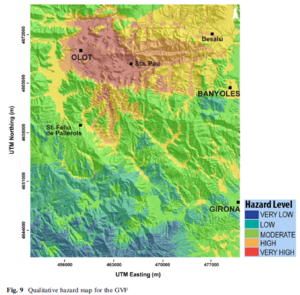
Figure in a journal article
Qualitative hazard map for the GVF
Figure 9 in: Bartolini, S., Bolós, X., Martí, J., Pedra, E. R., & Planagumà, L. (2015). Hazard assessment at the quaternary La Garrotxa volcanic field (NE Iberia). Natural Hazards, 78(2), 1349-1367. https://doi.org/10.1007/s11069-015-1774-y
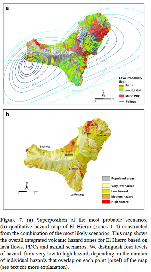
Figure in a journal article
Superposition of the most probable scenarios; qualitative hazard map of El Hierro (zones 1–4) constructed from the combination of the most likely scenarios
Figure 7 in: Becerril, L., Bartolini, S., Sobradelo, R., Martí, J., Morales, J. M., & Galindo, I. (2014). Long-term volcanic hazard assessment on El Hierro (Canary Islands). Natural Hazards and Earth System Sciences, 14(7), 1853-1870. https://doi.org/10.5194/nhess-14-1853-2014, 2014
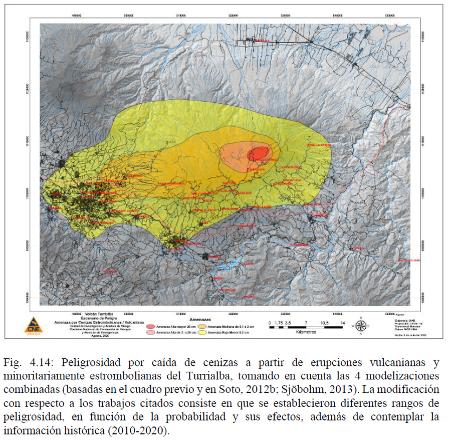
Official, Figure in hazard assessment
Volcán Turrialba Escenario de Peligro. Amenaza por Cenizas Estrombolianas/Vulcaniana
(Turrialba Volcano Danger Scenario. Threat from Strombolian/Vulcanian Ash)
Figure 4.14 in: Alvarado, G.E., Esquivel, L., Sánchez, B.E., & Matamoros, G. (2020). Peligro Volcánico del Turrialba, Costa Rica. Comisión Nacional de Prevención de Riesgos y Atención de Emergencias (CNE). Setiembre 2020.