
Advanced Search for Maps
Showing 211-218 of 218
Official, Insert/poster-size map with accompanying report
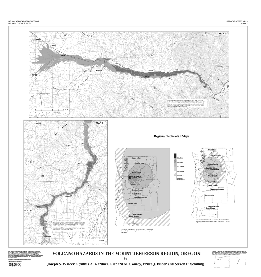
Volcano Hazards in the Mount Jefferson Region, Oregon
Plate 2 in: Walder, J.S., Gardner, C.A., Conrey, R.M., Fisher, B.J., & Schilling, S.P. (1999). Volcano Hazards in the Mount Jefferson Region, Oregon. U.S. Geological Survey, Open-File Report 99-24, 14 p. https://doi.org/10.3133/ofr9924
Official, Map in a booklet, long fact-sheet, or handbook
Volcano Information
Nanae Town. (2020). Disaster Prevention Hazard Map for Nanae Town. https://www.town.nanae.hokkaido.jp/hotnews/detail/00009274.html
Official (foreign agency), Insert/poster-size map with accompanying report
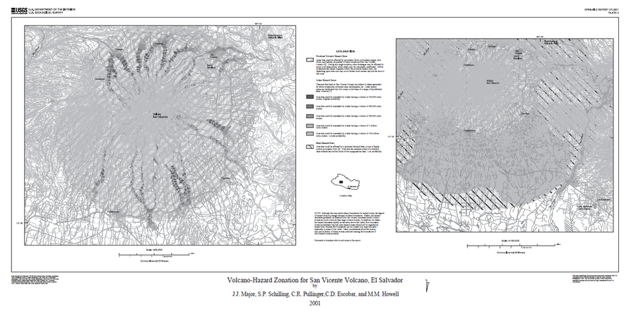
Volcano-Hazard Zonation for San Vicente Volcano, El Salvador
Plate 1 in: Major, J.J., Schilling, S.P., Pullinger, C.R., Escobar, C.D., & Howell, M.M. (2001). Volcano-Hazard Zonation for San Vicente Volcano, El Salvador. U.S. Geological Survey, Open-File Report 2001-367, 22 p., 1 plate. https://doi.org/10.3133/ofr01367

Official, Insert/poster-size map with accompanying report
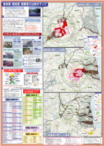
Yakedake Basic Volcano Disaster Prevention Map
Yakedake Volcano Disaster Prevention Council. (2019). Yakedake volcano disaster prevention and evacuation plan.

Official, Flyer, brochure, short fact-sheet, or handout
Yakedake Volcano Disaster Prevention Map
Matsumoto City, Nagano Prefecture & Yakedake Volcano Eruption Countermeasure Council. (2015). Yakedake Volcano Disaster Prevention Map.
Official, Flyer, brochure, short fact-sheet, or handout
Yakedake Volcano Disaster Prevention Map
Takeyama City. (2014). Yakedake Volcano Disaster Prevention Map.
Official, Map sheet or poster
Yufudake/Tsurumidake/Garandake Volcano Disaster Prevention Map
Beppu City, Yufu City, Oita Prefecture, Usa City, & Hiji Town Survey. (2006). Yufudake/Tsurumidake/Garandake Volcano Disaster Prevention Map.
Official, Flyer, brochure, short fact-sheet, or handout
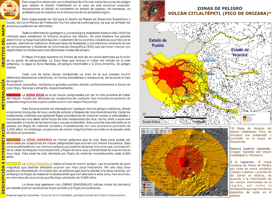
Zonas de Peligro Volcán Citlaltépetl (Pico de Orizaba)
(Hazard Zones Citlaltépetl Volcano (Pico de Orizaba))
Veracruz Gobierno del Estado. (Year Unknown). Zonas de Peligro Volcán Citlaltépetl (Pico de Orizaba). Veracruz Gobierno del Estado, Riesgo Volcánico. http://www.veracruz.gob.mx/proteccioncivil/riesgo-volcanico/