
Advanced Search for Maps
Showing 321-329 of 329

Official, Figure in hazard assessment
Zonage de L'Aléa "Retombée Aérienne" pour la période actuelle
(Zoning of the "Aerial Fallout" hazard for the current period)
Annex 4.3 in: Stieltjes, L. & Mirgon, C. (1998). Approche méthodologique de la vulnérabilité aux phénomènes volcaniques. Test d’application sur les réseaux de la Martinique. Rapport de synthese. Rapport Bureau de Recherches Géologiques et Minières (BRGM), Marseille, R 40098. http://infoterre.brgm.fr/rapports/RR-40098-FR.pdf
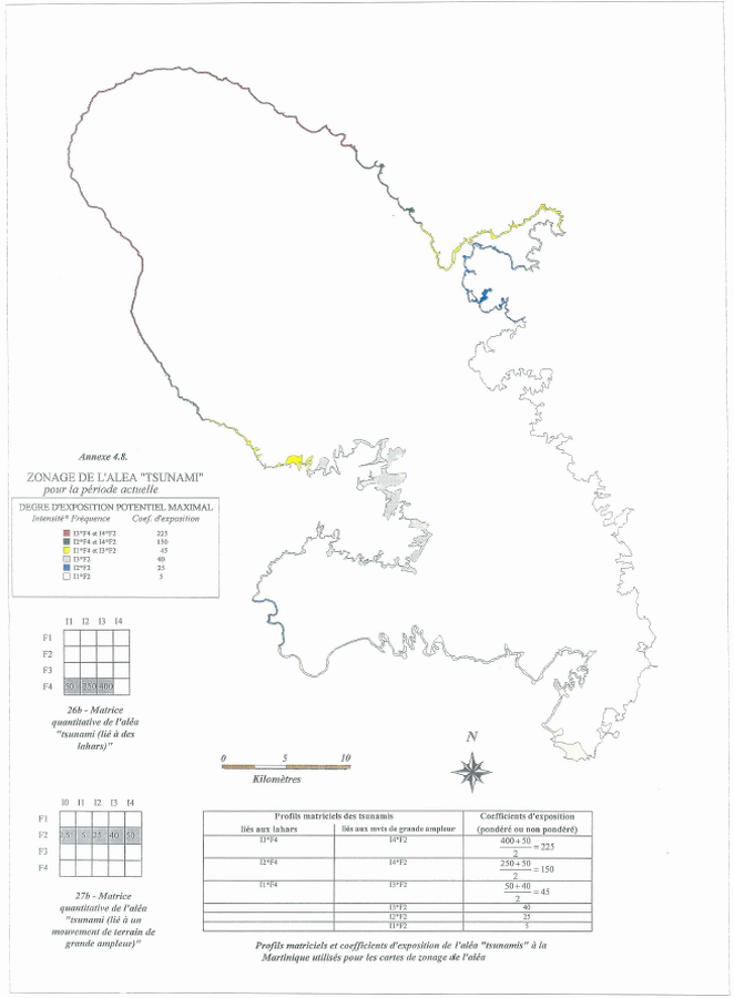
Official, Figure in hazard assessment
Zonage de L'Aléa "Tsunami" pour la période actuelle
(Zoning of the "Tsunami" Hazard for the current period)
Annex 4.8 in: Stieltjes, L. & Mirgon, C. (1998). Approche méthodologique de la vulnérabilité aux phénomènes volcaniques. Test d’application sur les réseaux de la Martinique. Rapport de synthese. Rapport Bureau de Recherches Géologiques et Minières (BRGM), Marseille, R 40098. http://infoterre.brgm.fr/rapports/RR-40098-FR.pdf
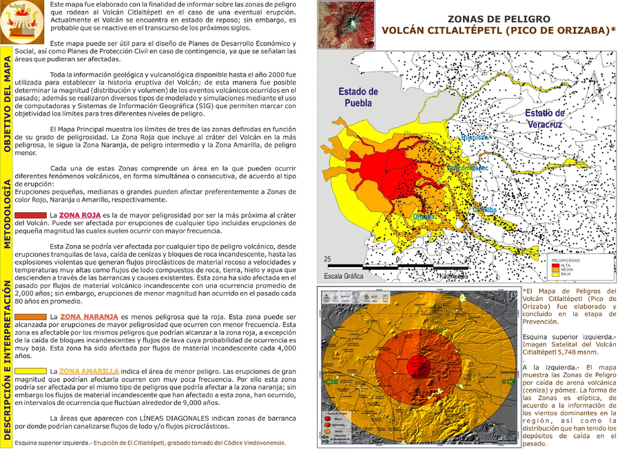
Official, Flyer, brochure, short fact-sheet, or handout
Zonas de Peligro Volcán Citlaltépetl (Pico de Orizaba)
(Hazard Zones Citlaltépetl Volcano (Pico de Orizaba))
Veracruz Gobierno del Estado. (Year Unknown). Zonas de Peligro Volcán Citlaltépetl (Pico de Orizaba). Veracruz Gobierno del Estado, Riesgo Volcánico. http://www.veracruz.gob.mx/proteccioncivil/riesgo-volcanico/
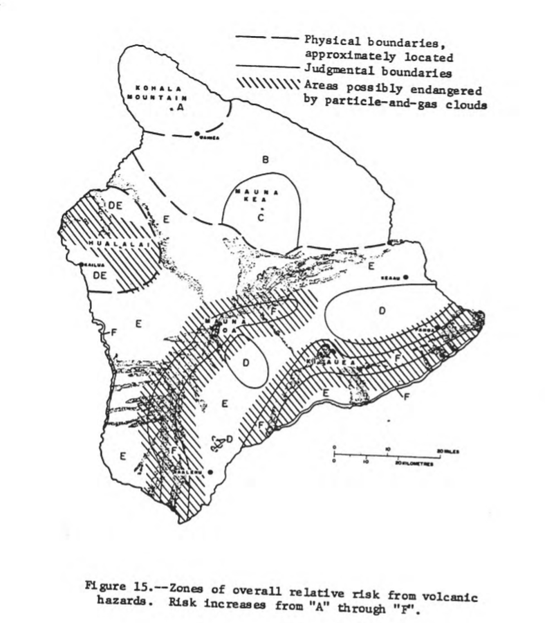
Official, Figure in hazard assessment
Zones of overall relative risk from volcanic hazards. Risk increases from "A" through "F"
Figure 15 in: Mullineaux, D.R. & Peterson, D.W. (1974). Volcanic hazards on the Island of Hawaii. U.S. Geological Survey, Open-File Report 74-239. https://doi.org/10.3133/ofr74239
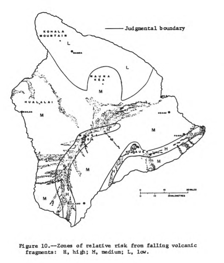
Official, Figure in hazard assessment
Zones of relative risk from falling volcanic fragments
Figure 10 in: Mullineaux, D.R. & Peterson, D.W. (1974). Volcanic hazards on the Island of Hawaii. U.S. Geological Survey, Open-File Report 74-239. https://doi.org/10.3133/ofr74239

Official, Figure in hazard assessment
Zones of relative risk from lateral blasts
Figure 3 in: Crandell, D. R. (1975). Assessment of volcanic risk on the island of Oahu, Hawaii. U.S. Geological Survey, Open-File Report 75-287. https://doi.org/10.3133/ofr75287

Official, Figure in hazard assessment
Zones of relative risk from lava flows
Figure 4 in: Crandell, D. R. (1975). Assessment of volcanic risk on the island of Oahu, Hawaii. U.S. Geological Survey, Open-File Report 75-287. https://doi.org/10.3133/ofr75287

Official, Figure in hazard assessment
Zones of relative risk from lava-flow burial
Figure 9 in: Mullineaux, D.R. & Peterson, D.W. (1974). Volcanic hazards on the Island of Hawaii. U.S. Geological Survey, Open-File Report 74-239. https://doi.org/10.3133/ofr74239
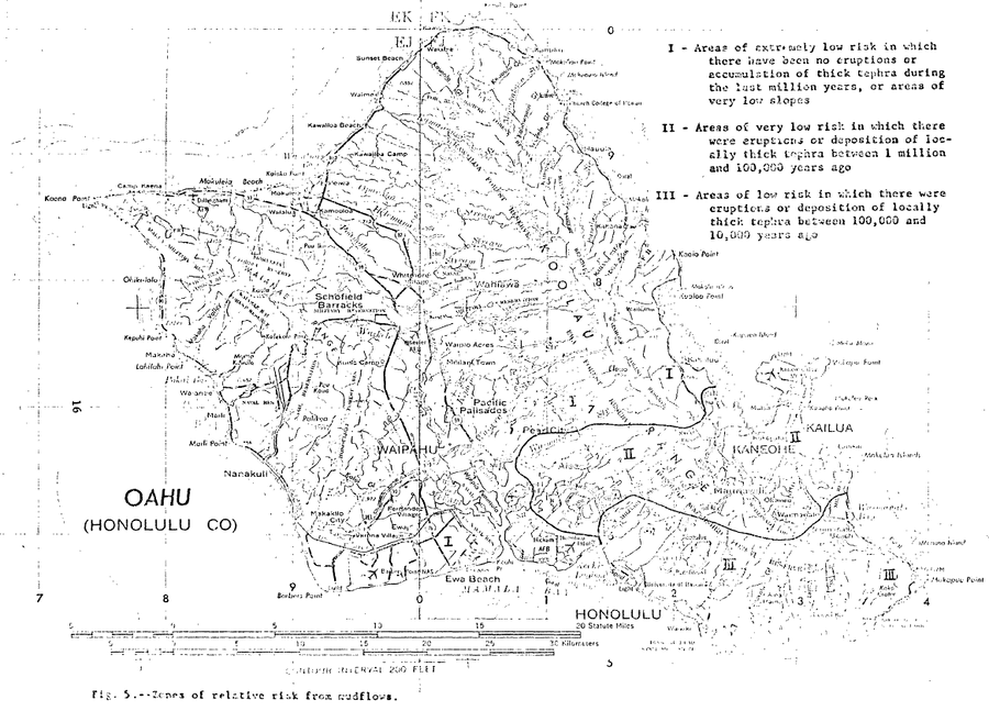
Official, Figure in hazard assessment
Zones of relative risk from mudflows
Figure 5 in: Crandell, D. R. (1975). Assessment of volcanic risk on the island of Oahu, Hawaii. U.S. Geological Survey, Open-File Report 75-287. https://doi.org/10.3133/ofr75287