
Advanced Search for Maps
Showing 161-167 of 167
Official, Sign or billboard
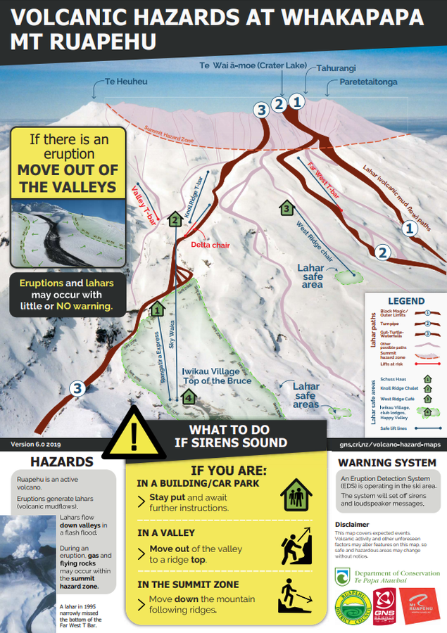
Volcanic Hazards at Whakapapa Mt. Ruapehu
GNS Science (compiler). (2019). Volcanic Hazards at Whakapapa Mt. Ruapehu. Version 6.0 2019.

Official, Sign or billboard
Volcanic Hazards at Whakapapa Mt. Ruapehu
GNS Science (compiler). (2004). Volcanic Hazards at Whakapapa Mt. Ruapehu.
Official, Figure in hazard assessment
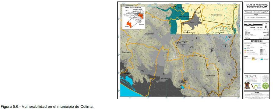
Vulcanismo Vulernabilidad
(Volcanism Vulnerability)
Figure 5.6 in: Grupo de Análisis, Evaluación y Gestión de Riesgos de la Universidad de Colima. (2014). Atlas de Riesgos Naturales del Municipio de Colima. Universidad de Colima, Colima, Mexico.
Official, Insert/poster-size map with accompanying report
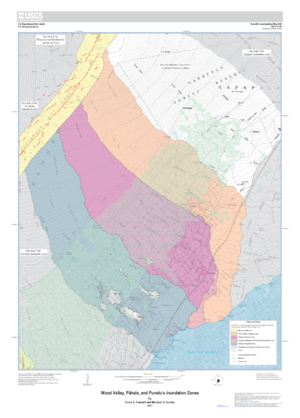
Wood Valley, Pāhala, and Punaluʻu Inundation Zones
Sheet 4 in: Trusdell, F.A. & Zoeller, M.H. (2017). Lava inundation zone maps for Mauna Loa, Island of Hawaiʻi, Hawaii. U.S. Geological Survey, Scientific Investigations Map 3387, 12 p., 10 sheets. https://doi.org/10.3133/sim3387

Official, Figure in hazard assessment
Zones of relative risk from lateral blasts
Figure 3 in: Crandell, D. R. (1975). Assessment of volcanic risk on the island of Oahu, Hawaii. U.S. Geological Survey, Open-File Report 75-287. https://doi.org/10.3133/ofr75287

Official, Figure in hazard assessment
Zones of relative risk from lava flows
Figure 4 in: Crandell, D. R. (1975). Assessment of volcanic risk on the island of Oahu, Hawaii. U.S. Geological Survey, Open-File Report 75-287. https://doi.org/10.3133/ofr75287
Official, Figure in hazard assessment
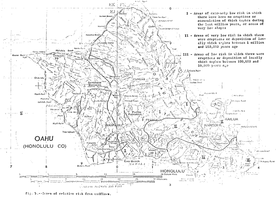
Zones of relative risk from mudflows
Figure 5 in: Crandell, D. R. (1975). Assessment of volcanic risk on the island of Oahu, Hawaii. U.S. Geological Survey, Open-File Report 75-287. https://doi.org/10.3133/ofr75287