
Advanced Search for Maps
Showing 51-60 of 1659
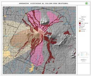
Official, Map in an information statement
Amenazas Asociadas al Volcán San Cristóbal
(Hazards Associated with the San Cristobal Volcano)
Instituto Nicaragüense de Estudios Territoriales (INETER). (2006). Amenazas Asociadas al Volcán San Cristóbal. https://webserver2.ineter.gob.ni/vol/cristobal/Chinandega.gif
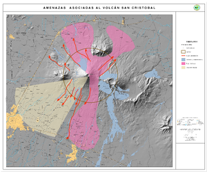
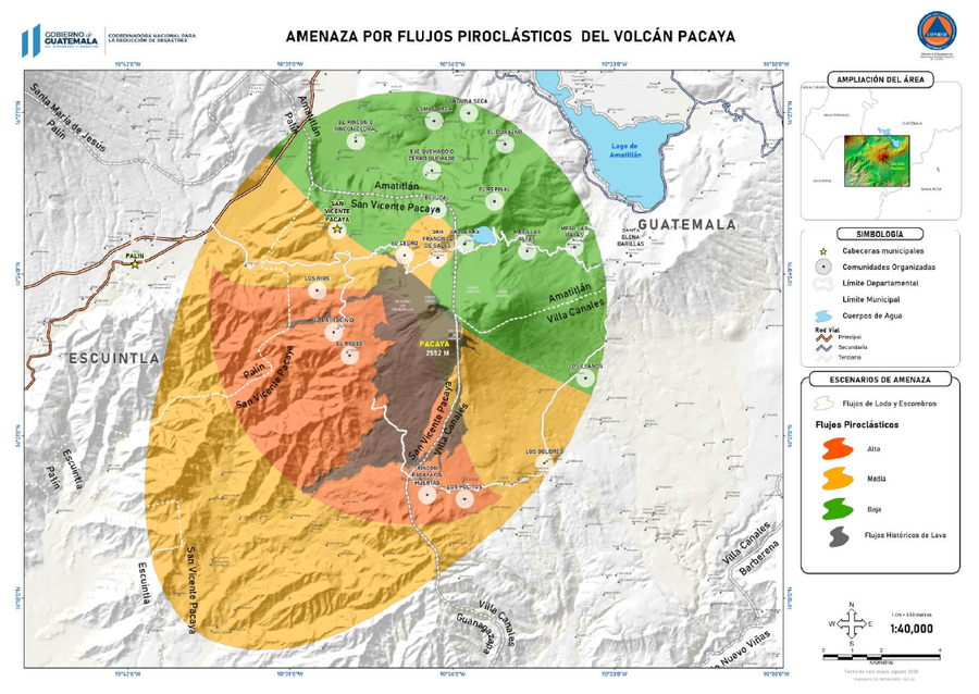
Official, Figure in hazard assessment
Amenazas por Flujos Piroclásticos del Volcán Pacaya
(Hazards from Pyroclastic Flows from Pacaya Volcano)
3.2.1 in: Coordinadora Nacional para la Reducción de Desastres (CONRED). (2021). Protocolo Operativo por Actividad Efusiva del Volcán Pacaya. https://conred.gob.gt/documentos/planes/DRE_20210211_01_PROTOCOLO_OPERATIVO_POR_ACTIVIDAD_EFUSIVA_VOLCAN_PACAYA.pdf
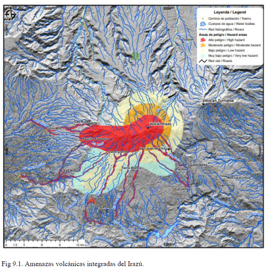
Official, Figure in hazard assessment
Amenazas volcánicas integradas del Irazú
(Integrated volcanic hazards of Irazú)
Figure 9.1 in: Alvarado, G.E., Campos-Durán, D., Brenes-André, J., Alpízar, Y., Núñez, S., Esquivel, L., Sibaja, J.P. & Fallas, B. (2021). Peligro Volcánico del Irazú, Costa Rica. Comisión Nacional de Prevención de Riesgos y Atención de Emergencias (CNE). Deciembre 2021.
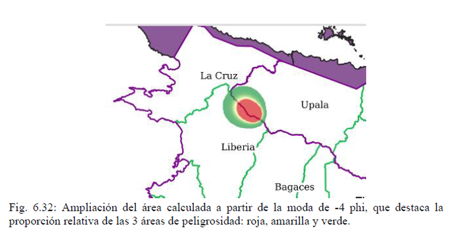
Official, Figure in hazard assessment
Ampliación del área calculada a partir de la moda de -4 phi, que destaca la proporción relativa de las 3 áreas de peligrosidad: roja, amarilla y verde
(Magnification of the area calculated from the -4 phi mode, highlighting the relative proportion of the 3 hazard areas: red, yellow and green)
Figure 6.32 in: Alvarado, G.E., Brenes-André, J., Venegas, L., Alpízar, Y., Núñez, S., Sánchez, M., Abarca, K., Abarca, J., Báez, W.A., Sibaja, J.P., Esquivel, L., & Arcia, T. (2022). Análisis del Peligro Volcánico del Rincón de la Vieja, Costa Rica. Instituto Costarricense de Electricidad (ICE). Setiembre 2022.
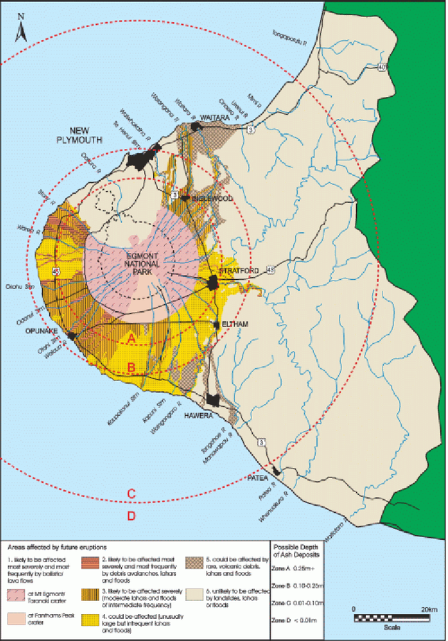
Official, Figure in a journal article
An example of a volcanic hazard map for Mount Taranaki
Figure 2 in: Becker, J.S., Saunders, W.S.A., Robertson, C.M., Leonard, G.S., & Johnston, D.M. (2010). A synthesis of challenges and opportunities for reducing volcanic risk through land use planning in New Zealand. The Australasian Journal of Disaster and Trauma Studies, 2010-1. (Simplified from: Taranaki Regional Council 2004)
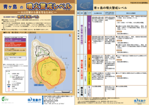
Official, Flyer, brochure, short fact-sheet, or handout
Aogashima Volcanic Alert Levels
Japan Meteorological Agency. (2018). Aogashima Volcanic Alert Levels. Volcano Monitoring and Warning Center, Volcano Division, Earthquake and Volcano Department.
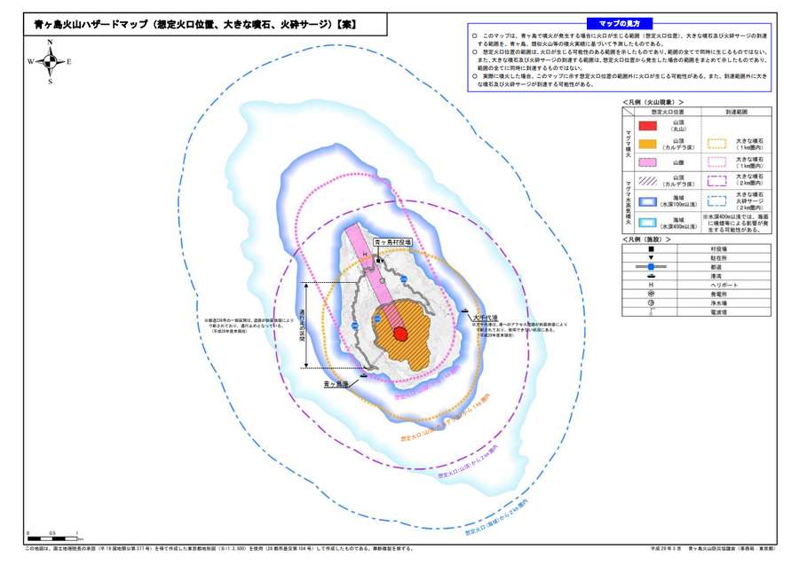
Official, Map sheet or poster
Aogashima volcanic hazard map (assumed crater position, volcanic blocks, pyroclastic surge)
Aogashima Volcano Disaster Prevention Council. (2017). Aogashima volcanic hazard map. Disaster Prevention Division, Bureau of General Affairs, Tokyo Metropolitan Government.
Official, Map sheet or poster
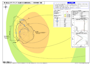
Aogashima volcano hazard map (volcanic ash (including volcanic lapilli): 4 million m³ DRE)
Aogashima Volcano Disaster Prevention Council. (2017). Aogashima volcanic hazard map. Disaster Prevention Division, Bureau of General Affairs, Tokyo Metropolitan Government.
Official, Map sheet or poster
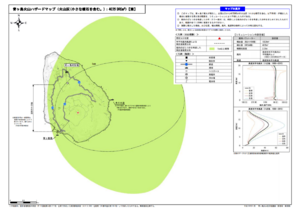
Aogashima volcano hazard map (volcanic ash (including volcanic lapilli): 400,000 m³ DRE)
Aogashima Volcano Disaster Prevention Council. (2017). Aogashima volcanic hazard map. Disaster Prevention Division, Bureau of General Affairs, Tokyo Metropolitan Government.