
Advanced Search for Maps
Showing 21-28 of 28
Official, Map in a booklet, long fact-sheet, or handbook
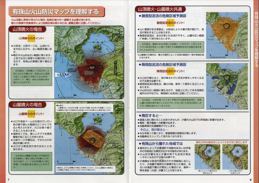
Usu Volcano Disaster Prevention Map
Hokkaido Disaster Prevention Committee. (2003). Usu Mountain Area Disaster Prevention Guidebook. Date City, Toyako Town, Sobetsu City, and Toyoura Town.
Official, Sign or billboard
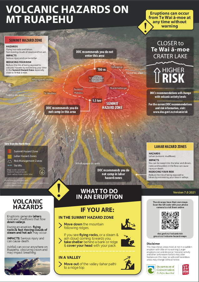
Volcanic Eruption Hazards on Mt. Ruapehu
GNS Science (compiler). (2021). Volcanic Eruption Hazards on Mt. Ruapehu. Version 7.0 2021.
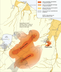
Figure in a journal article
Volcanic hazard map of the Okataina Volcanic Centre
Figure 8 in: Becker, J.S., Saunders, W.S.A., Robertson, C.M., Leonard, G.S., & Johnston, D.M. (2010). A synthesis of challenges and opportunities for reducing volcanic risk through land use planning in New Zealand. The Australasian Journal of Disaster and Trauma Studies, 2010-1. (Simplified from: Nairn, 2002)

Official, Sign or billboard
Volcanic Hazards at Tongariro
GNS Science (compiler). (2007). Volcanic Hazards at Tongariro.
Official, Sign or billboard
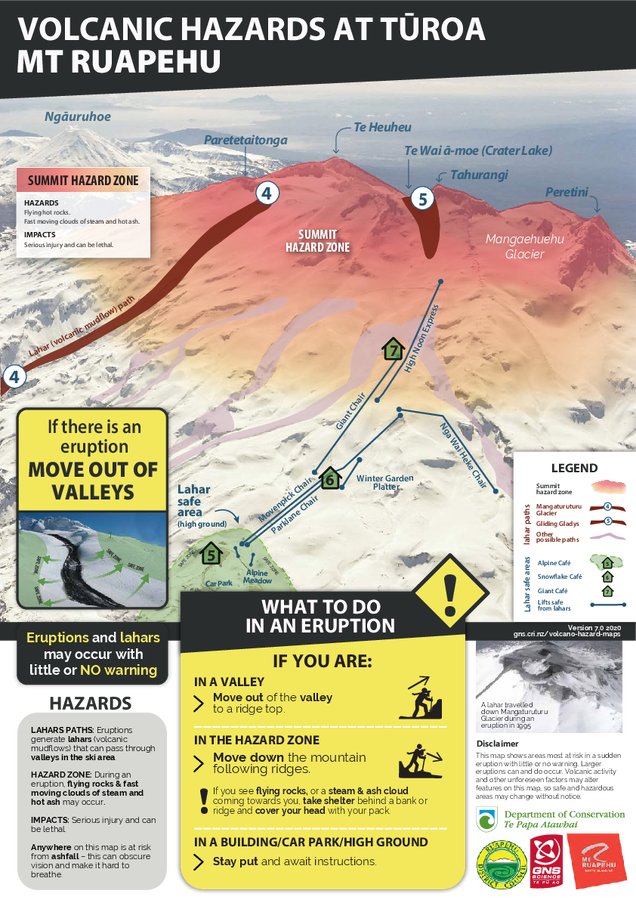
Volcanic Hazards at Tūroa Mt. Ruapehu
GNS Science (compiler). (2020). Volcanic Hazards at Tūroa Mt. Ruapehu. Version 7.0 2020.
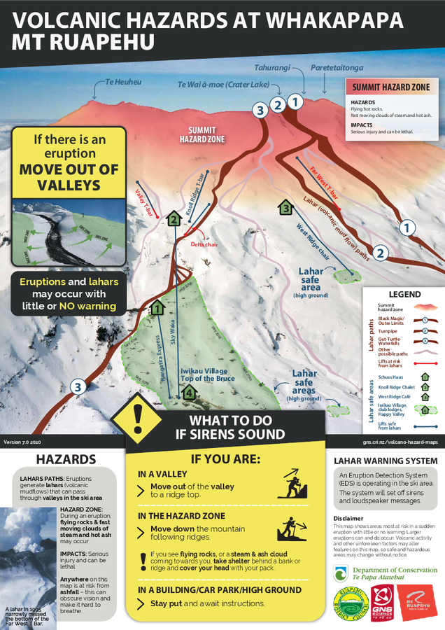
Official, Sign or billboard
Volcanic Hazards at Whakapapa Mt. Ruapehu
GNS Science (compiler). (2020). Volcanic Hazards at Whakapapa Mt. Ruapehu. Version 7.0 2020.
Official, Sign or billboard
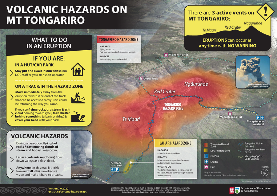
Volcanic Hazards on Mt Tongariro
GNS Science (compiler). (2020). Volcanic Hazards on Mt Tongariro. Version 7.0. 2020.

Official, Sign or billboard
Volcanic Hazards on Mt. Ruapehu - VAL 2
GNS Science (compiler). (2022). Volcanic Hazards on Mt. Ruapehu - VAL 2. Version 7-VAL2A 2022