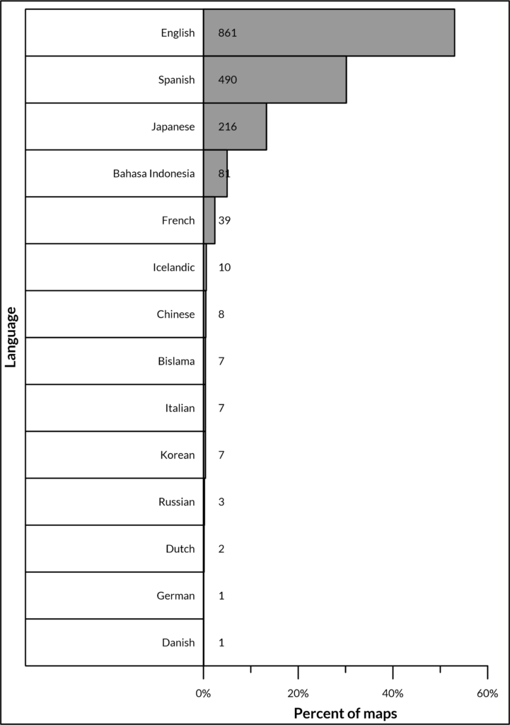
The database contains maps with text in 14 different languages, with the majority (Figure 1) in English (53%), followed by Spanish (30%), and Japanese (13%). The database is skewed toward maps in English, Spanish, and Japanese for a few reasons: the language proficiency of the database developer and collaborators; the relative abundance of volcanoes in English-, Spanish-, and Japanese-speaking countries; and because the majority of maps from journal articles are published in English-language sources. However, every effort was made to actively seek out maps in all languages.
In order to populate data from non-English maps, a combination of the developer’s language proficiency, online translation applications, geologic language dictionaries, and professional translations were used. For Japanese-language maps, collaborators Dr. Yasuhisa Tajima and Dr. Shinji Takarada entered map metadata.
About 6% of maps display text in multiple languages; notably official Indonesian maps display all map text in both Bahasa Indonesia and English (e.g. Semeru, Indonesia, 1996). Maps from Vanuatu also give all map information in English, French, and Bislama (e.g. Ambrym, Vanuatu, 2016), or have multiple versions of the same map in different languages (e.g. Yasur, Vanuatu, 2016 in English, French, and Bislama).

