
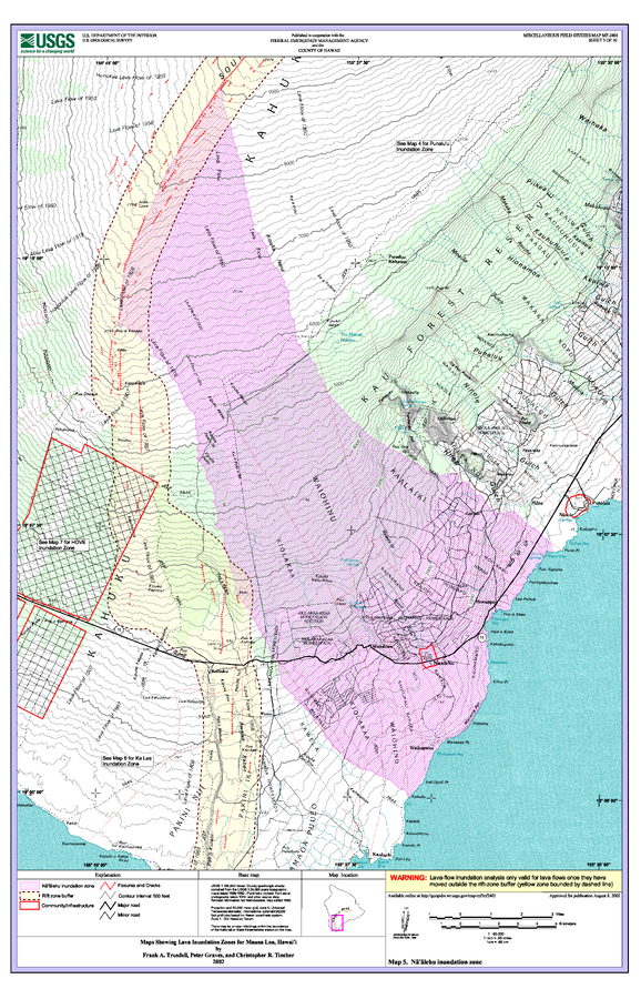
Maps Showing Lava Inundation Zones for Mauna Loa, Hawai'i - Map 5. Na'alehu inundation zone
Mauna Loa, United States, 2002
Sheet 5 in: Trusdell, F.A., Graves, P., & Tincher, C.R. (2002). Map Showing Lava Inundation Zones for Mauna Loa, Hawai‘i. U.S. Geological Survey, Miscellaneous Field Studies Map MF-2401. 10 Map Sheets (each 22 x 34 inches); Pamphlet (14 p.) scale 1:70000. https://doi.org/10.3133/mf2401
This map was produced by an official agency, but is NOT the most recent, most complete, or main operational map.
For the current operational hazard map, please consult the proper institutional authorities.
Click on image for full-size map. If link seems broken, try the archived version.
Trusdell, F.A., Graves, P., & Tincher, C.R. (2002). Map Showing Lava Inundation Zones for Mauna Loa, Hawai‘i. U.S. Geological Survey, Miscellaneous Field Studies Map MF-2401. 10 Map Sheets (each 22 x 34 inches); Pamphlet (14 p.) scale 1:70000. https://doi.org/10.3133/mf2401Map Set
https://doi.org/10.3133/mf2401
Other Maps In Set: