
Grímsvötn, tephra fall probability - After Thorarinsson (1974), Gudmundsson et al. (2004), Oddsson et al. (2012), Gudmundsson et al. (2013)
Grímsvötn, Iceland, 2019
Guðmundsson, M.T. & Larsen, G. (2019). Grímsvötn. In: Oladottir, B., Larsen, G. & Guðmundsson, M. T. Catalogue of Icelandic Volcanoes. Iceland Meteorological Office (IMO), Univeristy of Iceland, and Civil Protection Department of the National Commissioner of the Iceland Police (CPD-NCIP). (Simplified from: Thorarinsson 1974, Gudmundsson et al. 2004, Oddsson et al. 2012, Gudmundsson et al. 2013)
This map was produced by an official agency, but may not be the most recent, most complete, or main operational map.
For the current operational hazard map, please consult the proper institutional authorities.
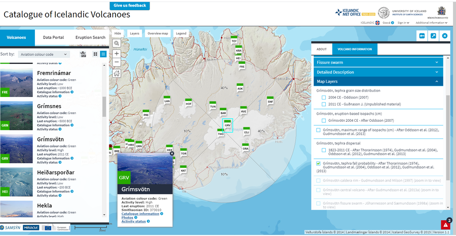
Click on image for full-size map.
Map Set
Guðmundsson, M.T. & Larsen, G. (2019). Grímsvötn. In: Oladottir, B., Larsen, G. & Guðmundsson, M. T. Catalogue of Icelandic Volcanoes. Iceland Meteorological Office (IMO), Univeristy of Iceland, and Civil Protection Department of the National Commissioner of the Iceland Police (CPD-NCIP). http://icelandicvolcanos.is/index.html?volcano=GRV#
http://icelandicvolcanos.is/index.html?volcano=GRV#
Other Maps In Set: