
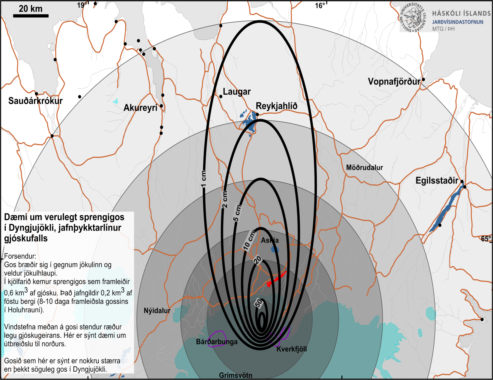
Dæmi um verulegt sprengigos í Dyngjujökli, jafnþykktarlínur gjóskufalls
Example of a major explosive eruption in Dyngjujökli, equal thickness lines of tephra
Holuhraun (Askja) & Bárdarbunga, Iceland, 2014
Kort Jarðvísindastofnun HÍ. (2014). Dæmi um verulegt sprengigos í Dyngjujökli, jafnþykktarlínur gjóskufalls.
This map was produced by an official agency, but is NOT the most recent, most complete, or main operational map.
For the current operational hazard map, please consult the proper institutional authorities.
Click on thumbnail for full-size map. We do not have copyright permission to display the full-size image. If you are the copyright holder and wish to provide copyright, please contact us at admin@volcanichazardmaps.org. If link seems broken, try the archived version.
Almannavarnir. (2014). Bárðarbunga jarðhræringar og eldgos í Holuhrauni: Ný skilgreining á hættusvæðum og lokuðum svæðum vegna umbrota í Bárðarbungu og Holuhrauni [Bárðarbunga Earthquake and Eruption in Holuhraun: New definition of hazardous areas and closed areas due to changes in Bárðarbunga and Holuhraun]. http://avd.is/is/?p=941Map Set
http://avd.is/is/?p=941
Other Maps In Set: