
An example of a volcanic hazard map for Mount Taranaki
Taranaki, New Zealand, 2010
Figure 2 in: Becker, J.S., Saunders, W.S.A., Robertson, C.M., Leonard, G.S., & Johnston, D.M. (2010). A synthesis of challenges and opportunities for reducing volcanic risk through land use planning in New Zealand. The Australasian Journal of Disaster and Trauma Studies, 2010-1. (Simplified from: Taranaki Regional Council 2004)
This map was produced by an official agency, but is NOT the most recent, most complete, or main operational map.
For the current operational hazard map, please consult the proper institutional authorities.
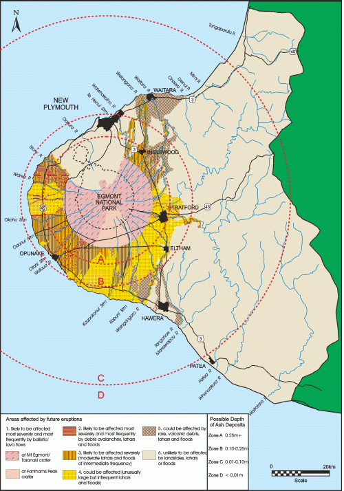
Click on image for full-size map. If link seems broken, try the archived version.
Becker, J.S., Saunders, W.S.A., Robertson, C.M., Leonard, G.S., & Johnston, D.M. (2010). A synthesis of challenges and opportunities for reducing volcanic risk through land use planning in New Zealand. The Australasian Journal of Disaster and Trauma Studies, 2010-1. Adapted from: Nakao, M. (2005). Eruption of Mt Usu, March 31 st 2000, at Mt Usu in Hokkaido. Failure Knowledge Database, 100 Selected Cases. Access date: 14 January 2009.Map Set
http://trauma.massey.ac.nz/issues/2010-1/becker.htm
Other Maps In Set: