
Preliminary probabilistic tephra-hazard map for Pacific Northwest
Cascades Range (regional, including Canada), Canada, United States, 2011
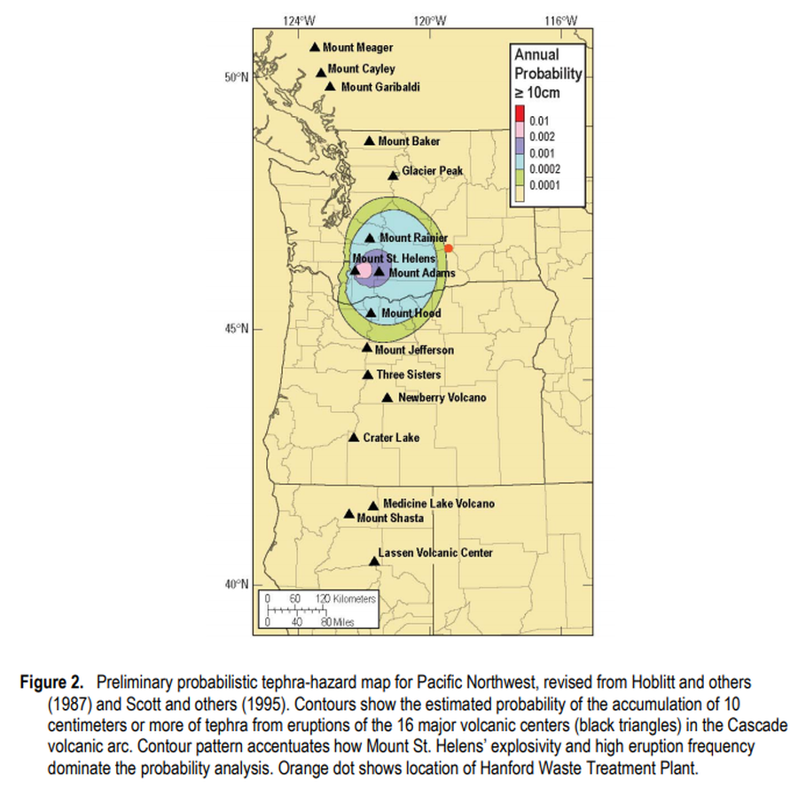
Figure 2 in: Hoblitt, R.P., & Scott, W.E. (2011). Estimate of tephra accumulation probabilities for the U.S. Department of Energy's Hanford Site, Washington. U.S. Geological Survey, Open-File Report 2011-1064, 15 p. https://doi.org/10.3133/ofr20111064
This map was produced by an official agency, but may not be the most recent, most complete, or main operational map.
For the current operational hazard map, please consult the proper institutional authorities.
Click on image for full-size map. If link seems broken, try the archived version.