
Road hazard exposure map for the Karthala volcano
Karthala, Comoros, 2019
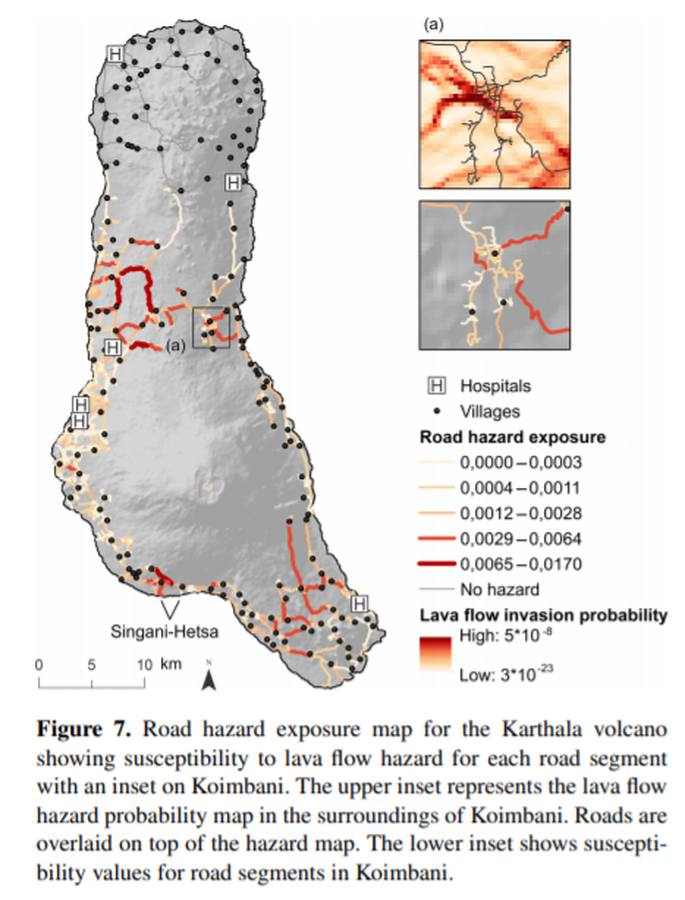
Figure 7 in: Mossoux, S., Kervyn, M., & Canters, F. (2019). Assessing the impact of road segment obstruction on accessibility of critical services in case of a hazard. Natural Hazards & Earth System Sciences, 19(6). https://doi.org/10.5194/nhess-19-1251-2019
This hazard map is the result of scientific research and was published in academic literature.
It is presented here to serve as an example of the map type or the map-making methodology. It is NOT the official, operational map. For the current operational hazard map, please consult the proper institutional authorities.
Click on image for full-size map. If link seems broken, try the archived version.
Mossoux, S., Kervyn, M., & Canters, F. (2019). Assessing the impact of road segment obstruction on accessibility of critical services in case of a hazard. Natural Hazards & Earth System Sciences, 19(6). https://doi.org/10.5194/nhess-19-1251-2019Map Set
https://doi.org/10.5194/nhess-19-1251-2019
Other Maps In Set: