
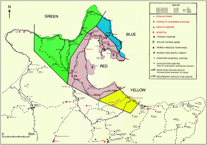
Part of a poster showing hazard/danger zones and (relatively) safe areas; developed in 1983–1984 during the early part of the Crisis Period
Rabaul, Papua New Guinea, 1984
Figure 6 (in reprint) in: RVO. (1984). (Reprinted in: McKee C., Itikarai I., & Davies H. (2017). Instrumental Volcano Surveillance and Community Awareness in the Lead-Up to the 1994 Eruptions at Rabaul, Papua New Guinea. In: Fearnley C.J., Bird D.K., Haynes K., McGuire W.J., & Jolly G. (eds) Observing the Volcano World. Advances in Volcanology (An Official Book Series of the International Association of Volcanology and Chemistry of the Earth’s Interior – IAVCEI, Barcelona, Spain). Springer, Cham. https://doi.org/10.1007/11157_2017_4)
This map was produced by an official agency, but is NOT the most recent, most complete, or main operational map.
For the current operational hazard map, please consult the proper institutional authorities.
Click on image for full-size map. If link seems broken, try the archived version.