
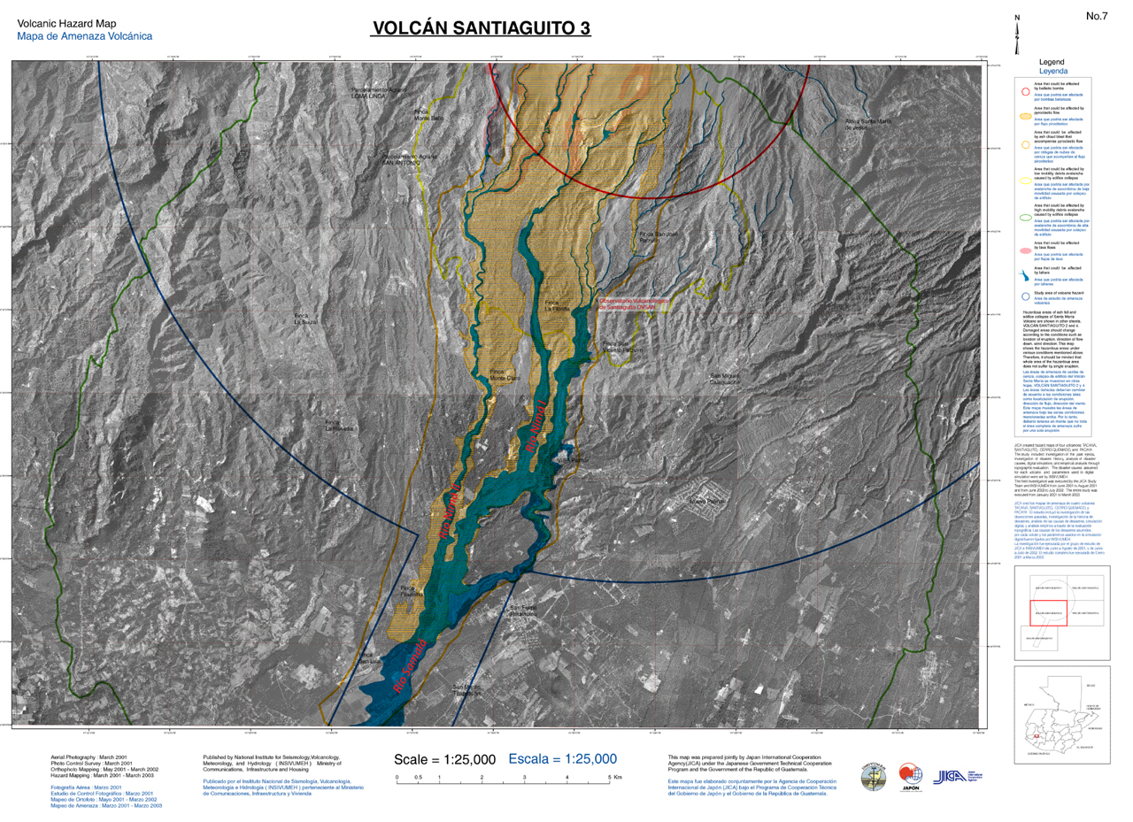
Volcanic Hazard Map Volcán Santiaguito 3
Santiaguito (Santa María), Guatemala, 2003
Plate 7 in: Instituto Nacional de Sismología, Vulcanologia, Meteorologia e Hidrología (INSIVUMEH), Japan International Cooperation Agency (JICA), & Instituto Geografico Nacional (IGN). (2003). Estudio del establecimiento de los mapas basicos y mapas de amenaza para el Sistema de informacion geografica de la Republica de Guatemala. Final report. (Reprinted in: Global Volcanism Program. (2014). Report on Santa Maria (Guatemala). In: Herrick, J.A., & Wunderman, R. (Eds.) Bulletin of the Global Volcanism Network, 39:3. Smithsonian Institution.)
This map was produced by an official agency, but is NOT the most recent, most complete, or main operational map.
For the current operational hazard map, please consult the proper institutional authorities.
Click on thumbnail for full-size map. We do not have copyright permission to display the full-size image. If you are the copyright holder and wish to provide copyright, please contact us at admin@volcanichazardmaps.org. If link seems broken, try the archived version.