
Vent opening probability maps - Model 1 (kernel denisty estimator)
Long Valley Area, United States, 2017
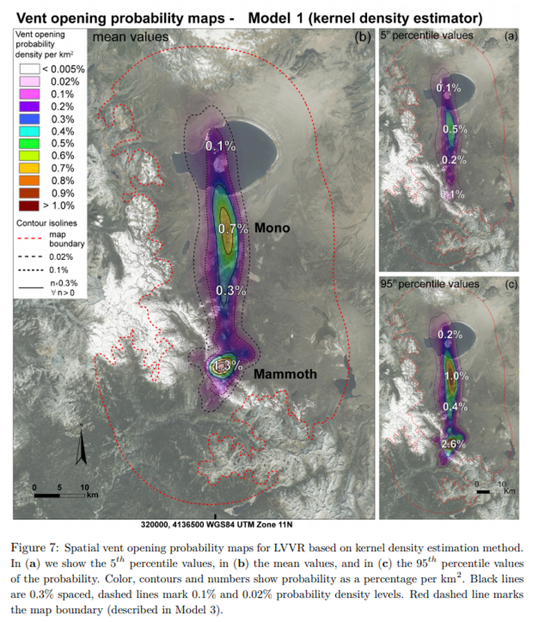
Figure 7 in: Bevilacqua, A., Bursik, M., Patra, A., Pitman, E. B., & Till, R. (2017). Bayesian construction of a long-term vent opening probability map in the Long Valley volcanic region (CA, USA). Statistics in Volcanology, 3(1), 1. http://dx.doi.org/10.5038/2163-338X.3.1
This hazard map is the result of scientific research and was published in academic literature.
It is presented here to serve as an example of the map type or the map-making methodology. It is NOT the official, operational map. For the current operational hazard map, please consult the proper institutional authorities.
Click on image for full-size map. If link seems broken, try the archived version.
Bevilacqua, A., Bursik, M., Patra, A., Pitman, E. B., & Till, R. (2017). Bayesian construction of a long-term vent opening probability map in the Long Valley volcanic region (CA, USA). Statistics in Volcanology, 3(1), 1. http://dx.doi.org/10.5038/2163-338X.3.1Map Set
http://dx.doi.org/10.5038/2163-338X.3.1
Other Maps In Set: