← Back to Search Results

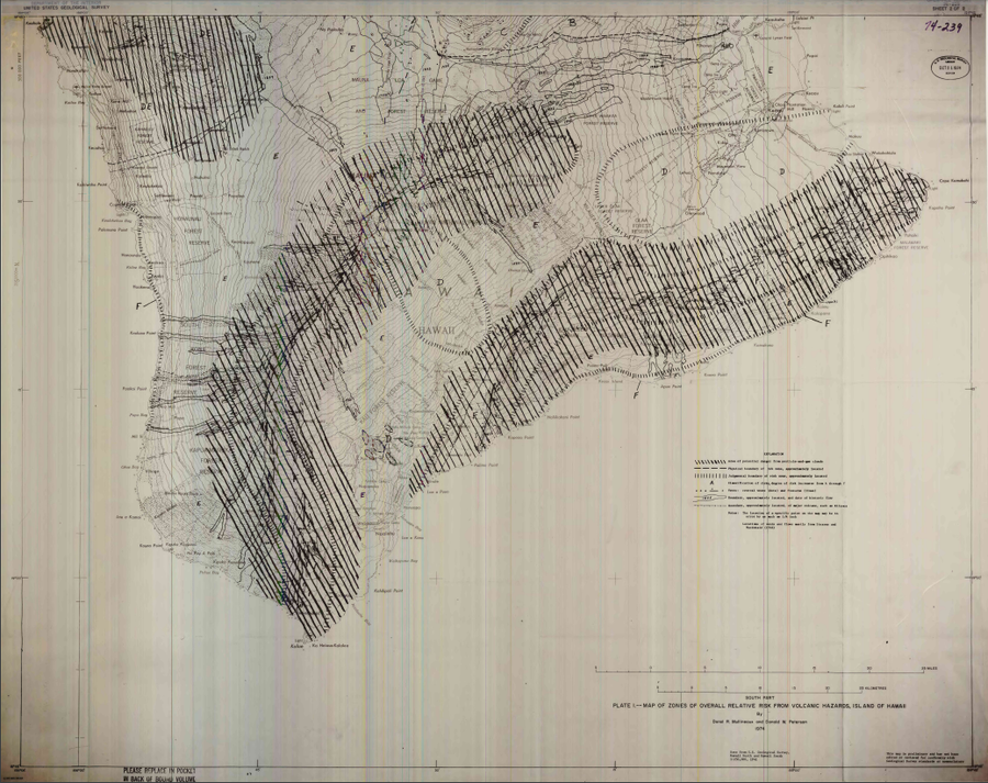
Map of Zones of Overall Relative Risk From Volcanic Hazards, Island of Hawaii

Hawai‘i (regional), United States, 1974

Plate 1 in: Mullineaux, D.R. & Peterson, D.W. (1974). Volcanic hazards on the Island of Hawaii. U.S. Geological Survey, Open-File Report 74-239. https://doi.org/10.3133/ofr74239


This map was produced by an official agency, but is NOT the most recent, most complete, or main operational map. For the current operational hazard map, please consult the proper institutional authorities.


Click on image for full-size map. If link seems broken, try the archived version.

Map Set

Mullineaux, D.R. & Peterson, D.W. (1974). Volcanic hazards on the Island of Hawaii. U.S. Geological Survey, Open-File Report 74-239. https://doi.org/10.3133/ofr74239
https://doi.org/10.3133/ofr74239

Other Maps In Set:

Map Data

Map ID3368
Hazard Process(es)Deformation hazards; Lava flows; Surges; Tephra fall
Hazard Zone PresentationHazard level- and process-focused: Hazards are both combined by hazard level and separated by hazard process type on a main map panel
Temporal ScaleBackground, or long-term, map
Spatial ScaleIsland
Publication FormatPoster-style map insert in hazard assessment
Zonation Method(s)Geologic history
Zonation Model(s)
Scenario(s) ConsideredSource location or direction
Hazard Zone Label(s)Hazard process name; Qualitative relative probability (e.g. high-medium-low)
Probability Definition(s)Qualitative relative probability (e.g. high-medium-low)
PurposeLand-use planning: Intended to inform citing of facilities, building restrictions, resource management, and infrastructure development
AudienceLand-use planners, city planners, government officials, etc.
Language(s)English
Basemap(s)Contour lines
Basemap overlay(s)
DiemsionalityPlanimetric (2D or map) view
Color SchemeSymbols and/or lines only